
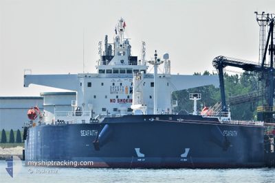
SEAFAITH
Tanker
Current Trip
| Time Travelled | 11 days |
|---|---|
| Remaining Time | --- |
| Distance Travelled | 1175.23 nm |
| Remaining Distance | --- |
| AVG Speed | 8.4 Knopen |
| MAX Speed | 13.3 Knopen |
| AVG Wind | 8.5 knots |
| MAX Wind | 23 knots |
| MIN Temp | -3.6°C / 25.52°F |
| MAX Temp | 11.4°C / 52.52°F |
| Diepgang | 13.9 M |
| Positie ontvangen | 1 h, 3 m geleden |
Current Position
| Lengtegraad | --- |
|---|---|
| Breedtegraat | --- |
| Status | Under way using engine |
| Snelheid | 13.2 Knopen |
| Koers | 255.9° |
| Gebied | Sea of Marmara |
| Station | T-AIS |
| Positie ontvangen | 1 h, 3 m geleden |
Info
Information
The current position of SEAFAITH is in Sea of Marmara with coordinates 40.79195° / 27.81008° as reported on 2025-02-27 17:21 by AIS to our vessel tracker app. The vessel's current speed is 13.2 Knopen and is heading at the port of TARRAGONA. The estimated time of arrival as calculated by MyShipTracking vessel tracking app is 2025-03-05 15:00 LT
The vessel SEAFAITH (IMO: 9843209, MMSI: 215515000) is a Tanker It's sailing under the flag of [MT] Malta.
In this page you can find informations about the vessels current position, last detected port calls, and current voyage information. If the vessels is not in coverage by AIS you will find the latest position.
The current position of SEAFAITH is detected by our AIS receivers and we are not responsible for the reliability of the data. The last position was recorded while the vessel was in Coverage by the Ais receivers of our vessel tracking app.
The current draught of SEAFAITH as reported by AIS is 13.9 meters
Weather
| Temperature | 9.2°C / 48.56°F |
|---|---|
| Wind Speed | 7 knots |
| Direction | 61° ENE |
| Pressure | 1020 hPa |
| Humidity | 80 % |
| Cloud Coverage | 100 % |
Featured Company
Last Port Calls
| Port | Arrival | Departure | Time In Port |
|---|---|---|---|
| 2025-02-12 06:15 | 2025-02-16 05:21 | 3 d | |
| 2025-01-31 20:01 | 2025-02-01 14:53 | 18 h | |
| 2025-01-15 09:11 | 2025-01-17 09:14 | 2 d | |
| 2025-01-07 20:48 | 2025-01-08 15:44 | 18 h | |
| 2024-12-27 17:54 | 2024-12-28 19:40 | 1 d | |
| 2024-12-21 21:25 | 2024-12-22 16:01 | 18 h | |
| 2024-12-05 23:06 | 2024-12-08 21:42 | 2 d |
Most Visited Ports (Last year)
| Port | Arrivals | |
|---|---|---|
| 8 | ||
| 2 | ||
| 2 | ||
| 2 | ||
| 2 | ||
| 2 |
Last Trips
| Origin | Departure | Destination | Arrival | Distance | |
|---|---|---|---|---|---|
| 2025-02-01 17:53 | 2025-02-12 08:15 | 1455.17 nm | |||
| 2025-01-17 10:14 | 2025-01-31 23:01 | 1745.28 nm | |||
| 2025-01-08 18:44 | 2025-01-15 10:11 | 1708.63 nm | |||
| 2024-12-28 20:40 | 2025-01-07 23:48 | 1603.56 nm | |||
| 2024-12-22 19:01 | 2024-12-27 18:54 | 1430.31 nm | |||
| 2024-12-08 22:42 | 2024-12-22 00:25 | 3327.76 nm | |||
| 2024-11-21 19:32 | 2024-12-06 00:06 | 3300.05 nm |
Events
| Tijd | Evenement | Details | Positie / Bestemming | Info |
|---|---|---|---|---|
| 2025-02-27 17:26 | Status Changed | Default Under way using engine |
40.78746 / 27.78610
PSBLY TARRAGONA TBC
|
Snelheid: 13.2 kn Koers: 255.9° |
| 2025-02-27 17:21 | Status Changed | Under way using engine Default |
40.79195 / 27.81008
PSBLY TARRAGONA TBC
|
Snelheid: 13.3 kn Koers: 257° |
| 2025-02-27 17:21 | Buitenbereik |
40.79195 / 27.81008
Sea of Marmara
PSBLY TARRAGONA TBC
|
Snelheid: 13.2 kn Koers: 255.9° |
|
| 2025-02-27 17:10 | Status Changed | Default Under way using engine |
40.80110 / 27.86041
PSBLY TARRAGONA TBC
|
Snelheid: 13.3 kn Koers: 259.2° |
| 2025-02-27 17:01 | Status Changed | Under way using engine Default |
40.80812 / 27.90661
PSBLY TARRAGONA TBC
|
Snelheid: 13.2 kn Koers: 260° |
| 2025-02-27 16:34 | Status Changed | Default Under way using engine |
40.82500 / 28.03188
PSBLY TARRAGONA TBC
|
Snelheid: 12.7 kn Koers: 262.7° |
| 2025-02-27 16:30 | Status Changed | Under way using engine Default |
40.82694 / 28.05027
PSBLY TARRAGONA TBC
|
Snelheid: 12.5 kn Koers: 263° |
| 2025-02-27 16:10 | Status Changed | Default Under way using engine |
40.83515 / 28.14209
PSBLY TARRAGONA TBC
|
Snelheid: 12.5 kn Koers: 262.2° |
| 2025-02-27 16:04 | Status Changed | Under way using engine Default |
40.83818 / 28.17172
PSBLY TARRAGONA TBC
|
Snelheid: 12.6 kn Koers: 262° |
| 2025-02-27 15:45 | Status Changed | Default Under way using engine |
40.84832 / 28.25652
PSBLY TARRAGONA TBC
|
Snelheid: 13 kn Koers: 260.6° |