
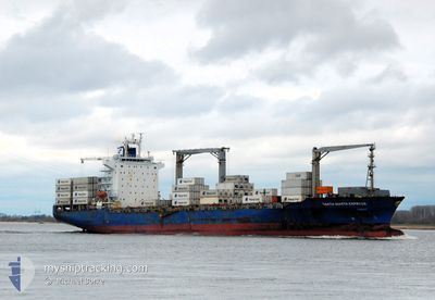
SANTA MARTA EXPRESS
Container Ship
Current Trip
| Time Travelled | 3 days |
|---|---|
| Remaining Time | --- |
| Distance Travelled | 1243.02 nm |
| Remaining Distance | --- |
| AVG Speed | 12.4 Knopen |
| MAX Speed | 18.7 Knopen |
| AVG Wind | 17.7 knots |
| MAX Wind | 27 knots |
| MIN Temp | 7°C / 44.6°F |
| MAX Temp | 12.3°C / 54.14°F |
| Diepgang | 10.8 M |
| Positie ontvangen | 2 d geleden |
Current Position
| Lengtegraad | -7.23447° |
|---|---|
| Breedtegraat | 49.71148° |
| Status | Under way using engine |
| Snelheid | 13.5 Knopen |
| Koers | 272° |
| Gebied | Celtic Sea |
| Station | T-AIS |
| Positie ontvangen | 2 d geleden |
Info
Information
The current position of SANTA MARTA EXPRESS is in Celtic Sea with coordinates 49.71148° / -7.23447° as reported on 2024-04-18 00:55 by AIS to our vessel tracker app. The vessel's current speed is 13.5 Knopen and is heading at the port of SAINT JOHN. The estimated time of arrival as calculated by MyShipTracking vessel tracking app is 2024-04-27 10:00 LT
The vessel SANTA MARTA EXPRESS (IMO: 9446104, MMSI: 477711300) is a Container Ship that was built in 2010 ( 14 Jaar oud ). It's sailing under the flag of [HK] Hong Kong.
In this page you can find informations about the vessels current position, last detected port calls, and current voyage information. If the vessels is not in coverage by AIS you will find the latest position.
The current position of SANTA MARTA EXPRESS is detected by our AIS receivers and we are not responsible for the reliability of the data. The last position was recorded while the vessel was in Coverage by the Ais receivers of our vessel tracking app.
The current draught of SANTA MARTA EXPRESS as reported by AIS is 10.8 meters
Weather
| Temperature | 12.1°C / 53.78°F |
|---|---|
| Wind Speed | 27 knots |
| Direction | 161° SSE |
| Pressure | 1013.3 hPa |
| Humidity | 89.7 % |
| Cloud Coverage | 100 % |
Featured Company
Last Port Calls
| Port | Arrival | Departure | Time In Port |
|---|---|---|---|
| 2024-04-15 12:35 | 2024-04-16 12:26 | 23 h | |
| 2024-04-14 08:18 | 2024-04-14 21:34 | 13 h | |
| 2024-04-12 03:19 | 2024-04-12 22:43 | 19 h | |
| 2024-04-10 02:04 | 2024-04-10 14:19 | 12 h | |
| 2024-04-08 04:09 | 2024-04-08 22:33 | 18 h | |
| 2024-03-28 07:36 | 2024-03-28 21:42 | 14 h | |
| 2024-03-22 17:39 | 2024-03-23 03:39 | 10 h | |
| 2024-03-18 21:19 | 2024-03-19 16:30 | 19 h | |
| 2024-03-14 22:07 | 2024-03-15 19:54 | 21 h | |
| 2024-03-11 14:13 | 2024-03-13 03:01 | 1 d |
Most Visited Ports (Last year)
| Port | Arrivals | |
|---|---|---|
| 14 | ||
| 8 | ||
| 8 | ||
| 8 | ||
| 8 | ||
| 7 |
Last Trips
| Origin | Departure | Destination | Arrival | Distance | |
|---|---|---|---|---|---|
| 2024-04-14 23:34 | 2024-04-15 14:35 | 130.75 nm | |||
| 2024-04-13 00:43 | 2024-04-14 10:18 | 344.68 nm | |||
| 2024-04-10 15:19 | 2024-04-12 05:19 | 430.10 nm | |||
| 2024-04-09 00:33 | 2024-04-10 03:04 | 194.16 nm | |||
| 2024-03-28 17:42 | 2024-04-08 06:09 | 4417.21 nm | |||
| 2024-03-22 22:39 | 2024-03-28 03:36 | 1483.61 nm | |||
| 2024-03-19 11:30 | 2024-03-22 12:39 | 449.31 nm | |||
| 2024-03-15 15:54 | 2024-03-18 16:19 | 1274.79 nm | |||
| 2024-03-13 00:01 | 2024-03-14 18:07 | 766.69 nm | |||
| 2024-02-29 08:41 | 2024-03-11 11:13 | 3943.83 nm |
Events
| Tijd | Evenement | Details | Positie / Bestemming | Info |
|---|---|---|---|---|
| 2024-04-18 00:59 | Status Changed | Default Under way using engine |
49.71222 / -7.25763
CASJB
|
Snelheid: 13.5 kn Koers: 272° |
| 2024-04-18 00:55 | Gevonden in zee | United Kingdom part of the Celtic Sea |
49.71148 / -7.23447
Celtic Sea
CASJB
|
Snelheid: 13.5 kn Koers: 272° |
| 2024-04-18 00:55 | Status Changed | Under way using engine Default |
49.71148 / -7.23447
CASJB
|
Snelheid: 13.5 kn Koers: 272° |
| 2024-04-18 00:55 | Buitenbereik |
49.71148 / -7.23447
Celtic Sea
CASJB
|
Snelheid: 13.5 kn Koers: 272° |
|
| 2024-04-18 00:44 | Binnenbereik |
49.71148 / -7.23447
Celtic Sea
CASJB
|
Snelheid: 13.5 kn Koers: 272° |
|
| 2024-04-17 17:47 | Status Changed | Default Under way using engine |
49.82852 / -4.79615
CASJB
|
Snelheid: 14 kn Koers: 260° |
| 2024-04-17 17:40 | Buitenbereik |
49.83318 / -4.75270
English Channel
CASJB
|
Snelheid: 14 kn Koers: 260° |
|
| 2024-04-17 12:59 | Status Changed | Under way using engine Default |
49.94313 / -3.17882
CASJB
|
Snelheid: 13.5 kn Koers: 263° |
| 2024-04-17 12:52 | Status Changed | Default Under way using engine |
49.94562 / -3.14340
CASJB
|
Snelheid: 13.4 kn Koers: 269° |
| 2024-04-17 12:43 | Wijzig zee gebeid | United Kingdom part of the English Channel Guernsey part of the English Channel |
49.94863 / -3.09130
English Channel
CASJB
|
Snelheid: 13.4 kn Koers: 269° |