
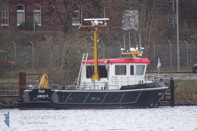
PIROL
Other Type
Current Trip
| Trip Time | --- |
|---|---|
| Trip Distance | --- |
| AVG Speed | --- |
| MAX Speed | --- |
| Diepgang | --- |
| AVG Wind | --- |
| MAX Wind | --- |
| MIN Temp | --- |
| MAX Temp | --- |
| Positie ontvangen | 1 d geleden |
Current Position
| Lengtegraad | 9.41309° |
|---|---|
| Breedtegraat | 53.78529° |
| Status | Moored |
| Snelheid | |
| Koers | 265° |
| Gebied | North Sea |
| Station | T-AIS |
| Positie ontvangen | 1 d geleden |
Info
Information
The current position of PIROL is in North Sea with coordinates 53.78529° / 9.41309° as reported on 2024-04-24 01:53 by AIS to our vessel tracker app. The vessel's current speed is 0 Knopen and is currently inside the port of GLUECKSTADT.
The vessel PIROL (MMSI: 211421690) is a Other Type It's sailing under the flag of [DE] Germany.
In this page you can find informations about the vessels current position, last detected port calls, and current voyage information. If the vessels is not in coverage by AIS you will find the latest position.
The current position of PIROL is detected by our AIS receivers and we are not responsible for the reliability of the data. The last position was recorded while the vessel was in Coverage by the Ais receivers of our vessel tracking app.
The current draught of PIROL as reported by AIS is 1.4 meters
Weather
| Temperature | 1.4°C / 34.52°F |
|---|---|
| Wind Speed | 7 knots |
| Direction | 200° SSW |
| Pressure | 1006.6 hPa |
| Humidity | 95.5 % |
| Cloud Coverage | 87 % |
Featured Company
Events
| Tijd | Evenement | Details | Positie / Bestemming | Info |
|---|---|---|---|---|
| 2024-04-24 01:53 | Buitenbereik |
53.78529 / 9.41309
North Sea
[DE] GLUECKSTADT
|
Snelheid: Koers: 314° |
|
| 2024-04-24 01:53 | Binnenbereik |
53.78529 / 9.41309
North Sea
[DE] GLUECKSTADT
|
Snelheid: Koers: 314° |
|
| 2024-04-23 03:05 | Buitenbereik |
53.78528 / 9.41309
North Sea
[DE] GLUECKSTADT
|
Snelheid: Koers: 301.8° |
|
| 2024-04-23 02:53 | Binnenbereik |
53.78527 / 9.41309
North Sea
[DE] GLUECKSTADT
|
Snelheid: Koers: 301.8° |
|
| 2024-04-23 01:14 | Buitenbereik |
53.78528 / 9.41311
North Sea
[DE] GLUECKSTADT
|
Snelheid: Koers: 301.8° |
|
| 2024-04-23 01:14 | Binnenbereik |
53.78528 / 9.41311
North Sea
[DE] GLUECKSTADT
|
Snelheid: Koers: 301.8° |
|
| 2024-04-17 11:25 | Buitenbereik |
53.78105 / 9.40918
North Sea
|
Snelheid: 8.1 kn Koers: 341.9° |
|
| 2024-04-17 09:25 | Vertrekhaven |
|
53.56955 / 9.67156
SURVEY VESSEL WSA HH
|
Snelheid: 8.1 kn Koers: 282° |
| 2024-04-17 09:21 | Start beweging |
53.56932 / 9.68579
[DE] WEDEL
|
Snelheid: 8.2 kn Koers: 203° |
|
| 2024-04-17 08:41 | Status Changed | Under way using engine Moored |
53.57164 / 9.68642
[DE] WEDEL
|
Snelheid: Koers: 279° |