
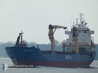
ONEGO DEUSTO
General Cargo
Current Trip
| Time Travelled | 6 days |
|---|---|
| Remaining Time | 16 h, 49 mins |
| Distance Travelled | 1837.02 nm |
| Remaining Distance | 229.56 nm |
| AVG Speed | 11.6 Knopen |
| MAX Speed | 14.1 Knopen |
| AVG Wind | 11.4 knots |
| MAX Wind | 20 knots |
| MIN Temp | 7.7°C / 45.86°F |
| MAX Temp | 26.1°C / 78.98°F |
| Diepgang | 6.9 M |
| Positie ontvangen | 3 d geleden |
Current Position
| Lengtegraad | -79.66684° |
|---|---|
| Breedtegraat | 25.45218° |
| Status | Under way using engine |
| Snelheid | 10.7 Knopen |
| Koers | 178.5° |
| Gebied | North Atlantic Ocean |
| Station | T-AIS |
| Positie ontvangen | 3 d geleden |
Info
Information
The current position of ONEGO DEUSTO is in North Atlantic Ocean with coordinates 25.45218° / -79.66684° as reported on 2024-04-22 16:17 by AIS to our vessel tracker app. The vessel's current speed is 10.7 Knopen and is heading at the port of HOUSTON. The estimated time of arrival as calculated by MyShipTracking vessel tracking app is 2024-04-26 09:07 LT
The vessel ONEGO DEUSTO (IMO: 9399129, MMSI: 244638000) is a General Cargo that was built in 2008 ( 16 Jaar oud ). It's sailing under the flag of [NL] Netherlands.
In this page you can find informations about the vessels current position, last detected port calls, and current voyage information. If the vessels is not in coverage by AIS you will find the latest position.
The current position of ONEGO DEUSTO is detected by our AIS receivers and we are not responsible for the reliability of the data. The last position was recorded while the vessel was in Coverage by the Ais receivers of our vessel tracking app.
The current draught of ONEGO DEUSTO as reported by AIS is 6.9 meters
Weather
| Temperature | 23.8°C / 74.84°F |
|---|---|
| Wind Speed | 14 knots |
| Direction | 139° SE |
| Pressure | 1018.5 hPa |
| Humidity | 88.4 % |
| Cloud Coverage | 68 % |
Featured Company
Last Port Calls
| Port | Arrival | Departure | Time In Port |
|---|---|---|---|
| 2024-04-18 04:08 | 2024-04-19 01:30 | 21 h | |
| 2024-03-30 13:19 | 2024-04-01 15:39 | 2 d | |
| 2024-03-23 09:04 | 2024-03-29 11:17 | 6 d | |
| 2024-03-15 07:50 | |||
| 2024-02-26 11:36 | 2024-03-05 00:21 | 7 d | |
| 2024-02-08 22:02 |
Most Visited Ports (Last year)
| Port | Arrivals | |
|---|---|---|
| 3 | ||
| 3 | ||
| 3 | ||
| 2 | ||
| 1 | ||
| 1 |
Last Trips
| Origin | Departure | Destination | Arrival | Distance | |
|---|---|---|---|---|---|
| 2024-04-01 17:39 | 2024-04-18 00:08 | 3885.31 nm | |||
| 2024-03-29 12:17 | 2024-03-30 14:19 | 261.43 nm | |||
| 2024-03-04 20:21 | 2024-03-15 07:50 | 1965.24 nm | |||
| 2024-02-08 23:02 | 2024-02-26 07:36 | 4096.33 nm |
Events
| Tijd | Evenement | Details | Positie / Bestemming | Info |
|---|---|---|---|---|
| 2024-04-22 16:27 | Status Changed | Default Under way using engine |
25.42257 / -79.66597
USHOU
|
Snelheid: 10.7 kn Koers: 178.5° |
| 2024-04-22 16:17 | Buitenbereik |
25.45218 / -79.66684
North Atlantic Ocean
USHOU
|
Snelheid: 10.7 kn Koers: 178.5° |
|
| 2024-04-22 13:29 | Status Changed | Under way using engine Default |
25.88501 / -79.50954
USHOU
|
Snelheid: 10.4 kn Koers: 215° |
| 2024-04-22 13:23 | Status Changed | Default Under way using engine |
25.89839 / -79.49900
USHOU
|
Snelheid: 10.2 kn Koers: 201.1° |
| 2024-04-22 12:41 | Status Changed | Under way using engine Default |
26.00151 / -79.42752
USHOU
|
Snelheid: 10.6 kn Koers: 200° |
| 2024-04-22 12:01 | Status Changed | Default Under way using engine |
26.11651 / -79.39673
USHOU
|
Snelheid: 10.7 kn Koers: 187.9° |
| 2024-04-22 10:53 | Status Changed | Under way using engine Default |
26.31770 / -79.36962
USHOU
|
Snelheid: 10.9 kn Koers: 178° |
| 2024-04-22 10:53 | Binnenbereik |
26.31770 / -79.36962
North Atlantic Ocean
USHOU
|
Snelheid: 10.6 kn Koers: 187.1° |
|
| 2024-04-22 01:26 | Status Changed | Default Under way using engine |
27.80941 / -78.95596
USHOU
|
Snelheid: 12.8 kn Koers: 268.1° |
| 2024-04-22 01:18 | Buitenbereik |
27.81085 / -78.92283
North Atlantic Ocean
USHOU
|
Snelheid: 12.8 kn Koers: 268.1° |