
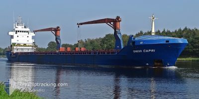
ONEGO CAPRI
General Cargo
Current Trip
| Time Travelled | 4 days |
|---|---|
| Remaining Time | --- |
| Distance Travelled | 1141.28 nm |
| Remaining Distance | --- |
| AVG Speed | 9 Knopen |
| MAX Speed | 14.5 Knopen |
| AVG Wind | 12.3 knots |
| MAX Wind | 23.9 knots |
| MIN Temp | -1.8°C / 28.76°F |
| MAX Temp | 8.3°C / 46.94°F |
| Diepgang | 8.1 M |
| Positie ontvangen | Nu |
Current Position
| Lengtegraad | 1.89757° |
|---|---|
| Breedtegraat | 51.40053° |
| Status | Under way using engine |
| Snelheid | 11.9 Knopen |
| Koers | 206.2° |
| Gebied | North Sea |
| Station | T-AIS |
| Positie ontvangen | Nu |
Info
Information
The current position of ONEGO CAPRI is in North Sea with coordinates 51.40053° / 1.89757° as reported on 2024-04-23 22:55 by AIS to our vessel tracker app. The vessel's current speed is 11.9 Knopen and is heading at the port of BARI. The estimated time of arrival as calculated by MyShipTracking vessel tracking app is 2024-05-03 21:00 LT
The vessel ONEGO CAPRI (IMO: 9245275, MMSI: 305394000) is a General Cargo that was built in 2002 ( 22 Jaar oud ). It's sailing under the flag of [AG] Antigua Barbuda.
In this page you can find informations about the vessels current position, last detected port calls, and current voyage information. If the vessels is not in coverage by AIS you will find the latest position.
The current position of ONEGO CAPRI is detected by our AIS receivers and we are not responsible for the reliability of the data. The last position was recorded while the vessel was in Coverage by the Ais receivers of our vessel tracking app.
The current draught of ONEGO CAPRI as reported by AIS is 8.1 meters
Weather
| Temperature | 8°C / 46.4°F |
|---|---|
| Wind Speed | 22 knots |
| Direction | 343° NNW |
| Pressure | 1018.7 hPa |
| Humidity | 67.3 % |
| Cloud Coverage | 95 % |
Featured Company
Last Port Calls
| Port | Arrival | Departure | Time In Port |
|---|---|---|---|
| 2024-04-09 06:21 | 2024-04-19 10:41 | 10 d | |
| 2024-03-23 13:33 | 2024-03-26 16:34 | 3 d | |
| 2024-03-12 10:09 | 2024-03-17 02:54 | 4 d | |
| 2024-03-04 23:57 | 2024-03-06 22:40 | 1 d | |
| 2024-02-15 20:39 | 2024-02-21 02:51 | 5 d | |
| 2024-02-10 11:44 | 2024-02-13 22:20 | 3 d | |
| 2024-02-03 04:26 | 2024-02-08 09:39 | 5 d |
Most Visited Ports (Last year)
| Port | Arrivals | |
|---|---|---|
| 6 | ||
| 4 | ||
| 2 | ||
| 2 | ||
| 2 | ||
| 2 |
Last Trips
| Origin | Departure | Destination | Arrival | Distance | |
|---|---|---|---|---|---|
| 2024-03-26 17:34 | 2024-04-09 09:21 | 2539.60 nm | |||
| 2024-03-17 03:54 | 2024-03-23 14:33 | 1655.84 nm | |||
| 2024-03-06 23:40 | 2024-03-12 11:09 | 273.56 nm | |||
| 2024-02-21 04:51 | 2024-03-05 00:57 | 1758.28 nm | |||
| 2024-02-14 00:20 | 2024-02-15 22:39 | 88.58 nm | |||
| 2024-02-08 13:39 | 2024-02-10 13:44 | 581.50 nm | |||
| 2024-01-27 14:44 | 2024-02-03 08:26 | 248.07 nm |
Events
| Tijd | Evenement | Details | Positie / Bestemming | Info |
|---|---|---|---|---|
| 2024-04-23 20:07 | Wijzig zee gebeid | United Kingdom part of the North Sea Dutch part of the North Sea |
51.86401 / 2.53014
North Sea
ITBRI
|
Snelheid: 13.2 kn Koers: 221.7° |
| 2024-04-23 18:53 | Status Changed | Under way using engine Default |
52.07267 / 2.81630
ITBRI
|
Snelheid: 12.7 kn Koers: 219° |
| 2024-04-23 18:53 | Binnenbereik |
52.06677 / 2.80939
North Sea
ITBRI
|
Snelheid: 13.1 kn Koers: 217.1° |
|
| 2024-04-23 11:20 | Status Changed | Default Under way using engine |
53.13174 / 4.31663
ITBRI
|
Snelheid: 12.3 kn Koers: 214.6° |
| 2024-04-23 11:07 | Buitenbereik |
53.16021 / 4.37120
North Sea
ITBRI
|
Snelheid: 12.3 kn Koers: 214.6° |
|
| 2024-04-23 11:05 | Status Changed | Under way using engine Default |
53.16658 / 4.37768
ITBRI
|
Snelheid: 12.3 kn Koers: 207° |
| 2024-04-23 11:05 | Binnenbereik |
53.16021 / 4.37120
North Sea
ITBRI
|
Snelheid: 12.3 kn Koers: 214.6° |
|
| 2024-04-23 09:20 | Status Changed | Default Under way using engine |
53.47251 / 4.64804
ITBRI
|
Snelheid: 11.8 kn Koers: 249.4° |
| 2024-04-23 09:12 | Buitenbereik |
53.48181 / 4.68962
North Sea
ITBRI
|
Snelheid: 11.8 kn Koers: 249.4° |
|
| 2024-04-23 04:55 | Wijzig zee gebeid | Dutch part of the North Sea German part of the North Sea |
53.72842 / 5.87829
North Sea
ITBRI
|
Snelheid: 11.3 kn Koers: 249.6° |