
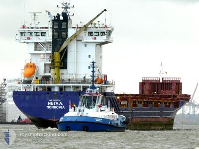
NETA A.
Container Ship
Current Trip
| Time Travelled | 15 h, 59 mins |
|---|---|
| Remaining Time | 14 h, 6 mins |
| Distance Travelled | 214.54 nm |
| Remaining Distance | 198.04 nm |
| AVG Speed | 12.6 Knopen |
| MAX Speed | 14.6 Knopen |
| AVG Wind | 21.2 knots |
| MAX Wind | 24 knots |
| MIN Temp | 6°C / 42.8°F |
| MAX Temp | 9°C / 48.2°F |
| Diepgang | 8.2 M |
| Positie ontvangen | 1 m geleden |
Current Position
| Lengtegraad | --- |
|---|---|
| Breedtegraat | --- |
| Status | Under way using engine |
| Snelheid | 14 Knopen |
| Koers | 260° |
| Gebied | Kattegat |
| Station | T-AIS |
| Positie ontvangen | 1 m geleden |
Info
Information
The current position of NETA A. is in Kattegat with coordinates 55.46168° / 14.74555° as reported on 2025-12-09 00:48 by AIS to our vessel tracker app. The vessel's current speed is 14 Knopen and is heading at the port of KIEL. The estimated time of arrival as calculated by MyShipTracking vessel tracking app is 2025-12-09 15:56 LT
The vessel NETA A. (IMO: 9412531, MMSI: 636025672) is a Container Ship that was built in 2011 ( 14 Jaar oud ). It's sailing under the flag of [LR] Liberia.
In this page you can find informations about the vessels current position, last detected port calls, and current voyage information. If the vessels is not in coverage by AIS you will find the latest position.
The current position of NETA A. is detected by our AIS receivers and we are not responsible for the reliability of the data. The last position was recorded while the vessel was in Coverage by the Ais receivers of our vessel tracking app.
The current draught of NETA A. as reported by AIS is 8.2 meters
Weather
| Temperature | 8.5°C / 47.3°F |
|---|---|
| Wind Speed | 19 knots |
| Direction | 247° WSW |
| Pressure | 1007.9 hPa |
| Humidity | 95.3 % |
| Cloud Coverage | 100 % |
Featured Company
Last Port Calls
| Port | Arrival | Departure | Time In Port |
|---|---|---|---|
| 2025-12-08 01:48 | 2025-12-08 10:51 | 9 h | |
| 2025-12-05 18:53 | 2025-12-07 10:03 | 1 d | |
| 2025-12-05 10:20 | 2025-12-05 16:15 | 5 h | |
| 2025-12-04 08:04 | 2025-12-04 08:07 | 3 m | |
| 2025-12-01 14:42 | 2025-12-03 02:04 | 1 d | |
| 2025-11-29 07:07 | 2025-12-01 14:35 | 2 d | |
| 2025-11-28 16:50 | 2025-11-29 05:55 | 13 h | |
| 2025-11-26 18:06 | 2025-11-27 15:12 | 21 h | |
| 2025-11-24 20:13 | 2025-11-25 12:19 | 16 h | |
| 2025-11-19 06:54 | 2025-11-20 21:17 | 1 d |
Most Visited Ports (Last year)
| Port | Arrivals | |
|---|---|---|
| 4 | ||
| 2 | ||
| 2 | ||
| 2 | ||
| 2 | ||
| 2 |
Last Trips
| Origin | Departure | Destination | Arrival | Distance | |
|---|---|---|---|---|---|
| 2025-12-07 10:03 | 2025-12-08 01:48 | 126.49 nm | |||
| 2025-12-05 16:15 | 2025-12-05 18:53 | 20.03 nm | |||
| 2025-12-04 08:07 | 2025-12-05 10:20 | 354.24 nm | |||
| 2025-12-03 02:04 | 2025-12-04 08:04 | 315.27 nm | |||
| 2025-12-01 14:35 | 2025-12-01 14:42 | 0.45 nm | |||
| 2025-11-29 05:55 | 2025-11-29 07:07 | 15.39 nm | |||
| 2025-11-27 15:12 | 2025-11-28 16:50 | 323.42 nm | |||
| 2025-11-25 12:19 | 2025-11-26 18:06 | 108.21 nm | |||
| 2025-11-20 21:17 | 2025-11-24 20:13 | 905.24 nm | |||
| 2025-11-15 15:45 | 2025-11-19 06:54 | 1058.20 nm |
Events
| Tijd | Evenement | Details | Positie / Bestemming | Info |
|---|---|---|---|---|
| 2025-12-08 23:07 | Gevonden in zee | Danish part of the Kattegat |
55.53996 / 15.42548
Kattegat
DENOK
|
Snelheid: 13.6 kn Koers: 258.7° |
| 2025-12-08 23:07 | Binnenbereik |
55.53996 / 15.42548
Kattegat
DENOK
|
Snelheid: 13.6 kn Koers: 258.7° |
|
| 2025-12-08 09:45 | Buitenbereik |
55.74548 / 20.76907
Baltic Sea
DENOK
|
Snelheid: 14.5 kn Koers: 272.5° |
|
| 2025-12-08 09:09 | ETA Changed | 2025/12/09 13:30 2025/12/10 23:30 |
55.73562 / 21.02130
DENOK
|
Snelheid: 11.9 kn Koers: 283.3° |
| 2025-12-08 08:51 | Vertrekhaven |
|
55.72577 / 21.08995
DENOK
|
Snelheid: 7.4 kn Koers: 295° |
| 2025-12-08 08:10 | Start beweging |
55.64847 / 21.15847
[LT] KLAIPEDA
|
Snelheid: 4.7 kn Koers: 334° |
|
| 2025-12-08 08:09 | Draught Changed | 8.2 8.6 |
55.64707 / 21.15959
[LT] KLAIPEDA
|
Snelheid: 2.9 kn Koers: 334° |
| 2025-12-08 08:09 | Destination Changed | DENOK LTKLJ |
55.64707 / 21.15959
[LT] KLAIPEDA
|
Snelheid: 2.9 kn Koers: 334° |
| 2025-12-08 08:09 | ETA Changed | 2025/12/10 23:30 2025/12/07 23:30 |
55.64707 / 21.15959
[LT] KLAIPEDA
|
Snelheid: 2.9 kn Koers: 334° |
| 2025-12-08 08:05 | Status Changed | Under way using engine Moored |
55.64593 / 21.16052
[LT] KLAIPEDA
|
Snelheid: Koers: 324° |