
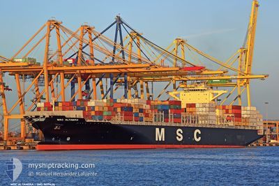
MSC ALTAMIRA
Container Ship
Current Trip
| Time Travelled | 1 day |
|---|---|
| Remaining Time | 8 days |
| Distance Travelled | 458.20 nm |
| Remaining Distance | 4056.87 nm |
| AVG Speed | 18.3 Knopen |
| MAX Speed | 19.9 Knopen |
| AVG Wind | 19.4 knots |
| MAX Wind | 25.4 knots |
| MIN Temp | 26.5°C / 79.7°F |
| MAX Temp | 28.4°C / 83.12°F |
| Diepgang | 10 M |
| Positie ontvangen | 7 h, 14 m geleden |
Current Position
| Lengtegraad | -74.89339° |
|---|---|
| Breedtegraat | 11.44905° |
| Status | Under way using engine |
| Snelheid | 18 Knopen |
| Koers | 67.5° |
| Gebied | Caribbean Sea |
| Station | T-AIS |
| Positie ontvangen | 7 h, 14 m geleden |
Info
Information
The current position of MSC ALTAMIRA is in Caribbean Sea with coordinates 11.44905° / -74.89339° as reported on 2024-04-25 07:29 by AIS to our vessel tracker app. The vessel's current speed is 18 Knopen and is heading at the port of SANTOS. The estimated time of arrival as calculated by MyShipTracking vessel tracking app is 2024-05-04 07:00 LT
The vessel MSC ALTAMIRA (IMO: 9619426, MMSI: 636015664) is a Container Ship that was built in 2012 ( 12 Jaar oud ). It's sailing under the flag of [LR] Liberia.
In this page you can find informations about the vessels current position, last detected port calls, and current voyage information. If the vessels is not in coverage by AIS you will find the latest position.
The current position of MSC ALTAMIRA is detected by our AIS receivers and we are not responsible for the reliability of the data. The last position was recorded while the vessel was in Coverage by the Ais receivers of our vessel tracking app.
The current draught of MSC ALTAMIRA as reported by AIS is 10 meters
Weather
| Temperature | 26.6°C / 79.88°F |
|---|---|
| Wind Speed | 19 knots |
| Direction | 74° ENE |
| Pressure | 1012.4 hPa |
| Humidity | 87 % |
| Cloud Coverage | 100 % |
Featured Company
Last Port Calls
| Port | Arrival | Departure | Time In Port |
|---|---|---|---|
| 2024-04-22 02:30 | 2024-04-24 13:26 | 2 d | |
| 2024-04-16 01:04 | 2024-04-19 03:12 | 3 d | |
| 2024-04-07 08:05 | 2024-04-07 23:48 | 15 h | |
| 2024-04-07 07:32 | 2024-04-07 07:46 | 14 m | |
| 2024-04-04 17:52 | 2024-04-05 21:07 | 1 d | |
| 2024-04-02 08:36 | 2024-04-03 00:55 | 16 h | |
| 2024-03-31 06:59 | 2024-04-01 02:43 | 19 h | |
| 2024-03-29 01:39 | 2024-03-29 13:52 | 12 h | |
| 2024-03-25 08:10 | 2024-03-28 00:36 | 2 d | |
| 2024-03-13 22:15 | 2024-03-15 20:55 | 1 d |
Most Visited Ports (Last year)
| Port | Arrivals | |
|---|---|---|
| 11 | ||
| 9 | ||
| 6 | ||
| 5 | ||
| 5 | ||
| 5 |
Last Trips
| Origin | Departure | Destination | Arrival | Distance | |
|---|---|---|---|---|---|
| 2024-04-18 23:12 | 2024-04-21 21:30 | 1235.55 nm | |||
| 2024-04-07 19:48 | 2024-04-15 21:04 | 602.91 nm | |||
| 2024-04-07 03:46 | 2024-04-07 04:05 | 0.24 nm | |||
| 2024-04-05 17:07 | 2024-04-07 03:32 | 410.51 nm | |||
| 2024-04-02 20:55 | 2024-04-04 13:52 | 125.62 nm | |||
| 2024-03-31 22:43 | 2024-04-02 04:36 | 425.79 nm | |||
| 2024-03-29 09:52 | 2024-03-31 02:59 | 272.33 nm | |||
| 2024-03-27 20:36 | 2024-03-28 21:39 | 244.02 nm | |||
| 2024-03-15 20:55 | 2024-03-25 04:10 | 3075.55 nm | |||
| 2024-02-29 07:24 | 2024-03-01 02:36 | 255.47 nm |
Events
| Tijd | Evenement | Details | Positie / Bestemming | Info |
|---|---|---|---|---|
| 2024-04-25 07:33 | Status Changed | Default Under way using engine |
11.45647 / -74.87459
BRSSZ
|
Snelheid: 18 kn Koers: 67.5° |
| 2024-04-25 07:29 | Buitenbereik |
11.44905 / -74.89339
Caribbean Sea
BRSSZ
|
Snelheid: 18 kn Koers: 67.5° |
|
| 2024-04-25 06:12 | Draught Changed | 10 12 |
11.31574 / -75.27129
BRSSZ
|
Snelheid: 18.5 kn Koers: 70.7° |
| 2024-04-25 06:12 | Destination Changed | BRSSZ PACTB |
11.31574 / -75.27129
BRSSZ
|
Snelheid: 18.5 kn Koers: 70.7° |
| 2024-04-25 06:12 | ETA Changed | 2024/05/04 19:00 |
11.31574 / -75.27129
BRSSZ
|
Snelheid: 18.5 kn Koers: 70.7° |
| 2024-04-25 05:54 | Status Changed | Under way using engine Default |
11.28420 / -75.35820
PACTB
|
Snelheid: 18.4 kn Koers: 70° |
| 2024-04-25 05:54 | Binnenbereik |
11.28676 / -75.35080
Caribbean Sea
|
Snelheid: 18.4 kn Koers: 70.6° |
|
| 2024-04-25 03:38 | Status Changed | Default Under way using engine |
11.03760 / -76.01608
PACTB
|
Snelheid: 18.4 kn Koers: 74° |
| 2024-04-25 03:35 | Buitenbereik |
11.03349 / -76.03055
Caribbean Sea
|
Snelheid: 18.4 kn Koers: 74° |
|
| 2024-04-25 03:35 | Wijzig zee gebeid | Colombian part of the Caribbean Sea Panamanian part of the Caribbean Sea |
11.03349 / -76.03055
Caribbean Sea
|
Snelheid: 18.4 kn Koers: 74° |