
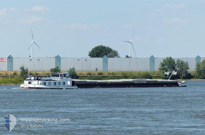
MIRAE
Cargo
Current Trip
MIRAE is out of coverage. Learn how you can join the community and extend the coverage to your area by clicking here!
| Time Travelled | 15 h, 20 mins |
|---|---|
| Remaining Time | --- |
| Distance Travelled | 16.08 nm |
| Remaining Distance | --- |
| AVG Speed | 5.7 Knopen |
| MAX Speed | 6.2 Knopen |
| AVG Wind | 10.2 knots |
| MAX Wind | 11 knots |
| MIN Temp | 11°C / 51.8°F |
| MAX Temp | 11.7°C / 53.06°F |
| Diepgang | 0 M |
| Positie ontvangen | 12 h, 19 m geleden |
Current Position
| Lengtegraad | --- |
|---|---|
| Breedtegraat | --- |
| Status | Under way using engine |
| Snelheid | 5.4 Knopen |
| Koers | 254.9° |
| Gebied | North Sea |
| Station | T-AIS |
| Positie ontvangen | 12 h, 19 m geleden |
Info
info
Information
The current position of MIRAE is in North Sea with coordinates 53.20202° / 6.07662° as reported on 2025-12-09 07:47 by AIS to our vessel tracker app. The vessel's current speed is 5.4 Knopen
The vessel MIRAE (MMSI: 244690437) is a Cargo It's sailing under the flag of [NL] Netherlands.
In this page you can find informations about the vessels current position, last detected port calls, and current voyage information. If the vessels is not in coverage by AIS you will find the latest position.
The current position of MIRAE is detected by our AIS receivers and we are not responsible for the reliability of the data. The last position was recorded while the vessel was in Coverage by the Ais receivers of our vessel tracking app.
Weather
| Temperature | 11.7°C / 53.06°F |
|---|---|
| Wind Speed | 11 knots |
| Direction | 193° SSW |
| Pressure | 1009.6 hPa |
| Humidity | 96.4 % |
| Cloud Coverage | 100 % |
Featured Company
Limited time offer - Install a base station receiver to your area and list your company on MyShipTracking Free forever!
Last Port Calls
| Port | Arrival | Departure | Time In Port |
|---|---|---|---|
| 2025-12-08 19:29 | 2025-12-09 04:47 | 9 h | |
| 2025-12-08 16:58 | 2025-12-08 17:27 | 29 m | |
| 2025-11-28 21:16 | 2025-11-29 05:15 | 7 h | |
| 2025-11-27 13:31 | 2025-11-28 19:32 | 1 d | |
| 2025-11-26 05:43 | 2025-11-26 17:00 | 11 h | |
| 2025-11-25 08:58 | 2025-11-25 09:54 | 56 m | |
| 2025-11-11 16:05 | 2025-11-12 05:49 | 13 h | |
| 2025-11-07 18:26 | 2025-11-10 15:50 | 2 d | |
| 2025-11-01 18:13 | 2025-11-07 07:21 | 5 d | |
| 2025-10-31 12:47 | 2025-10-31 13:34 | 46 m |
Last Trips
| Origin | Departure | Destination | Arrival | Distance | |
|---|---|---|---|---|---|
| 2025-12-08 18:27 | 2025-12-08 20:29 | 12.16 nm | |||
| 2025-11-29 06:15 | 2025-12-08 17:58 | 430.50 nm | |||
| 2025-11-28 20:32 | 2025-11-28 22:16 | 15.63 nm | |||
| 2025-11-26 18:00 | 2025-11-27 14:31 | 60.00 nm | |||
| 2025-11-25 10:54 | 2025-11-26 06:43 | 85.33 nm | |||
| 2025-11-12 06:49 | 2025-11-25 09:58 | 447.74 nm | |||
| 2025-11-10 16:50 | 2025-11-11 17:05 | 73.18 nm | |||
| 2025-11-07 08:21 | 2025-11-07 19:26 | 91.02 nm | |||
| 2025-10-31 14:34 | 2025-11-01 19:13 | 85.18 nm | |||
| 2025-10-20 09:46 | 2025-10-31 13:47 | 137.73 nm |
Events
| Tijd | Evenement | Details | Positie / Bestemming | Info |
|---|---|---|---|---|
| 2025-12-09 07:47 | Buitenbereik |
53.20202 / 6.07662
North Sea
LEEUWARDEN
|
Snelheid: 5.4 kn Koers: 254.9° |
|
| 2025-12-09 06:11 | Start beweging | 2.96 nm, West of BRILTIL |
53.24868 / 6.30921
LEEUWARDEN
|
Snelheid: 3.7 kn Koers: 260° |
| 2025-12-09 06:09 | Status Changed | Under way using engine Moored |
53.24894 / 6.31137
LEEUWARDEN
|
Snelheid: 0.5 kn Koers: 511° |
| 2025-12-09 06:02 | Status Changed | Moored Under way using engine |
53.24902 / 6.31233
LEEUWARDEN
|
Snelheid: 0.3 kn Koers: 511° |
| 2025-12-09 06:02 | Stop beweging | 2.84 nm, West of BRILTIL |
53.24902 / 6.31235
LEEUWARDEN
|
Snelheid: 0.3 kn Koers: 511° |
| 2025-12-09 04:47 | Vertrekhaven |
|
53.25689 / 6.50985
LEEUWARDEN
|
Snelheid: 5.8 kn Koers: 296.2° |
| 2025-12-09 04:19 | Start beweging |
53.23770 / 6.57314
[NL] GRONINGEN
|
Snelheid: 3.7 kn Koers: 293.7° |
|
| 2025-12-09 04:17 | Status Changed | Under way using engine Moored |
53.23714 / 6.57547
[NL] GRONINGEN
|
Snelheid: Koers: 511° |
| 2025-12-09 01:19 | Binnenbereik |
53.23709 / 6.57610
North Sea
[NL] GRONINGEN
|
Snelheid: Koers: 511° |
|
| 2025-12-08 23:13 | Buitenbereik |
53.23707 / 6.57612
North Sea
[NL] GRONINGEN
|
Snelheid: Koers: 511° |