
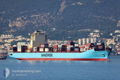
MAERSK LEON
Container Ship
Current Trip
BRSSZ>BRRSH
| Time Travelled | 21 h, 37 mins |
|---|---|
| Remaining Time | --- |
| Distance Travelled | 309.42 nm |
| Remaining Distance | --- |
| AVG Speed | 15.5 Knopen |
| MAX Speed | 16.6 Knopen |
| AVG Wind | 10.9 knots |
| MAX Wind | 15.8 knots |
| MIN Temp | 23.1°C / 73.58°F |
| MAX Temp | 27.5°C / 81.5°F |
| Diepgang | 13.7 M |
| Positie ontvangen | 2 d geleden |
Current Position
| Lengtegraad | --- |
|---|---|
| Breedtegraat | --- |
| Status | Under way using engine |
| Snelheid | 0.9 Knopen |
| Koers | 59° |
| Gebied | South Atlantic Ocean |
| Station | T-AIS |
| Positie ontvangen | 2 d geleden |
Info
Information
The current position of MAERSK LEON is in South Atlantic Ocean with coordinates -23.33612° / -44.11075° as reported on 2025-02-25 05:47 by AIS to our vessel tracker app. The vessel's current speed is 0.9 Knopen
The vessel MAERSK LEON (IMO: 9526966, MMSI: 219516000) is a Container Ship that was built in 2012 ( 13 Jaar oud ). It's sailing under the flag of [DK] Denmark.
In this page you can find informations about the vessels current position, last detected port calls, and current voyage information. If the vessels is not in coverage by AIS you will find the latest position.
The current position of MAERSK LEON is detected by our AIS receivers and we are not responsible for the reliability of the data. The last position was recorded while the vessel was in Coverage by the Ais receivers of our vessel tracking app.
The current draught of MAERSK LEON as reported by AIS is 13.7 meters
Weather
| Temperature | 26.6°C / 79.88°F |
|---|---|
| Wind Speed | 11 knots |
| Direction | 71° ENE |
| Pressure | 1015.5 hPa |
| Humidity | 78.4 % |
| Cloud Coverage | 40 % |
Featured Company
Last Port Calls
| Port | Arrival | Departure | Time In Port |
|---|---|---|---|
| 2025-02-25 10:25 | 2025-02-26 08:18 | 21 h | |
| 2025-02-23 04:59 | 2025-02-23 05:48 | 49 m | |
| 2025-02-19 13:39 | 2025-02-20 13:40 | 1 d | |
| 2025-02-16 08:52 | 2025-02-17 19:05 | 1 d | |
| 2025-02-14 02:32 | 2025-02-14 03:24 | 52 m | |
| 2025-02-10 23:50 | 2025-02-11 14:34 | 14 h | |
| 2025-02-01 23:28 | 2025-02-02 18:39 | 19 h | |
| 2025-01-29 00:17 | 2025-01-29 21:09 | 20 h | |
| 2025-01-28 00:24 | 2025-01-28 23:52 | 23 h | |
| 2025-01-26 12:52 | 2025-01-27 02:34 | 13 h |
Last Trips
| Origin | Departure | Destination | Arrival | Distance | |
|---|---|---|---|---|---|
| 2025-02-23 02:48 | 2025-02-25 07:25 | 225.59 nm | |||
| 2025-02-20 10:40 | 2025-02-23 01:59 | 186.24 nm | |||
| 2025-02-17 16:05 | 2025-02-19 10:39 | 76.82 nm | |||
| 2025-02-14 00:24 | 2025-02-16 05:52 | 214.47 nm | |||
| 2025-02-11 11:34 | 2025-02-13 23:32 | 990.95 nm | |||
| 2025-02-02 19:39 | 2025-02-10 20:50 | 3551.34 nm | |||
| 2025-01-29 22:09 | 2025-02-02 00:28 | 186.27 nm | |||
| 2025-01-29 00:52 | 2025-01-29 01:17 | 3.49 nm | |||
| 2025-01-27 03:34 | 2025-01-28 01:24 | 119.92 nm | |||
| 2025-01-15 07:26 | 2025-01-26 13:52 | 4269.54 nm |
Events
| Tijd | Evenement | Details | Positie / Bestemming | Info |
|---|---|---|---|---|
| 2025-02-26 08:18 | Start beweging | 0.88 nm, South East of ITAGUAI |
-22.94419 / -43.83802
BRSSZ>BRRSH
|
Snelheid: 7.3 kn Koers: 234° |
| 2025-02-26 08:18 | Vertrekhaven |
|
-22.94419 / -43.83802
BRSSZ>BRRSH
|
Snelheid: 1.4 kn Koers: 172° |
| 2025-02-25 10:30 | Stop beweging |
-22.93242 / -43.84112
[BR] ITAGUAI
|
Snelheid: 0.1 kn Koers: 86° |
|
| 2025-02-25 10:25 | Aankomsthaven |
|
-22.93275 / -43.84117
[BR] ITAGUAI
|
Snelheid: 1.8 kn Koers: 57° |
| 2025-02-25 06:28 | Start beweging | 11.96 nm, South of VILA DO ABRAAO |
-23.32768 / -44.10062
BRSSZ>BRRSH
|
Snelheid: 3.8 kn Koers: 32° |
| 2025-02-25 05:50 | Status Changed | Default Under way using engine |
-23.33654 / -44.11015
BRSSZ>BRRSH
|
Snelheid: 0.9 kn Koers: 59° |
| 2025-02-25 05:47 | Status Changed | Under way using engine Default |
-23.33612 / -44.11075
BRSSZ>BRRSH
|
Snelheid: 0.7 kn Koers: 56° |
| 2025-02-25 05:47 | Buitenbereik |
-23.33612 / -44.11075
South Atlantic Ocean
|
Snelheid: 0.9 kn Koers: 201.8° |
|
| 2025-02-25 05:38 | Binnenbereik |
-23.33612 / -44.11075
South Atlantic Ocean
|
Snelheid: 0.9 kn Koers: 201.8° |
|
| 2025-02-25 05:18 | Stop beweging | 12.07 nm, South of VILA DO ABRAAO |
-23.33137 / -44.10746
BRSSZ>BRRSH
|
Snelheid: Koers: 32° |