
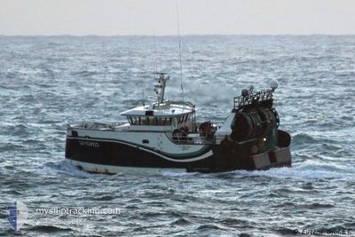
LE DOLMEN
Fishing
Current Trip
LORIENT
| Time Travelled | 30 days |
|---|---|
| Remaining Time | --- |
| Distance Travelled | 763.47 nm |
| Remaining Distance | --- |
| AVG Speed | 7.9 Knopen |
| MAX Speed | 10.7 Knopen |
| AVG Wind | 14.1 knots |
| MAX Wind | 24.8 knots |
| MIN Temp | 10.2°C / 50.36°F |
| MAX Temp | 17.3°C / 63.14°F |
| Diepgang | 0 M |
| Positie ontvangen | 1 d geleden |
Current Position
| Lengtegraad | --- |
|---|---|
| Breedtegraat | --- |
| Status | Pushing Ahead - Towing |
| Snelheid | 9.7 Knopen |
| Koers | 35.8° |
| Gebied | North Atlantic Ocean |
| Station | T-AIS |
| Positie ontvangen | 1 d geleden |
Info
Information
The current position of LE DOLMEN is in North Atlantic Ocean with coordinates 51.60183° / -9.93914° as reported on 2024-09-28 13:42 by AIS to our vessel tracker app. The vessel's current speed is 9.7 Knopen
The vessel LE DOLMEN (IMO: 9851074, MMSI: 228364600) is a Fishing It's sailing under the flag of [FR] France.
In this page you can find informations about the vessels current position, last detected port calls, and current voyage information. If the vessels is not in coverage by AIS you will find the latest position.
The current position of LE DOLMEN is detected by our AIS receivers and we are not responsible for the reliability of the data. The last position was recorded while the vessel was in Coverage by the Ais receivers of our vessel tracking app.
Weather
| Temperature | 12.9°C / 55.22°F |
|---|---|
| Wind Speed | 10 knots |
| Direction | 182° S |
| Pressure | 1024.5 hPa |
| Humidity | 68 % |
| Cloud Coverage | 100 % |
Featured Company
Last Port Calls
| Port | Arrival | Departure | Time In Port |
|---|---|---|---|
| 2024-08-19 01:52 | 2024-08-29 21:47 | 10 d | |
| 2024-08-08 12:27 | 2024-08-08 12:55 | 28 m | |
| 2024-08-08 09:53 | 2024-08-08 12:16 | 2 h | |
| 2024-08-05 08:03 | 2024-08-06 14:10 | 1 d | |
| 2024-07-17 13:19 | 2024-07-22 17:18 | 5 d | |
| 2024-07-06 14:43 | 2024-07-17 13:11 | 10 d |
Most Visited Ports (Last year)
| Port | Arrivals | |
|---|---|---|
| 27 | ||
| 16 | ||
| 2 | ||
| 1 |
Last Trips
| Origin | Departure | Destination | Arrival | Distance | |
|---|---|---|---|---|---|
| 2024-08-08 14:55 | 2024-08-19 03:52 | 112.18 nm | |||
| 2024-08-08 14:16 | 2024-08-08 14:27 | 1.35 nm | |||
| 2024-08-06 16:10 | 2024-08-08 11:53 | 166.00 nm | |||
| 2024-07-22 19:18 | 2024-08-05 10:03 | 585.12 nm | |||
| 2024-07-17 15:11 | 2024-07-17 15:19 | 0.79 nm | |||
| 2024-06-27 12:06 | 2024-07-06 16:43 | 386.30 nm |
Events
| Tijd | Evenement | Details | Positie / Bestemming | Info |
|---|---|---|---|---|
| 2024-09-28 13:42 | Buitenbereik |
51.60183 / -9.93914
North Atlantic Ocean
|
Snelheid: 9.7 kn Koers: 35.8° |
|
| 2024-09-28 12:50 | Binnenbereik |
51.49972 / -10.07157
North Atlantic Ocean
|
Snelheid: 10.6 kn Koers: 37.6° |
|
| 2024-09-27 12:21 | Buitenbereik |
51.51089 / -10.02095
North Atlantic Ocean
|
Snelheid: 10.1 kn Koers: 208.5° |
|
| 2024-09-27 11:51 | Binnenbereik |
51.58516 / -9.95497
North Atlantic Ocean
|
Snelheid: 10.2 kn Koers: 208.9° |
|
| 2024-09-26 15:36 | Buitenbereik |
51.54238 / -9.98542
North Atlantic Ocean
|
Snelheid: 6.4 kn Koers: 31.6° |
|
| 2024-09-26 14:40 | Gevonden in zee | Irish part of the North Atlantic Ocean |
51.43402 / -10.08919
North Atlantic Ocean
|
Snelheid: 8.1 kn Koers: 29.8° |
| 2024-09-26 14:40 | Binnenbereik |
51.43402 / -10.08919
North Atlantic Ocean
|
Snelheid: 8.1 kn Koers: 29.8° |