
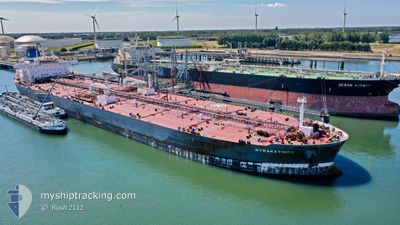
KYRAKATINGO
Tanker
Current Trip
| Time Travelled | 47 days |
|---|---|
| Remaining Time | --- |
| Distance Travelled | 9959.69 nm |
| Remaining Distance | --- |
| AVG Speed | 12.2 Knopen |
| MAX Speed | 16.4 Knopen |
| AVG Wind | 11 knots |
| MAX Wind | 31 knots |
| MIN Temp | 7.6°C / 45.68°F |
| MAX Temp | 29.9°C / 85.82°F |
| Diepgang | 12.9 M |
| Positie ontvangen | 1 m geleden |
Current Position
| Lengtegraad | -75.18680° |
|---|---|
| Breedtegraat | 38.95770° |
| Status | At anchor |
| Snelheid | |
| Koers | 353° |
| Gebied | North Atlantic Ocean |
| Station | T-AIS |
| Positie ontvangen | 1 m geleden |
Info
Information
The current position of KYRAKATINGO is in North Atlantic Ocean with coordinates 38.95770° / -75.18680° as reported on 2024-04-25 20:13 by AIS to our vessel tracker app. The vessel's current speed is 0 Knopen
The vessel KYRAKATINGO (IMO: 9779965, MMSI: 249997000) is a Tanker It's sailing under the flag of [MT] Malta.
In this page you can find informations about the vessels current position, last detected port calls, and current voyage information. If the vessels is not in coverage by AIS you will find the latest position.
The current position of KYRAKATINGO is detected by our AIS receivers and we are not responsible for the reliability of the data. The last position was recorded while the vessel was in Coverage by the Ais receivers of our vessel tracking app.
The current draught of KYRAKATINGO as reported by AIS is 12.9 meters
Weather
| Temperature | 10.1°C / 50.18°F |
|---|---|
| Wind Speed | 13 knots |
| Direction | 107° ESE |
| Pressure | 1025.7 hPa |
| Humidity | 62.9 % |
| Cloud Coverage | 8 % |
Featured Company
Last Port Calls
| Port | Arrival | Departure | Time In Port |
|---|---|---|---|
| 2024-03-07 22:15 | 2024-03-09 10:03 | 1 d | |
| 2024-03-01 22:40 | 2024-03-03 04:32 | 1 d | |
| 2024-02-13 09:24 | 2024-02-14 12:50 | 1 d | |
| 2024-02-03 14:39 | 2024-02-05 10:47 | 1 d |
Last Trips
| Origin | Departure | Destination | Arrival | Distance | |
|---|---|---|---|---|---|
| 2024-03-03 05:32 | 2024-03-07 22:15 | 767.19 nm | |||
| 2024-02-14 12:50 | 2024-03-01 23:40 | 1269.85 nm | |||
| 2024-02-05 11:47 | 2024-02-13 09:24 | 1035.43 nm | |||
| 2024-01-31 22:59 | 2024-02-03 15:39 | 760.14 nm |
Events
| Tijd | Evenement | Details | Positie / Bestemming | Info |
|---|---|---|---|---|
| 2024-04-25 20:13 | Status Changed | At anchor Default |
38.95770 / -75.18680
US MAH
|
Snelheid: Koers: -1° |
| 2024-04-25 19:37 | Status Changed | Default At anchor |
38.95766 / -75.18728
US MAH
|
Snelheid: Koers: 353° |
| 2024-04-25 19:28 | Status Changed | At anchor Default |
38.95772 / -75.18701
US MAH
|
Snelheid: Koers: 352° |
| 2024-04-25 19:25 | Status Changed | Default At anchor |
38.95775 / -75.18696
US MAH
|
Snelheid: Koers: 353° |
| 2024-04-25 19:22 | Status Changed | At anchor Default |
38.95781 / -75.18695
US MAH
|
Snelheid: Koers: -1° |
| 2024-04-25 18:55 | Status Changed | Default At anchor |
38.95778 / -75.18726
US MAH
|
Snelheid: Koers: 351° |
| 2024-04-25 18:43 | Status Changed | At anchor Default |
38.95778 / -75.18724
US MAH
|
Snelheid: Koers: 354° |
| 2024-04-25 18:25 | Status Changed | Default At anchor |
38.95772 / -75.18737
US MAH
|
Snelheid: Koers: 353° |
| 2024-04-25 18:22 | Status Changed | At anchor Default |
38.95772 / -75.18736
US MAH
|
Snelheid: Koers: 352° |
| 2024-04-25 17:06 | Buitenbereik |
38.95811 / -75.18963
North Atlantic Ocean
|
Snelheid: Koers: 116.3° |