
JULIUS S
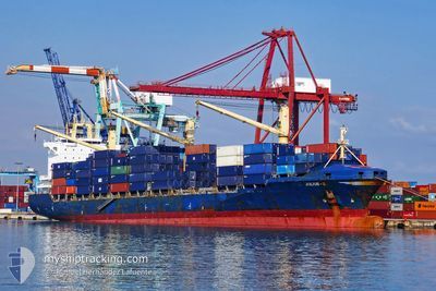
Container Ship
Current Trip
FREETOWN
| Time Travelled | 1 day |
|---|---|
| Remaining Time | --- |
| Distance Travelled | 5.65 nm |
| Remaining Distance | --- |
| AVG Speed | 6.9 Knopen |
| MAX Speed | 6.9 Knopen |
| AVG Wind | 7.7 knots |
| MAX Wind | 15 knots |
| MIN Temp | 26.8°C / 80.24°F |
| MAX Temp | 28.9°C / 84.02°F |
| Diepgang | 11.2 M |
| Positie ontvangen | 2024-03-23 10:44 |
Current Position
| Lengtegraad | 3.38794° |
|---|---|
| Breedtegraat | 6.43592° |
| Status | Moored |
| Snelheid | |
| Koers | 294° |
| Gebied | Gulf of Guinea |
| Station | T-AIS |
| Positie ontvangen | 2024-03-23 10:44 |
Info
Information
The current position of JULIUS S is in Gulf of Guinea with coordinates 6.43592° / 3.38794° as reported on 2024-03-23 10:44 by AIS to our vessel tracker app. The vessel's current speed is 0 Knopen
The vessel JULIUS S (IMO: 9294018, MMSI: 304010000) is a Container Ship that was built in 2004 ( 20 Jaar oud ). It's sailing under the flag of [AG] Antigua Barbuda.
In this page you can find informations about the vessels current position, last detected port calls, and current voyage information. If the vessels is not in coverage by AIS you will find the latest position.
The current position of JULIUS S is detected by our AIS receivers and we are not responsible for the reliability of the data. The last position was recorded while the vessel was in Coverage by the Ais receivers of our vessel tracking app.
The current draught of JULIUS S as reported by AIS is 11.2 meters
Weather
| Temperature | 27.5°C / 81.5°F |
|---|---|
| Wind Speed | 5 knots |
| Direction | 312° NW |
| Pressure | 1011 hPa |
| Humidity | 89 % |
| Cloud Coverage | 100 % |
Featured Company
Last Port Calls
| Port | Arrival | Departure | Time In Port |
|---|---|---|---|
| 2024-04-21 13:07 | 2024-04-22 13:14 | 1 d | |
| 2024-04-21 12:23 | 2024-04-21 12:38 | 15 m | |
| 2024-04-15 20:37 | 2024-04-17 21:39 | 2 d | |
| 2024-04-06 15:51 | 2024-04-07 10:20 | 18 h | |
| 2024-04-02 16:40 | 2024-04-03 17:41 | 1 d | |
| 2024-03-26 13:53 | |||
| 2024-03-22 06:52 | 2024-03-23 23:29 | 1 d | |
| 2024-03-13 18:17 | 2024-03-14 21:49 | 1 d | |
| 2024-02-25 21:35 | 2024-02-27 17:11 | 1 d | |
| 2024-02-14 22:11 | 2024-02-16 08:51 | 1 d |
Last Trips
| Origin | Departure | Destination | Arrival | Distance | |
|---|---|---|---|---|---|
| 2024-04-21 13:38 | 2024-04-21 14:07 | 0.53 nm | |||
| 2024-04-17 21:39 | 2024-04-21 13:23 | 1355.64 nm | |||
| 2024-04-07 12:20 | 2024-04-15 20:37 | 2036.38 nm | |||
| 2024-04-03 18:41 | 2024-04-06 17:51 | 966.79 nm | |||
| 2024-03-24 00:29 | 2024-03-26 14:53 | 100.38 nm | |||
| 2024-03-14 22:49 | 2024-03-22 07:52 | 423.05 nm | |||
| 2024-02-27 18:11 | 2024-03-13 19:17 | 772.00 nm | |||
| 2024-02-16 09:51 | 2024-02-25 22:35 | 374.91 nm | |||
| 2024-02-07 14:18 | 2024-02-14 23:11 | 388.20 nm | |||
| 2024-01-25 14:47 | 2024-02-06 08:50 | 398.62 nm |
Events
| Tijd | Evenement | Details | Positie / Bestemming | Info |
|---|---|---|---|---|
| 2024-04-22 14:40 | Stop beweging | 6.67 nm, North East of LUANDA |
-8.68683 / 13.29393
FREETOWN
|
Snelheid: 0.1 kn Koers: 252° |
| 2024-04-22 13:14 | Vertrekhaven |
|
-8.76196 / 13.27708
FREETOWN
|
Snelheid: 7.9 kn Koers: 50° |
| 2024-04-22 12:51 | Start beweging |
-8.79633 / 13.24979
[AO] LUANDA
|
Snelheid: 6.1 kn Koers: 323° |
|
| 2024-04-21 13:46 | Stop beweging |
-8.79852 / 13.25337
[AO] LUANDA
|
Snelheid: 0.3 kn Koers: 237° |
|
| 2024-04-21 13:11 | Start beweging |
-8.77218 / 13.27118
[AO] LUANDA
|
Snelheid: 3.6 kn Koers: 231° |
|
| 2024-04-21 13:07 | Aankomsthaven |
|
-8.77005 / 13.27415
[AO] LUANDA
|
Snelheid: 0.2 kn Koers: 223° |
| 2024-04-21 12:58 | Stop beweging | 2.24 nm, North East of LUANDA |
-8.76562 / 13.27765
FREETOWN
|
Snelheid: 0.2 kn Koers: 223° |
| 2024-04-21 12:38 | Vertrekhaven |
|
-8.76400 / 13.27797
FREETOWN
|
Snelheid: 2.2 kn Koers: 230° |
| 2024-04-21 12:23 | Aankomsthaven |
|
-8.76844 / 13.27193
[AO] LUANDA
|
Snelheid: 5 kn Koers: 216° |
| 2024-04-21 11:35 | Start beweging | 5 nm, North East of LUANDA |
-8.71322 / 13.28410
FREETOWN
|
Snelheid: 5.4 kn Koers: 191° |