
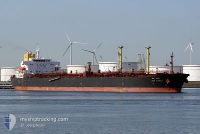
JAG AABHA
Oil Products Tanker
Current Trip
| Time Travelled | 6 days |
|---|---|
| Remaining Time | --- |
| Distance Travelled | 96.57 nm |
| Remaining Distance | --- |
| AVG Speed | 5.2 Knopen |
| MAX Speed | 12.4 Knopen |
| AVG Wind | 12.4 knots |
| MAX Wind | 25 knots |
| MIN Temp | 21.4°C / 70.52°F |
| MAX Temp | 25.9°C / 78.62°F |
| Diepgang | 7.8 M |
| Positie ontvangen | 1 m geleden |
Current Position
| Lengtegraad | 55.03602° |
|---|---|
| Breedtegraat | 25.44350° |
| Status | At anchor |
| Snelheid | 0.1 Knopen |
| Koers | 142° |
| Gebied | Persian Gulf |
| Station | T-AIS |
| Positie ontvangen | 1 m geleden |
Info
Information
The current position of JAG AABHA is in Persian Gulf with coordinates 25.44350° / 55.03602° as reported on 2024-04-19 00:14 by AIS to our vessel tracker app. The vessel's current speed is 0.1 Knopen
The vessel JAG AABHA (IMO: 9388948, MMSI: 419746000) is a Oil Products Tanker that was built in 2008 ( 16 Jaar oud ). It's sailing under the flag of [IN] India.
In this page you can find informations about the vessels current position, last detected port calls, and current voyage information. If the vessels is not in coverage by AIS you will find the latest position.
The current position of JAG AABHA is detected by our AIS receivers and we are not responsible for the reliability of the data. The last position was recorded while the vessel was in Coverage by the Ais receivers of our vessel tracking app.
The current draught of JAG AABHA as reported by AIS is 7.8 meters
Weather
| Temperature | 24.9°C / 76.82°F |
|---|---|
| Wind Speed | 4 knots |
| Direction | 312° NW |
| Pressure | 1008.4 hPa |
| Humidity | 67.8 % |
| Cloud Coverage | --- |
Featured Company
Events
| Tijd | Evenement | Details | Positie / Bestemming | Info |
|---|---|---|---|---|
| 2024-04-18 03:00 | Status Changed | At anchor Default |
25.44331 / 55.03890
DUBAI
|
Snelheid: Koers: 235° |
| 2024-04-18 02:56 | Status Changed | Default At anchor |
25.44331 / 55.03889
DUBAI
|
Snelheid: Koers: 234° |
| 2024-04-18 02:00 | Status Changed | At anchor Default |
25.44346 / 55.03893
DUBAI
|
Snelheid: Koers: 235° |
| 2024-04-18 01:54 | Status Changed | Default At anchor |
25.44339 / 55.03888
DUBAI
|
Snelheid: Koers: 232° |
| 2024-04-17 23:09 | Status Changed | At anchor Default |
25.44323 / 55.03893
DUBAI
|
Snelheid: Koers: 251° |
| 2024-04-17 23:00 | Status Changed | Default At anchor |
25.44301 / 55.03912
DUBAI
|
Snelheid: Koers: 246° |
| 2024-04-17 22:09 | Status Changed | At anchor Default |
25.44248 / 55.03920
DUBAI
|
Snelheid: Koers: 266° |
| 2024-04-17 21:59 | Status Changed | Default At anchor |
25.44236 / 55.03927
DUBAI
|
Snelheid: Koers: 263° |
| 2024-04-17 21:21 | Status Changed | At anchor Default |
25.44233 / 55.03931
DUBAI
|
Snelheid: Koers: 268° |
| 2024-04-17 21:12 | Status Changed | Default At anchor |
25.44233 / 55.03921
DUBAI
|
Snelheid: 0.1 kn Koers: 269° |