
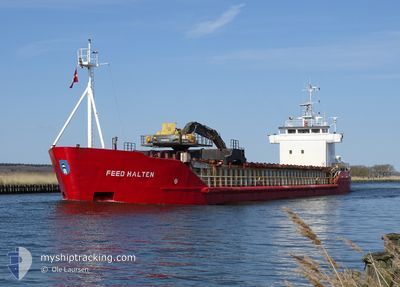
FEED HALTEN
General Cargo
Current Trip
| Time Travelled | 3 days |
|---|---|
| Remaining Time | 14 h, 33 mins |
| Distance Travelled | 626.97 nm |
| Remaining Distance | 195.94 nm |
| AVG Speed | 9.1 Knopen |
| MAX Speed | 10.2 Knopen |
| AVG Wind | 10.2 knots |
| MAX Wind | 18 knots |
| MIN Temp | 1.4°C / 34.52°F |
| MAX Temp | 7.3°C / 45.14°F |
| Diepgang | 5.5 M |
| Positie ontvangen | 22 h, 11 m geleden |
Current Position
| Lengtegraad | 16.57583° |
|---|---|
| Breedtegraat | 56.00785° |
| Status | Under way using engine |
| Snelheid | 9.4 Knopen |
| Koers | 59.7° |
| Gebied | Baltic Sea |
| Station | T-AIS |
| Positie ontvangen | 22 h, 11 m geleden |
Info
Information
The current position of FEED HALTEN is in Baltic Sea with coordinates 56.00785° / 16.57583° as reported on 2024-04-23 19:52 by AIS to our vessel tracker app. The vessel's current speed is 9.4 Knopen and is heading at the port of BEKKERI. The estimated time of arrival as calculated by MyShipTracking vessel tracking app is 2024-04-25 08:36 LT
The vessel FEED HALTEN (IMO: 9057226, MMSI: 305210000) is a General Cargo that was built in 1992 ( 32 Jaar oud ). It's sailing under the flag of [AG] Antigua Barbuda.
In this page you can find informations about the vessels current position, last detected port calls, and current voyage information. If the vessels is not in coverage by AIS you will find the latest position.
The current position of FEED HALTEN is detected by our AIS receivers and we are not responsible for the reliability of the data. The last position was recorded while the vessel was in Coverage by the Ais receivers of our vessel tracking app.
The current draught of FEED HALTEN as reported by AIS is 5.5 meters
Weather
| Temperature | 4°C / 39.2°F |
|---|---|
| Wind Speed | 11 knots |
| Direction | 102° ESE |
| Pressure | 1010.2 hPa |
| Humidity | 80.2 % |
| Cloud Coverage | 83 % |
Featured Company
Last Port Calls
| Port | Arrival | Departure | Time In Port |
|---|---|---|---|
| 2024-04-21 04:10 | 2024-04-21 16:10 | 11 h | |
| 2024-04-19 05:05 | 2024-04-19 18:29 | 13 h | |
| 2024-04-12 16:31 | 2024-04-13 17:11 | 1 d | |
| 2024-04-11 16:46 | 2024-04-12 10:14 | 17 h | |
| 2024-04-09 11:58 | 2024-04-09 21:37 | 9 h | |
| 2024-04-08 15:57 | 2024-04-09 09:48 | 17 h | |
| 2024-04-05 04:41 | 2024-04-05 14:14 | 9 h | |
| 2024-03-27 08:50 | 2024-04-05 03:49 | 8 d | |
| 2024-03-26 02:05 | 2024-03-26 19:56 | 17 h | |
| 2024-03-20 13:43 | 2024-03-21 12:59 | 23 h |
Last Trips
| Origin | Departure | Destination | Arrival | Distance | |
|---|---|---|---|---|---|
| 2024-04-19 20:29 | 2024-04-21 06:10 | 350.02 nm | |||
| 2024-04-13 19:11 | 2024-04-19 07:05 | 635.51 nm | |||
| 2024-04-12 12:14 | 2024-04-12 18:31 | 60.74 nm | |||
| 2024-04-09 23:37 | 2024-04-11 18:46 | 389.41 nm | |||
| 2024-04-09 11:48 | 2024-04-09 13:58 | 19.81 nm | |||
| 2024-04-05 16:14 | 2024-04-08 17:57 | 473.28 nm | |||
| 2024-04-05 05:49 | 2024-04-05 06:41 | 6.47 nm | |||
| 2024-03-26 20:56 | 2024-03-27 09:50 | 88.93 nm | |||
| 2024-03-21 13:59 | 2024-03-26 03:05 | 840.93 nm | |||
| 2024-03-15 13:42 | 2024-03-20 14:43 | 940.57 nm |
Events
| Tijd | Evenement | Details | Positie / Bestemming | Info |
|---|---|---|---|---|
| 2024-04-23 19:56 | Status Changed | Default Under way using engine |
56.01373 / 16.59407
BEKKERI
|
Snelheid: 9.4 kn Koers: 59.7° |
| 2024-04-23 19:52 | Buitenbereik |
56.00785 / 16.57583
Baltic Sea
BEKKERI
|
Snelheid: 9.4 kn Koers: 59.7° |
|
| 2024-04-23 18:02 | Status Changed | Under way using engine Default |
55.86738 / 16.12648
BEKKERI
|
Snelheid: 10.2 kn Koers: 59° |
| 2024-04-23 17:52 | Status Changed | Default Under way using engine |
55.85283 / 16.08225
BEKKERI
|
Snelheid: 9.8 kn Koers: 59° |
| 2024-04-23 14:52 | Wijzig zee gebeid | Swedish part of the Baltic Sea Danish part of the Kattegat |
55.63233 / 15.32803
Baltic Sea
BEKKERI
|
Snelheid: 9.5 kn Koers: 61.7° |
| 2024-04-23 10:14 | Gevonden in zee | Danish part of the Kattegat |
55.19234 / 14.31135
Kattegat
BEKKERI
|
Snelheid: 9.7 kn Koers: 82.5° |
| 2024-04-23 08:19 | Status Changed | Under way using engine Default |
55.18953 / 13.78465
BEKKERI
|
Snelheid: 9.5 kn Koers: 94° |
| 2024-04-23 08:13 | Binnenbereik |
55.18953 / 13.78465
Baltic Sea
BEKKERI
|
Snelheid: 9.4 kn Koers: 92.6° |
|
| 2024-04-23 07:04 | Status Changed | Default Under way using engine |
55.20607 / 13.44326
BEKKERI
|
Snelheid: 9.5 kn Koers: 95.3° |
| 2024-04-23 06:58 | Buitenbereik |
55.20758 / 13.41579
Baltic Sea
BEKKERI
|
Snelheid: 9.5 kn Koers: 95.3° |