
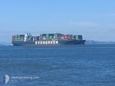
EVER FAR
Cargo A
Current Trip
| Time Travelled | 2 days |
|---|---|
| Remaining Time | --- |
| Distance Travelled | 401.26 nm |
| Remaining Distance | --- |
| AVG Speed | 12.1 Knopen |
| MAX Speed | 18 Knopen |
| AVG Wind | 13.7 knots |
| MAX Wind | 19 knots |
| MIN Temp | 2.2°C / 35.96°F |
| MAX Temp | 8.2°C / 46.76°F |
| Diepgang | 11.8 M |
| Positie ontvangen | 5 m geleden |
Current Position
| Lengtegraad | --- |
|---|---|
| Breedtegraat | --- |
| Status | At anchor |
| Snelheid | 0.1 Knopen |
| Koers | 223° |
| Gebied | North Atlantic Ocean |
| Station | T-AIS |
| Positie ontvangen | 5 m geleden |
Info
Information
The current position of EVER FAR is in North Atlantic Ocean with coordinates 42.41618° / -70.78974° as reported on 2025-02-27 21:34 by AIS to our vessel tracker app. The vessel's current speed is 0.1 Knopen
The vessel EVER FAR (IMO: 9850862, MMSI: 636020371) is a Cargo A It's sailing under the flag of [LR] Liberia.
In this page you can find informations about the vessels current position, last detected port calls, and current voyage information. If the vessels is not in coverage by AIS you will find the latest position.
The current position of EVER FAR is detected by our AIS receivers and we are not responsible for the reliability of the data. The last position was recorded while the vessel was in Coverage by the Ais receivers of our vessel tracking app.
The current draught of EVER FAR as reported by AIS is 11.8 meters
Weather
| Temperature | 8.2°C / 46.76°F |
|---|---|
| Wind Speed | 17 knots |
| Direction | 227° SW |
| Pressure | 1000 hPa |
| Humidity | 82.9 % |
| Cloud Coverage | 99 % |
Featured Company
Last Port Calls
| Port | Arrival | Departure | Time In Port |
|---|---|---|---|
| 2025-02-23 09:49 | 2025-02-25 01:04 | 1 d | |
| 2025-02-18 07:17 | 2025-02-19 06:07 | 22 h | |
| 2025-02-14 11:09 | 2025-02-16 00:05 | 1 d | |
| 2025-02-02 23:23 | 2025-02-04 01:28 | 1 d | |
| 2025-01-09 13:20 | 2025-01-10 12:44 | 23 h | |
| 2025-01-05 09:01 | 2025-01-06 00:04 | 15 h | |
| 2024-12-29 21:33 | 2024-12-30 17:41 | 20 h | |
| 2024-12-25 10:03 | 2024-12-27 07:11 | 1 d | |
| 2024-12-08 11:57 | 2024-12-10 14:38 | 2 d | |
| 2024-12-04 14:20 | 2024-12-06 02:40 | 1 d |
Last Trips
| Origin | Departure | Destination | Arrival | Distance | |
|---|---|---|---|---|---|
| 2025-02-19 01:07 | 2025-02-23 04:49 | 806.85 nm | |||
| 2025-02-15 19:05 | 2025-02-18 02:17 | 257.90 nm | |||
| 2025-02-03 20:28 | 2025-02-14 06:09 | 1585.33 nm | |||
| 2025-01-10 21:44 | 2025-02-02 18:23 | 8422.54 nm | |||
| 2025-01-06 08:04 | 2025-01-09 22:20 | 670.43 nm | |||
| 2024-12-31 01:41 | 2025-01-05 17:01 | 639.92 nm | |||
| 2024-12-27 15:11 | 2024-12-30 05:33 | 964.31 nm | |||
| 2024-12-10 06:38 | 2024-12-25 18:03 | 6659.02 nm | |||
| 2024-12-05 18:40 | 2024-12-08 03:57 | 876.10 nm | |||
| 2024-12-02 20:04 | 2024-12-04 06:20 | 413.02 nm |
Events
| Tijd | Evenement | Details | Positie / Bestemming | Info |
|---|---|---|---|---|
| 2025-02-27 19:56 | Status Changed | At anchor Default |
42.41693 / -70.79168
USNYK>>>USBOS
|
Snelheid: 0.1 kn Koers: 208° |
| 2025-02-27 19:53 | Status Changed | Default At anchor |
42.41685 / -70.79165
USNYK>>>USBOS
|
Snelheid: 0.1 kn Koers: 216° |
| 2025-02-27 19:41 | Status Changed | At anchor Default |
42.41669 / -70.79106
USNYK>>>USBOS
|
Snelheid: 0.1 kn Koers: 208° |
| 2025-02-27 19:38 | Status Changed | Default At anchor |
42.41665 / -70.79109
USNYK>>>USBOS
|
Snelheid: 0.1 kn Koers: 200° |
| 2025-02-27 19:18 | Status Changed | At anchor Default |
42.41664 / -70.79111
USNYK>>>USBOS
|
Snelheid: 0.2 kn Koers: 222° |
| 2025-02-27 19:15 | Status Changed | Default At anchor |
42.41653 / -70.79090
USNYK>>>USBOS
|
Snelheid: 0.2 kn Koers: 222° |
| 2025-02-27 18:27 | Status Changed | At anchor Default |
42.41667 / -70.79133
USNYK>>>USBOS
|
Snelheid: 0.1 kn Koers: 214° |
| 2025-02-27 18:22 | Status Changed | Default At anchor |
42.41656 / -70.79123
USNYK>>>USBOS
|
Snelheid: 0.2 kn Koers: 218° |
| 2025-02-27 18:13 | Status Changed | At anchor Default |
42.41617 / -70.79104
USNYK>>>USBOS
|
Snelheid: 0.1 kn Koers: 220° |
| 2025-02-27 18:10 | Status Changed | Default At anchor |
42.41609 / -70.79105
USNYK>>>USBOS
|
Snelheid: 0.1 kn Koers: 211° |