
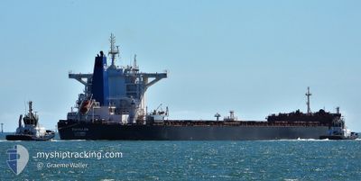
DUHALLOW
Cargo
Current Trip
| Time Travelled | 55 days |
|---|---|
| Remaining Time | 20 days |
| Distance Travelled | 11628.33 nm |
| Remaining Distance | 5611.46 nm |
| AVG Speed | 9.9 Knopen |
| MAX Speed | 13.9 Knopen |
| AVG Wind | 14.7 knots |
| MAX Wind | 30.6 knots |
| MIN Temp | 12.6°C / 54.68°F |
| MAX Temp | 30.2°C / 86.36°F |
| Diepgang | 18.3 M |
| Positie ontvangen | 6 d geleden |
Current Position
| Lengtegraad | --- |
|---|---|
| Breedtegraat | --- |
| Status | Under way using engine |
| Snelheid | 8.7 Knopen |
| Koers | 107.4° |
| Gebied | South Atlantic Ocean |
| Station | T-AIS |
| Positie ontvangen | 6 d geleden |
Info
Information
The current position of DUHALLOW is in South Atlantic Ocean with coordinates -34.77948° / 18.38490° as reported on 2024-09-23 14:30 by AIS to our vessel tracker app. The vessel's current speed is 8.7 Knopen and is heading at the port of SINGAPORE. The estimated time of arrival as calculated by MyShipTracking vessel tracking app is 2024-10-20 11:41 LT
The vessel DUHALLOW (IMO: 9729207, MMSI: 235115734) is a Cargo It's sailing under the flag of [GB] United Kingdom.
In this page you can find informations about the vessels current position, last detected port calls, and current voyage information. If the vessels is not in coverage by AIS you will find the latest position.
The current position of DUHALLOW is detected by our AIS receivers and we are not responsible for the reliability of the data. The last position was recorded while the vessel was in Coverage by the Ais receivers of our vessel tracking app.
The current draught of DUHALLOW as reported by AIS is 18.3 meters
Weather
| Temperature | 16°C / 60.8°F |
|---|---|
| Wind Speed | 26 knots |
| Direction | 116° ESE |
| Pressure | 1011.5 hPa |
| Humidity | 88.5 % |
| Cloud Coverage | 8 % |
Featured Company
Last Port Calls
| Port | Arrival | Departure | Time In Port |
|---|---|---|---|
| 2024-08-02 06:38 | 2024-08-05 03:48 | 2 d | |
| 2024-07-11 08:00 | 2024-07-13 19:28 | 2 d |
Most Visited Ports (Last year)
| Port | Arrivals | |
|---|---|---|
| 3 | ||
| 2 | ||
| 1 | ||
| 1 | ||
| 1 | ||
| 1 |
Last Trips
| Origin | Departure | Destination | Arrival | Distance | |
|---|---|---|---|---|---|
| 2024-07-13 21:28 | 2024-08-02 12:08 | 4339.01 nm | |||
| 2024-06-24 19:45 | 2024-07-11 10:00 | 4100.19 nm |
Events
| Tijd | Evenement | Details | Positie / Bestemming | Info |
|---|---|---|---|---|
| 2024-09-23 14:30 | Buitenbereik |
-34.77948 / 18.38490
South Atlantic Ocean
SGSIN PEBGA
|
Snelheid: 8.7 kn Koers: 107.4° |
|
| 2024-09-23 13:42 | Status Changed | Under way using engine Default |
-34.76154 / 18.24454
SGSIN PEBGA
|
Snelheid: 8.9 kn Koers: 95° |
| 2024-09-23 13:39 | Status Changed | Default Under way using engine |
-34.76080 / 18.23606
SGSIN PEBGA
|
Snelheid: 8.8 kn Koers: 95.6° |
| 2024-09-23 13:24 | Status Changed | Under way using engine Default |
-34.75696 / 18.19061
SGSIN PEBGA
|
Snelheid: 8.8 kn Koers: 96° |
| 2024-09-23 13:13 | Status Changed | Default Under way using engine |
-34.75420 / 18.15793
SGSIN PEBGA
|
Snelheid: 8.8 kn Koers: 96.9° |
| 2024-09-23 13:08 | Status Changed | Under way using engine Default |
-34.75285 / 18.14305
SGSIN PEBGA
|
Snelheid: 9 kn Koers: 96° |
| 2024-09-23 13:04 | Status Changed | Default Under way using engine |
-34.75162 / 18.13040
SGSIN PEBGA
|
Snelheid: 9 kn Koers: 95.4° |
| 2024-09-23 13:03 | Status Changed | Under way using engine Default |
-34.75153 / 18.12938
SGSIN PEBGA
|
Snelheid: 9 kn Koers: 95° |
| 2024-09-23 12:31 | Status Changed | Default Under way using engine |
-34.74254 / 18.03363
SGSIN PEBGA
|
Snelheid: 8.7 kn Koers: 101° |
| 2024-09-23 12:31 | Status Changed | Under way using engine Default |
-34.74222 / 18.03163
SGSIN PEBGA
|
Snelheid: 8.8 kn Koers: 100° |