
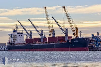
CURIA
Cargo
Current Trip
| Time Travelled | 3 days |
|---|---|
| Remaining Time | 1 day |
| Distance Travelled | 1024.71 nm |
| Remaining Distance | 530.82 nm |
| AVG Speed | 11.5 Knopen |
| MAX Speed | 13.7 Knopen |
| AVG Wind | 11.5 knots |
| MAX Wind | 24.3 knots |
| MIN Temp | 14.1°C / 57.38°F |
| MAX Temp | 21°C / 69.8°F |
| Diepgang | 10.3 M |
| Positie ontvangen | 1 d geleden |
Current Position
| Lengtegraad | 14.12360° |
|---|---|
| Breedtegraat | 36.38010° |
| Status | Under way using engine |
| Snelheid | 11.9 Knopen |
| Koers | 293.1° |
| Gebied | Mediterranean Sea - Eastern Basin |
| Station | T-AIS |
| Positie ontvangen | 1 d geleden |
Info
Information
The current position of CURIA is in Mediterranean Sea - Eastern Basin with coordinates 36.38010° / 14.12360° as reported on 2024-04-18 14:38 by AIS to our vessel tracker app. The vessel's current speed is 11.9 Knopen and is heading at the port of ALGECIRAS. The estimated time of arrival as calculated by MyShipTracking vessel tracking app is 2024-04-21 21:57 LT
The vessel CURIA (IMO: 9710048, MMSI: 269056000) is a Cargo It's sailing under the flag of [CH] Switzerland.
In this page you can find informations about the vessels current position, last detected port calls, and current voyage information. If the vessels is not in coverage by AIS you will find the latest position.
The current position of CURIA is detected by our AIS receivers and we are not responsible for the reliability of the data. The last position was recorded while the vessel was in Coverage by the Ais receivers of our vessel tracking app.
The current draught of CURIA as reported by AIS is 10.3 meters
Weather
| Temperature | 14.6°C / 58.28°F |
|---|---|
| Wind Speed | 9 knots |
| Direction | 87° E |
| Pressure | 1015.8 hPa |
| Humidity | 60.8 % |
| Cloud Coverage | 6 % |
Featured Company
Last Port Calls
| Port | Arrival | Departure | Time In Port |
|---|---|---|---|
| 2024-04-09 06:18 | 2024-04-16 14:15 | 7 d | |
| 2024-03-24 06:49 | 2024-04-06 02:03 | 12 d | |
| 2024-03-21 00:26 | 2024-03-21 02:14 | 1 h | |
| 2024-02-23 08:21 | 2024-02-24 12:57 | 1 d |
Last Trips
| Origin | Departure | Destination | Arrival | Distance | |
|---|---|---|---|---|---|
| 2024-04-06 04:03 | 2024-04-09 09:18 | 582.69 nm | |||
| 2024-03-21 04:14 | 2024-03-24 08:49 | 22.35 nm | |||
| 2024-02-24 06:57 | 2024-03-21 02:26 | 6731.98 nm | |||
| 2024-01-05 17:14 | 2024-02-23 02:21 | 10402.82 nm |
Events
| Tijd | Evenement | Details | Positie / Bestemming | Info |
|---|---|---|---|---|
| 2024-04-18 14:38 | Buitenbereik |
36.38010 / 14.12360
Mediterranean Sea - Eastern Basin
ES ALG
|
Snelheid: 11.9 kn Koers: 293.1° |
|
| 2024-04-18 13:04 | ETA Changed | 2024/04/21 20:00 2024/04/21 14:00 |
36.27028 / 14.47762
ES ALG
|
Snelheid: 11.5 kn Koers: 293.6° |
| 2024-04-18 12:18 | Wijzig zee gebeid | Maltese part of the Mediterranean Sea - Eastern Basin Greek part of the Mediterranean Sea - Eastern Basin |
36.21456 / 14.64562
Mediterranean Sea - Eastern Basin
ES ALG
|
Snelheid: 11.2 kn Koers: 290.9° |
| 2024-04-18 12:18 | Binnenbereik |
36.21456 / 14.64562
Mediterranean Sea - Eastern Basin
ES ALG
|
Snelheid: 11.2 kn Koers: 290.9° |
|
| 2024-04-17 12:07 | Status Changed | Default Under way using engine |
36.05234 / 20.30864
ES ALG
|
Snelheid: 12.3 kn Koers: 274.7° |
| 2024-04-17 11:58 | Buitenbereik |
36.05035 / 20.34363
Mediterranean Sea - Eastern Basin
ES ALG
|
Snelheid: 12.3 kn Koers: 274.7° |
|
| 2024-04-17 09:39 | Status Changed | Under way using engine Default |
36.03988 / 20.93136
ES ALG
|
Snelheid: 12 kn Koers: 269° |
| 2024-04-17 09:34 | Binnenbereik |
36.03984 / 20.92572
Mediterranean Sea - Eastern Basin
ES ALG
|
Snelheid: 12.1 kn Koers: 270° |
|
| 2024-04-17 03:39 | Status Changed | Default Under way using engine |
36.02702 / 22.48353
ES ALG
|
Snelheid: 13.3 kn Koers: 271.7° |
| 2024-04-17 03:37 | Buitenbereik |
36.02679 / 22.49343
Mediterranean Sea - Eastern Basin
ES ALG
|
Snelheid: 13.3 kn Koers: 271.7° |