
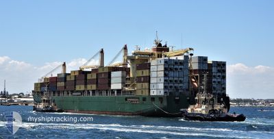
CAPE MOSS
Container Ship
Current Trip
| Time Travelled | 8 days |
|---|---|
| Remaining Time | --- |
| Distance Travelled | 2680.05 nm |
| Remaining Distance | 50.35 nm |
| AVG Speed | 13.9 Knopen |
| MAX Speed | 16.8 Knopen |
| AVG Wind | 11.7 knots |
| MAX Wind | 30.3 knots |
| MIN Temp | 15.7°C / 60.26°F |
| MAX Temp | 29.8°C / 85.64°F |
| Diepgang | 10.9 M |
| Positie ontvangen | 5 d geleden |
Current Position
| Lengtegraad | -17.71195° |
|---|---|
| Breedtegraat | 20.85062° |
| Status | Under way using engine |
| Snelheid | 15 Knopen |
| Koers | 197.1° |
| Gebied | North Atlantic Ocean |
| Station | T-AIS |
| Positie ontvangen | 5 d geleden |
Info
Information
The current position of CAPE MOSS is in North Atlantic Ocean with coordinates 20.85062° / -17.71195° as reported on 2024-04-15 09:26 by AIS to our vessel tracker app. The vessel's current speed is 15 Knopen and is heading at the port of ABIDJAN. The estimated time of arrival as calculated by MyShipTracking vessel tracking app is 2024-04-19 12:00 LT
The vessel CAPE MOSS (IMO: 9445916, MMSI: 538004165) is a Container Ship that was built in 2011 ( 13 Jaar oud ). It's sailing under the flag of [MH] Marshall Is.
In this page you can find informations about the vessels current position, last detected port calls, and current voyage information. If the vessels is not in coverage by AIS you will find the latest position.
The current position of CAPE MOSS is detected by our AIS receivers and we are not responsible for the reliability of the data. The last position was recorded while the vessel was in Coverage by the Ais receivers of our vessel tracking app.
The current draught of CAPE MOSS as reported by AIS is 10.9 meters
Weather
| Temperature | 29.7°C / 85.46°F |
|---|---|
| Wind Speed | 9 knots |
| Direction | 192° SSW |
| Pressure | 1010.7 hPa |
| Humidity | 73.4 % |
| Cloud Coverage | 9 % |
Featured Company
Last Port Calls
| Port | Arrival | Departure | Time In Port |
|---|---|---|---|
| 2024-04-11 20:22 | 2024-04-12 08:18 | 11 h | |
| 2024-04-09 16:55 | 2024-04-10 00:37 | 7 h | |
| 2024-04-02 13:19 | 2024-04-04 14:27 | 2 d | |
| 2024-03-26 06:49 | 2024-03-26 15:40 | 8 h | |
| 2024-03-23 01:30 | 2024-03-23 12:16 | 10 h | |
| 2024-03-12 20:43 | 2024-03-14 18:31 | 1 d | |
| 2024-03-06 13:57 | 2024-03-06 23:04 | 9 h | |
| 2024-02-23 22:14 | 2024-02-25 09:49 | 1 d | |
| 2024-02-21 17:37 | 2024-02-22 14:47 | 21 h | |
| 2024-02-14 12:39 | 2024-02-15 07:57 | 19 h |
Most Visited Ports (Last year)
| Port | Arrivals | |
|---|---|---|
| 12 | ||
| 9 | ||
| 9 | ||
| 7 | ||
| 3 | ||
| 3 |
Last Trips
| Origin | Departure | Destination | Arrival | Distance | |
|---|---|---|---|---|---|
| 2024-04-10 02:37 | 2024-04-11 20:22 | 125.14 nm | |||
| 2024-04-04 14:27 | 2024-04-09 18:55 | 1539.23 nm | |||
| 2024-03-26 16:40 | 2024-04-02 13:19 | 1543.61 nm | |||
| 2024-03-23 13:16 | 2024-03-26 07:49 | 213.27 nm | |||
| 2024-03-14 18:31 | 2024-03-23 02:30 | 1539.45 nm | |||
| 2024-03-07 00:04 | 2024-03-12 20:43 | 1537.86 nm | |||
| 2024-02-25 09:49 | 2024-03-06 14:57 | 2038.59 nm | |||
| 2024-02-22 14:47 | 2024-02-23 22:14 | 129.28 nm | |||
| 2024-02-15 08:57 | 2024-02-21 17:37 | 2060.74 nm | |||
| 2024-02-08 10:54 | 2024-02-14 13:39 | 2031.25 nm |
Events
| Tijd | Evenement | Details | Positie / Bestemming | Info |
|---|---|---|---|---|
| 2024-04-15 09:32 | Status Changed | Default Under way using engine |
20.82927 / -17.71884
CIABJCI
|
Snelheid: 15 kn Koers: 197.1° |
| 2024-04-15 09:26 | Buitenbereik |
20.85062 / -17.71195
North Atlantic Ocean
CIABJCI
|
Snelheid: 15 kn Koers: 197.1° |
|
| 2024-04-15 08:36 | Status Changed | Under way using engine Default |
21.06086 / -17.66146
CIABJCI
|
Snelheid: 15 kn Koers: 185° |
| 2024-04-15 07:59 | Status Changed | Default Under way using engine |
21.21666 / -17.64500
CIABJCI
|
Snelheid: 15.5 kn Koers: 190.2° |
| 2024-04-15 07:42 | Status Changed | Under way using engine Default |
21.28807 / -17.63323
CIABJCI
|
Snelheid: 15.1 kn Koers: 189° |
| 2024-04-15 07:20 | Status Changed | Default Under way using engine |
21.38167 / -17.61500
CIABJCI
|
Snelheid: 15.8 kn Koers: 189° |
| 2024-04-15 07:08 | Status Changed | Under way using engine Default |
21.43313 / -17.60690
CIABJCI
|
Snelheid: 15.9 kn Koers: 187° |
| 2024-04-15 07:01 | Status Changed | Default Under way using engine |
21.46448 / -17.60206
CIABJCI
|
Snelheid: 16.1 kn Koers: 188.9° |
| 2024-04-15 06:42 | Status Changed | Under way using engine Default |
21.55127 / -17.58820
CIABJCI
|
Snelheid: 15 kn Koers: 189° |
| 2024-04-15 06:17 | Status Changed | Default Under way using engine |
21.65667 / -17.56833
CIABJCI
|
Snelheid: 15.8 kn Koers: 189° |