
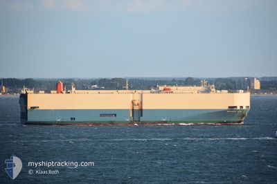
BRAVERY ACE
Vehicles Carrier
Current Trip
| Time Travelled | 6 days |
|---|---|
| Remaining Time | 2 h, 58 mins |
| Distance Travelled | 2165.67 nm |
| Remaining Distance | 49.10 nm |
| AVG Speed | 13.6 Knopen |
| MAX Speed | 17.1 Knopen |
| AVG Wind | 14.3 knots |
| MAX Wind | 22 knots |
| MIN Temp | 6.4°C / 43.52°F |
| MAX Temp | 26.9°C / 80.42°F |
| Diepgang | 7.6 M |
| Positie ontvangen | 7 h, 17 m geleden |
Current Position
| Lengtegraad | -94.12892° |
|---|---|
| Breedtegraat | 20.39952° |
| Status | Under way using engine |
| Snelheid | 13.1 Knopen |
| Koers | 238° |
| Gebied | Gulf of Mexico |
| Station | T-AIS |
| Positie ontvangen | 7 h, 17 m geleden |
Info
Information
The current position of BRAVERY ACE is in Gulf of Mexico with coordinates 20.39952° / -94.12892° as reported on 2024-04-20 03:55 by AIS to our vessel tracker app. The vessel's current speed is 13.1 Knopen and is heading at the port of VERACRUZ. The estimated time of arrival as calculated by MyShipTracking vessel tracking app is 2024-04-20 14:10 LT
The vessel BRAVERY ACE (IMO: 9207120, MMSI: 357961000) is a Vehicles Carrier that was built in 2000 ( 24 Jaar oud ). It's sailing under the flag of [PA] Panama.
In this page you can find informations about the vessels current position, last detected port calls, and current voyage information. If the vessels is not in coverage by AIS you will find the latest position.
The current position of BRAVERY ACE is detected by our AIS receivers and we are not responsible for the reliability of the data. The last position was recorded while the vessel was in Coverage by the Ais receivers of our vessel tracking app.
The current draught of BRAVERY ACE as reported by AIS is 7.6 meters
Weather
| Temperature | 26.4°C / 79.52°F |
|---|---|
| Wind Speed | 10 knots |
| Direction | 121° ESE |
| Pressure | 1011.4 hPa |
| Humidity | 88.1 % |
| Cloud Coverage | 1 % |
Featured Company
Last Port Calls
| Port | Arrival | Departure | Time In Port |
|---|---|---|---|
| 2024-04-13 09:30 | 2024-04-14 01:38 | 16 h | |
| 2024-04-11 02:15 | 2024-04-11 18:20 | 16 h | |
| 2024-04-07 21:03 | 2024-04-09 00:36 | 1 d | |
| 2024-03-30 18:37 | 2024-04-01 19:32 | 2 d | |
| 2024-03-29 03:01 | 2024-03-29 22:38 | 19 h | |
| 2024-03-21 07:02 | 2024-03-22 06:18 | 23 h | |
| 2024-03-19 00:53 | 2024-03-20 00:31 | 23 h | |
| 2024-03-12 12:28 | 2024-03-14 19:54 | 2 d | |
| 2024-03-04 09:37 | 2024-03-07 01:15 | 2 d | |
| 2024-02-24 20:21 | 2024-02-25 23:24 | 1 d |
Last Trips
| Origin | Departure | Destination | Arrival | Distance | |
|---|---|---|---|---|---|
| 2024-04-11 14:20 | 2024-04-13 05:30 | 381.38 nm | |||
| 2024-04-08 20:36 | 2024-04-10 22:15 | 278.55 nm | |||
| 2024-04-01 13:32 | 2024-04-07 17:03 | 2195.74 nm | |||
| 2024-03-29 16:38 | 2024-03-30 12:37 | 239.58 nm | |||
| 2024-03-22 02:18 | 2024-03-28 21:01 | 1498.76 nm | |||
| 2024-03-19 20:31 | 2024-03-21 03:02 | 110.03 nm | |||
| 2024-03-14 13:54 | 2024-03-18 20:53 | 1347.84 nm | |||
| 2024-03-06 20:15 | 2024-03-12 06:28 | 2140.33 nm | |||
| 2024-02-25 17:24 | 2024-03-04 04:37 | 2181.59 nm | |||
| 2024-02-15 21:10 | 2024-02-24 14:21 | 475.70 nm |
Events
| Tijd | Evenement | Details | Positie / Bestemming | Info |
|---|---|---|---|---|
| 2024-04-20 04:04 | Status Changed | Default Under way using engine |
20.38103 / -94.16182
MX VER
|
Snelheid: 13.1 kn Koers: 238° |
| 2024-04-20 03:55 | Gevonden in zee | Mexican part of the Gulf of Mexico |
20.39952 / -94.12892
Gulf of Mexico
MX VER
|
Snelheid: 13.1 kn Koers: 238° |
| 2024-04-20 03:55 | Buitenbereik |
20.39952 / -94.12892
Gulf of Mexico
MX VER
|
Snelheid: 13.1 kn Koers: 238° |
|
| 2024-04-20 03:54 | Status Changed | Under way using engine Default |
20.40015 / -94.12778
MX VER
|
Snelheid: 13.1 kn Koers: 238° |
| 2024-04-20 03:38 | Binnenbereik |
20.39952 / -94.12892
Gulf of Mexico
MX VER
|
Snelheid: 13.1 kn Koers: 238° |
|
| 2024-04-17 09:00 | Status Changed | Default Under way using engine |
25.34665 / -79.58611
MX VER
|
Snelheid: 13.2 kn Koers: 190° |
| 2024-04-17 08:58 | Buitenbereik |
25.35453 / -79.58455
North Atlantic Ocean
MX VER
|
Snelheid: 13.2 kn Koers: 190° |
|
| 2024-04-17 04:39 | Status Changed | Under way using engine Default |
26.29482 / -79.44195
MX VER
|
Snelheid: 13.2 kn Koers: 186° |
| 2024-04-17 04:39 | Binnenbereik |
26.29303 / -79.44223
North Atlantic Ocean
MX VER
|
Snelheid: 13.2 kn Koers: 189° |
|
| 2024-04-17 03:13 | Buitenbereik |
26.60973 / -79.40352
North Atlantic Ocean
MX VER
|
Snelheid: 13.4 kn Koers: 180° |