
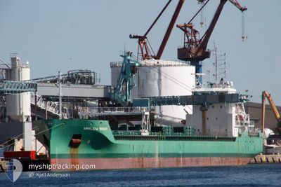
ARKLOW BRAVE
Cargo
Current Trip
| Time Travelled | 4 days |
|---|---|
| Remaining Time | -3 mins |
| Distance Travelled | 1160.77 nm |
| Remaining Distance | 20.92 nm |
| AVG Speed | 11.8 Knopen |
| MAX Speed | 14.2 Knopen |
| AVG Wind | 11.9 knots |
| MAX Wind | 21 knots |
| MIN Temp | 2.1°C / 35.78°F |
| MAX Temp | 9.2°C / 48.56°F |
| Diepgang | 6.9 M |
| Positie ontvangen | Nu |
Current Position
| Lengtegraad | -6.91462° |
|---|---|
| Breedtegraat | 55.28068° |
| Status | Under way using engine |
| Snelheid | 0.7 Knopen |
| Koers | 168° |
| Gebied | Inner Seas off the West Coast of Scotland |
| Station | T-AIS |
| Positie ontvangen | Nu |
Info
Information
The current position of ARKLOW BRAVE is in Inner Seas off the West Coast of Scotland with coordinates 55.28068° / -6.91462° as reported on 2024-04-24 02:26 by AIS to our vessel tracker app. The vessel's current speed is 0.7 Knopen and is heading at the port of LONDONDERRY. The estimated time of arrival as calculated by MyShipTracking vessel tracking app is 2024-04-24 02:23 LT
The vessel ARKLOW BRAVE (IMO: 9638800, MMSI: 244730944) is a Cargo It's sailing under the flag of [NL] Netherlands.
In this page you can find informations about the vessels current position, last detected port calls, and current voyage information. If the vessels is not in coverage by AIS you will find the latest position.
The current position of ARKLOW BRAVE is detected by our AIS receivers and we are not responsible for the reliability of the data. The last position was recorded while the vessel was in Coverage by the Ais receivers of our vessel tracking app.
The current draught of ARKLOW BRAVE as reported by AIS is 6.9 meters
Weather
| Temperature | 6.6°C / 43.88°F |
|---|---|
| Wind Speed | 14 knots |
| Direction | 348° NNW |
| Pressure | 1023.4 hPa |
| Humidity | 76.9 % |
| Cloud Coverage | 3 % |
Featured Company
Last Port Calls
| Port | Arrival | Departure | Time In Port |
|---|---|---|---|
| 2024-04-18 01:26 | 2024-04-19 22:24 | 1 d | |
| 2024-04-16 16:35 | 2024-04-18 01:17 | 1 d | |
| 2024-04-12 04:56 | 2024-04-12 18:26 | 13 h | |
| 2024-04-04 16:53 | 2024-04-05 23:07 | 1 d | |
| 2024-03-28 20:09 | 2024-04-03 09:51 | 5 d | |
| 2024-03-19 19:07 | 2024-03-21 21:50 | 2 d | |
| 2024-03-15 06:22 | 2024-03-18 23:26 | 3 d | |
| 2024-03-12 02:46 | 2024-03-13 13:11 | 1 d | |
| 2024-03-08 13:27 | 2024-03-12 00:16 | 3 d | |
| 2024-03-05 22:21 | 2024-03-07 07:51 | 1 d |
Most Visited Ports (Last year)
| Port | Arrivals | |
|---|---|---|
| 7 | ||
| 6 | ||
| 4 | ||
| 3 | ||
| 3 | ||
| 3 |
Last Trips
| Origin | Departure | Destination | Arrival | Distance | |
|---|---|---|---|---|---|
| 2024-04-18 03:17 | 2024-04-18 03:26 | 1.59 nm | |||
| 2024-04-12 20:26 | 2024-04-16 18:35 | 449.84 nm | |||
| 2024-04-06 01:07 | 2024-04-12 06:56 | 1034.73 nm | |||
| 2024-04-03 11:51 | 2024-04-04 18:53 | 322.92 nm | |||
| 2024-03-21 22:50 | 2024-03-28 21:09 | 598.61 nm | |||
| 2024-03-18 23:26 | 2024-03-19 20:07 | 229.01 nm | |||
| 2024-03-13 14:11 | 2024-03-15 06:22 | 370.93 nm | |||
| 2024-03-12 01:16 | 2024-03-12 03:46 | 24.70 nm | |||
| 2024-03-07 08:51 | 2024-03-08 14:27 | 354.52 nm | |||
| 2024-03-03 11:39 | 2024-03-05 23:21 | 622.05 nm |
Events
| Tijd | Evenement | Details | Positie / Bestemming | Info |
|---|---|---|---|---|
| 2024-04-24 01:32 | Status Changed | Under way using engine Default |
55.27250 / -6.90075
LONDONDERRY
|
Snelheid: 0.6 kn Koers: 49° |
| 2024-04-24 01:25 | Status Changed | Default Under way using engine |
55.27160 / -6.89948
LONDONDERRY
|
Snelheid: 0.8 kn Koers: 43° |
| 2024-04-24 01:20 | Status Changed | Under way using engine Default |
55.27078 / -6.89863
LONDONDERRY
|
Snelheid: 0.8 kn Koers: 34° |
| 2024-04-24 01:18 | Status Changed | Default Under way using engine |
55.27033 / -6.89830
LONDONDERRY
|
Snelheid: 0.8 kn Koers: 37° |
| 2024-04-24 00:45 | Stop beweging | 5.04 nm, North East of GREENCASTLE |
55.26802 / -6.89342
LONDONDERRY
|
Snelheid: 0.3 kn Koers: 63° |
| 2024-04-23 22:10 | Wijzig zee gebeid | Irish part of the Inner Seas off the West Coast of Scotland United Kingdom part of the Inner Seas off the West Coast of Scotland |
55.73267 / -7.07880
Inner Seas off the West Coast of Scotland
LONDONDERRY
|
Snelheid: 13.5 kn Koers: 167.8° |
| 2024-04-23 22:03 | ETA Changed | 2024/04/24 00:30 2024/04/24 03:30 |
55.75950 / -7.08898
LONDONDERRY
|
Snelheid: 13.6 kn Koers: 168.8° |
| 2024-04-23 21:49 | Gevonden in zee | United Kingdom part of the Inner Seas off the West Coast of Scotland |
55.80938 / -7.10813
Inner Seas off the West Coast of Scotland
LONDONDERRY
|
Snelheid: 13.5 kn Koers: 168° |
| 2024-04-23 21:49 | Status Changed | Under way using engine Default |
55.80938 / -7.10813
LONDONDERRY
|
Snelheid: 13.5 kn Koers: 169° |
| 2024-04-23 21:34 | Binnenbereik |
55.80938 / -7.10813
Inner Seas off the West Coast of Scotland
LONDONDERRY
|
Snelheid: 13.5 kn Koers: 168° |