
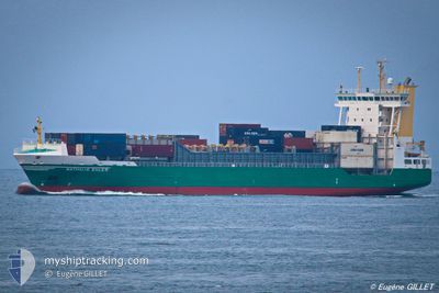
AMELIE BORCHARD
Container Ship
Current Trip
| Time Travelled | 2 days |
|---|---|
| Remaining Time | 7 h, 55 mins |
| Distance Travelled | 735.74 nm |
| Remaining Distance | 100.44 nm |
| AVG Speed | 13.2 Knopen |
| MAX Speed | 15 Knopen |
| AVG Wind | 13.4 knots |
| MAX Wind | 32 knots |
| MIN Temp | 8.2°C / 46.76°F |
| MAX Temp | 18.1°C / 64.58°F |
| Diepgang | 7.5 M |
| Positie ontvangen | 1 d geleden |
Current Position
| Lengtegraad | -9.52800° |
|---|---|
| Breedtegraat | 43.66689° |
| Status | Under way using engine |
| Snelheid | 10.9 Knopen |
| Koers | 22° |
| Gebied | North Atlantic Ocean |
| Station | T-AIS |
| Positie ontvangen | 1 d geleden |
Info
Information
The current position of AMELIE BORCHARD is in North Atlantic Ocean with coordinates 43.66689° / -9.52800° as reported on 2024-04-23 03:39 by AIS to our vessel tracker app. The vessel's current speed is 10.9 Knopen and is heading at the port of LIVERPOOL. The estimated time of arrival as calculated by MyShipTracking vessel tracking app is 2024-04-25 06:34 LT
The vessel AMELIE BORCHARD (IMO: 9242560, MMSI: 305886000) is a Container Ship that was built in 2002 ( 22 Jaar oud ). It's sailing under the flag of [AG] Antigua Barbuda.
In this page you can find informations about the vessels current position, last detected port calls, and current voyage information. If the vessels is not in coverage by AIS you will find the latest position.
The current position of AMELIE BORCHARD is detected by our AIS receivers and we are not responsible for the reliability of the data. The last position was recorded while the vessel was in Coverage by the Ais receivers of our vessel tracking app.
The current draught of AMELIE BORCHARD as reported by AIS is 7.5 meters
Weather
| Temperature | 8.2°C / 46.76°F |
|---|---|
| Wind Speed | 4 knots |
| Direction | 257° WSW |
| Pressure | 1013.5 hPa |
| Humidity | 69.1 % |
| Cloud Coverage | 71 % |
Featured Company
Last Port Calls
| Port | Arrival | Departure | Time In Port |
|---|---|---|---|
| 2024-04-22 10:14 | 2024-04-22 15:19 | 5 h | |
| 2024-04-16 22:23 | 2024-04-17 09:32 | 11 h | |
| 2024-04-12 21:05 | 2024-04-13 11:50 | 14 h | |
| 2024-04-10 06:38 | 2024-04-10 18:09 | 11 h | |
| 2024-04-09 13:03 | 2024-04-09 18:24 | 5 h | |
| 2024-04-06 04:55 | 2024-04-06 15:35 | 10 h | |
| 2024-04-01 14:28 | 2024-04-01 23:21 | 8 h | |
| 2024-03-25 21:54 | 2024-03-26 17:59 | 20 h | |
| 2024-03-22 18:50 | 2024-03-23 07:05 | 12 h | |
| 2024-03-21 06:38 | 2024-03-21 19:22 | 12 h |
Last Trips
| Origin | Departure | Destination | Arrival | Distance | |
|---|---|---|---|---|---|
| 2024-04-17 11:32 | 2024-04-22 11:14 | 1610.32 nm | |||
| 2024-04-13 13:50 | 2024-04-17 00:23 | 987.47 nm | |||
| 2024-04-10 21:09 | 2024-04-12 23:05 | 315.90 nm | |||
| 2024-04-09 21:24 | 2024-04-10 09:38 | 189.54 nm | |||
| 2024-04-06 17:35 | 2024-04-09 16:03 | 1080.05 nm | |||
| 2024-04-02 00:21 | 2024-04-06 06:55 | 1499.08 nm | |||
| 2024-03-26 18:59 | 2024-04-01 15:28 | 1191.47 nm | |||
| 2024-03-23 07:05 | 2024-03-25 22:54 | 641.53 nm | |||
| 2024-03-21 19:22 | 2024-03-22 18:50 | 121.70 nm | |||
| 2024-03-18 12:33 | 2024-03-21 06:38 | 835.62 nm |
Events
| Tijd | Evenement | Details | Positie / Bestemming | Info |
|---|---|---|---|---|
| 2024-04-23 03:45 | Status Changed | Default Under way using engine |
43.68500 / -9.51667
GBLIV
|
Snelheid: 10.9 kn Koers: 22° |
| 2024-04-23 03:39 | Buitenbereik |
43.66689 / -9.52800
North Atlantic Ocean
GBLIV
|
Snelheid: 10.9 kn Koers: 22° |
|
| 2024-04-23 03:30 | Status Changed | Under way using engine Default |
43.64070 / -9.54178
GBLIV
|
Snelheid: 10 kn Koers: 19° |
| 2024-04-23 03:18 | Status Changed | Default Under way using engine |
43.60667 / -9.55833
GBLIV
|
Snelheid: 10.8 kn Koers: 22° |
| 2024-04-23 03:15 | Status Changed | Under way using engine Default |
43.59869 / -9.56409
GBLIV
|
Snelheid: 11 kn Koers: 21° |
| 2024-04-23 03:00 | Binnenbereik |
43.60054 / -9.56309
North Atlantic Ocean
GBLIV
|
Snelheid: 10.8 kn Koers: 22° |
|
| 2024-04-23 02:09 | Status Changed | Default Under way using engine |
43.41167 / -9.66667
GBLIV
|
Snelheid: 10.5 kn Koers: 21° |
| 2024-04-23 02:03 | Status Changed | Under way using engine Default |
43.39510 / -9.67695
GBLIV
|
Snelheid: 11 kn Koers: 21° |
| 2024-04-23 02:03 | Buitenbereik |
43.39510 / -9.67695
North Atlantic Ocean
GBLIV
|
Snelheid: 10.5 kn Koers: 21° |
|
| 2024-04-23 01:56 | Status Changed | Default Under way using engine |
43.37491 / -9.68794
GBLIV
|
Snelheid: 10.7 kn Koers: 20° |