
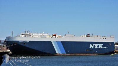
ZENITH LEADER
Cargo
Current Trip
| Time Travelled | 8 days |
|---|---|
| Remaining Time | --- |
| Distance Travelled | 3245.56 nm |
| Remaining Distance | --- |
| AVG Speed | 16.7 Noeuds |
| MAX Speed | 18.8 Noeuds |
| AVG Wind | 15.6 knots |
| MAX Wind | 26.6 knots |
| MIN Temp | 7.8°C / 46.04°F |
| MAX Temp | 19.3°C / 66.74°F |
| Tirant d eau | 9.3 m |
| Position reçue | 7 d depuis |
Current Position
| Longitude | 141.22777° |
|---|---|
| Latitude | 34.70758° |
| Etat | Under way using engine |
| Vitesse | 18.5 Noeuds |
| Parcours | 63° |
| Zone | North Pacific Ocean |
| Station | T-AIS |
| Position reçue | 7 d depuis |
Info
Information
The current position of ZENITH LEADER is in North Pacific Ocean with coordinates 34.70758° / 141.22777° as reported on 2024-04-17 01:35 by AIS to our vessel tracker app. The vessel's current speed is 18.5 Noeuds and is heading at the port of BALBOA. The estimated time of arrival as calculated by MyShipTracking vessel tracking app is 2024-05-06 07:00 LT
The vessel ZENITH LEADER (IMO: 938494200, MMSI: 235058697) is a Cargo It's sailing under the flag of [GB] United Kingdom.
In this page you can find informations about the vessels current position, last detected port calls, and current voyage information. If the vessels is not in coverage by AIS you will find the latest position.
The current position of ZENITH LEADER is detected by our AIS receivers and we are not responsible for the reliability of the data. The last position was recorded while the vessel was in Coverage by the Ais receivers of our vessel tracking app.
The current draught of ZENITH LEADER as reported by AIS is 9.3 meters
Weather
| Temperature | 11°C / 51.8°F |
|---|---|
| Wind Speed | 18 knots |
| Direction | 233° SW |
| Pressure | 1017.7 hPa |
| Humidity | 98.5 % |
| Cloud Coverage | 100 % |
Featured Company
Last Port Calls
| Port | Arrival | Departure | Time In Port |
|---|---|---|---|
| 2024-04-14 21:09 | 2024-04-16 09:31 | 1 d | |
| 2024-03-12 01:55 | 2024-03-13 01:43 | 23 h | |
| 2024-03-09 00:45 | 2024-03-09 22:21 | 21 h | |
| 2024-02-08 23:59 | 2024-02-12 09:19 | 3 d |
Most Visited Ports (Last year)
| Port | Arrivals | |
|---|---|---|
| 6 | ||
| 3 | ||
| 3 | ||
| 2 | ||
| 2 | ||
| 2 |
Last Trips
| Origin | Departure | Destination | Arrival | Distance | |
|---|---|---|---|---|---|
| 2024-03-12 21:43 | 2024-04-15 06:09 | 10370.04 nm | |||
| 2024-03-09 17:21 | 2024-03-11 21:55 | 803.63 nm | |||
| 2024-02-12 18:19 | 2024-03-08 19:45 | 9476.79 nm | |||
| 2024-01-05 23:24 | 2024-02-09 08:59 | 10861.36 nm |
Events
| Heure | Evenement | Détails | Position/ Destination | Info |
|---|---|---|---|---|
| 2024-04-17 01:37 | Etat Changé | Default Under way using engine |
34.71088 / 141.23605
PA BLB
|
Vitesse: 18.5 kn Parcours: 63° |
| 2024-04-17 01:35 | Hors de la zone couverte |
34.70758 / 141.22777
North Pacific Ocean
PA BLB
|
Vitesse: 18.5 kn Parcours: 63° |
|
| 2024-04-17 01:31 | Detecté en mer | Japanese part of the North Pacific Ocean |
34.69862 / 141.20560
North Pacific Ocean
PA BLB
|
Vitesse: 18.5 kn Parcours: 64° |
| 2024-04-17 01:31 | Etat Changé | Under way using engine Default |
34.69820 / 141.20455
PA BLB
|
Vitesse: 18 kn Parcours: 64° |
| 2024-04-17 01:25 | Dans la zone couverte |
34.69862 / 141.20560
North Pacific Ocean
PA BLB
|
Vitesse: 18.5 kn Parcours: 64° |
|
| 2024-04-16 19:04 | Etat Changé | Default Under way using engine |
34.43471 / 138.90311
PA BLB
|
Vitesse: 18.2 kn Parcours: 69° |
| 2024-04-16 18:59 | Etat Changé | Under way using engine Default |
34.42740 / 138.87705
PA BLB
|
Vitesse: 18 kn Parcours: 68° |
| 2024-04-16 18:59 | Hors de la zone couverte |
34.42740 / 138.87705
Philippine Sea
PA BLB
|
Vitesse: 18.2 kn Parcours: 69° |
|
| 2024-04-16 18:55 | Etat Changé | Default Under way using engine |
34.42087 / 138.85609
PA BLB
|
Vitesse: 18 kn Parcours: 69° |
| 2024-04-16 18:51 | Etat Changé | Under way using engine Default |
34.41332 / 138.83240
PA BLB
|
Vitesse: 17.9 kn Parcours: 69° |