
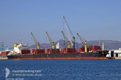
WINTER SEA
Bulk Carrier
Current Trip
| Time Travelled | 41 days |
|---|---|
| Remaining Time | --- |
| Distance Travelled | 10705.21 nm |
| Remaining Distance | --- |
| AVG Speed | 11.3 Noeuds |
| MAX Speed | 16.4 Noeuds |
| AVG Wind | 13.1 knots |
| MAX Wind | 30 knots |
| MIN Temp | 5.7°C / 42.26°F |
| MAX Temp | 32.7°C / 90.86°F |
| Tirant d eau | 10.7 m |
| Position reçue | 2 m depuis |
Current Position
| Longitude | -97.72851° |
|---|---|
| Latitude | 22.44377° |
| Etat | At anchor |
| Vitesse | |
| Parcours | 142° |
| Zone | Gulf of Mexico |
| Station | T-AIS |
| Position reçue | 2 m depuis |
Info
Information
The current position of WINTER SEA is in Gulf of Mexico with coordinates 22.44377° / -97.72851° as reported on 2024-04-25 16:53 by AIS to our vessel tracker app. The vessel's current speed is 0 Noeuds
The vessel WINTER SEA (IMO: 9639787, MMSI: 538004923) is a Bulk Carrier that was built in 2014 ( 10 Age ). It's sailing under the flag of [MH] Marshall Is.
In this page you can find informations about the vessels current position, last detected port calls, and current voyage information. If the vessels is not in coverage by AIS you will find the latest position.
The current position of WINTER SEA is detected by our AIS receivers and we are not responsible for the reliability of the data. The last position was recorded while the vessel was in Coverage by the Ais receivers of our vessel tracking app.
The current draught of WINTER SEA as reported by AIS is 10.7 meters
Weather
| Temperature | 25.6°C / 78.08°F |
|---|---|
| Wind Speed | 10 knots |
| Direction | 147° SSE |
| Pressure | 1015.8 hPa |
| Humidity | 85.7 % |
| Cloud Coverage | 2 % |
Featured Company
Last Port Calls
| Port | Arrival | Departure | Time In Port |
|---|---|---|---|
| 2024-03-12 23:57 | 2024-03-15 11:19 | 2 d | |
| 2024-03-04 08:28 | 2024-03-12 14:20 | 8 d | |
| 2024-02-22 05:52 | 2024-02-26 04:19 | 3 d | |
| 2024-02-12 10:04 | 2024-02-17 07:02 | 4 d |
Most Visited Ports (Last year)
| Port | Arrivals | |
|---|---|---|
| 1 | ||
| 1 | ||
| 1 | ||
| 1 | ||
| 1 | ||
| 1 |
Last Trips
| Origin | Departure | Destination | Arrival | Distance | |
|---|---|---|---|---|---|
| 2024-03-12 23:20 | 2024-03-13 08:57 | 52.94 nm | |||
| 2024-02-26 13:19 | 2024-03-04 17:28 | 971.26 nm | |||
| 2024-02-17 15:02 | 2024-02-22 14:52 | 952.22 nm | |||
| 2024-01-11 23:53 | 2024-02-12 18:04 | 3898.48 nm |
Events
| Heure | Evenement | Détails | Position/ Destination | Info |
|---|---|---|---|---|
| 2024-04-25 00:34 | Changement d'ETA | 2024/04/24 23:00 2024/04/24 00:00 |
22.44303 / -97.72917
MX ATM
|
Vitesse: 0.4 kn Parcours: 115° |
| 2024-04-25 00:28 | Changement d'ETA | 2024/04/24 00:00 2024/04/25 00:00 |
22.44357 / -97.72871
MX ATM
|
Vitesse: 0.5 kn Parcours: 135° |
| 2024-04-25 00:05 | Etat Changé | At anchor Under way using engine |
22.44260 / -97.72571
MX ATM
|
Vitesse: 0.4 kn Parcours: 224° |
| 2024-04-25 00:04 | Arret | 9.07 nm, East of ALTAMIRA |
22.44253 / -97.72558
MX ATM
|
Vitesse: 0.3 kn Parcours: 224° |
| 2024-04-24 23:03 | Tirant d'eau modifié | 10.7 10.8 |
22.49702 / -97.57642
MX ATM
|
Vitesse: 12.5 kn Parcours: 248.9° |
| 2024-04-24 23:03 | Changement d'ETA | 2024/04/25 00:00 2024/04/25 12:00 |
22.49702 / -97.57642
MX ATM
|
Vitesse: 12.5 kn Parcours: 248.9° |
| 2024-04-24 22:41 | Changement de zone | Mexican part of the Gulf of Mexico Panamanian part of the Caribbean Sea |
22.52439 / -97.49739
Gulf of Mexico
MX ATM
|
Vitesse: 12.5 kn Parcours: 249.9° |
| 2024-04-24 22:38 | Etat Changé | Under way using engine Default |
22.52702 / -97.48969
MX ATM
|
Vitesse: 12 kn Parcours: 251° |
| 2024-04-24 22:24 | Dans la zone couverte |
22.52439 / -97.49739
Gulf of Mexico
MX ATM
|
Vitesse: 12.5 kn Parcours: 249.9° |
|
| 2024-04-20 01:22 | Hors de la zone couverte |
9.81929 / -79.95068
Caribbean Sea
MX ATM
|
Vitesse: 12.7 kn Parcours: 1.8° |