
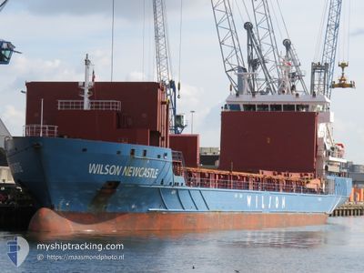
WILSON NEWCASTLE
General Cargo
Current Trip
| Time Travelled | 1 h, 38 mins |
|---|---|
| Remaining Time | --- |
| Distance Travelled | 17.51 nm |
| Remaining Distance | --- |
| AVG Speed | 10.6 Noeuds |
| MAX Speed | 12.3 Noeuds |
| AVG Wind | 7.9 knots |
| MAX Wind | 9.3 knots |
| MIN Temp | 11.7°C / 53.06°F |
| MAX Temp | 12.3°C / 54.14°F |
| Tirant d eau | 7.5 m |
| Position reçue | Maintenant |
Current Position
| Longitude | -1.63458° |
|---|---|
| Latitude | 46.10900° |
| Etat | Under way using engine |
| Vitesse | 12 Noeuds |
| Parcours | 265° |
| Zone | Bay of Biscay |
| Station | T-AIS |
| Position reçue | Maintenant |
Info
Information
The current position of WILSON NEWCASTLE is in Bay of Biscay with coordinates 46.10900° / -1.63458° as reported on 2024-04-19 13:49 by AIS to our vessel tracker app. The vessel's current speed is 12 Noeuds and is heading at the port of TENERIFE. The estimated time of arrival as calculated by MyShipTracking vessel tracking app is 2024-04-24 07:00 LT
The vessel WILSON NEWCASTLE (IMO: 9431006, MMSI: 259016000) is a General Cargo that was built in 2011 ( 13 Age ). It's sailing under the flag of [NO] Norway.
In this page you can find informations about the vessels current position, last detected port calls, and current voyage information. If the vessels is not in coverage by AIS you will find the latest position.
The current position of WILSON NEWCASTLE is detected by our AIS receivers and we are not responsible for the reliability of the data. The last position was recorded while the vessel was in Coverage by the Ais receivers of our vessel tracking app.
The current draught of WILSON NEWCASTLE as reported by AIS is 7.5 meters
Weather
| Temperature | 12.2°C / 53.96°F |
|---|---|
| Wind Speed | 7 knots |
| Direction | 316° NW |
| Pressure | 1023.1 hPa |
| Humidity | 63.6 % |
| Cloud Coverage | --- |
Featured Company
Last Port Calls
| Port | Arrival | Departure | Time In Port |
|---|---|---|---|
| 2024-04-10 04:20 | 2024-04-19 12:12 | 9 d | |
| 2024-03-22 15:17 | 2024-03-29 17:36 | 7 d | |
| 2024-03-19 12:04 | 2024-03-21 22:04 | 2 d | |
| 2024-03-11 18:57 | 2024-03-15 05:39 | 3 d | |
| 2024-03-10 06:07 | 2024-03-10 06:44 | 37 m | |
| 2024-03-08 23:29 | 2024-03-09 23:03 | 23 h | |
| 2024-03-05 16:58 | 2024-03-07 14:44 | 1 d | |
| 2024-03-03 16:43 | 2024-03-04 17:31 | 1 d | |
| 2024-02-29 06:26 | 2024-03-01 00:11 | 17 h | |
| 2024-02-26 11:33 | 2024-02-27 18:36 | 1 d |
Last Trips
| Origin | Departure | Destination | Arrival | Distance | |
|---|---|---|---|---|---|
| 2024-03-29 17:36 | 2024-04-10 06:20 | 1465.34 nm | |||
| 2024-03-21 22:04 | 2024-03-22 15:17 | 185.41 nm | |||
| 2024-03-15 06:39 | 2024-03-19 12:04 | 1161.81 nm | |||
| 2024-03-10 07:44 | 2024-03-11 19:57 | 396.18 nm | |||
| 2024-03-10 00:03 | 2024-03-10 07:07 | 81.46 nm | |||
| 2024-03-07 15:44 | 2024-03-09 00:29 | 286.25 nm | |||
| 2024-03-04 18:31 | 2024-03-05 17:58 | 298.04 nm | |||
| 2024-03-01 01:11 | 2024-03-03 17:43 | 289.44 nm | |||
| 2024-02-27 19:36 | 2024-02-29 07:26 | 407.62 nm | |||
| 2024-02-24 06:05 | 2024-02-26 12:33 | 537.98 nm |
Events
| Heure | Evenement | Détails | Position/ Destination | Info |
|---|---|---|---|---|
| 2024-04-19 12:12 | PORT DE DEPART |
|
46.15265 / -1.23862
FR LPE > ES SCT
|
Vitesse: 8.2 kn Parcours: 215° |
| 2024-04-19 12:10 | Etat Changé | Under way using engine Moored |
46.15573 / -1.23430
[FR] LA PALLICE
|
Vitesse: 6.5 kn Parcours: 239° |
| 2024-04-19 12:09 | Démarrage |
46.15640 / -1.23188
[FR] LA PALLICE
|
Vitesse: 5.3 kn Parcours: 249° |
|
| 2024-04-19 11:41 | Tirant d'eau modifié | 7.5 4.9 |
46.15908 / -1.22743
[FR] LA PALLICE
|
Vitesse: Parcours: 233° |
| 2024-04-19 11:41 | Changement de destination | FR LPE > ES SCT FR URO > FR LPE |
46.15908 / -1.22743
[FR] LA PALLICE
|
Vitesse: Parcours: 233° |
| 2024-04-19 11:41 | Changement d'ETA | 2024/04/24 07:00 2024/04/07 04:00 |
46.15908 / -1.22743
[FR] LA PALLICE
|
Vitesse: Parcours: 233° |
| 2024-04-10 04:43 | Etat Changé | Moored Under way using engine |
46.15793 / -1.22988
[FR] LA PALLICE
|
Vitesse: Parcours: 54° |
| 2024-04-10 04:29 | Arret |
46.15792 / -1.22997
[FR] LA PALLICE
|
Vitesse: 0.3 kn Parcours: 54° |
|
| 2024-04-10 04:20 | Port d'arrivée |
|
46.15418 / -1.23760
[FR] LA PALLICE
|
Vitesse: 5.5 kn Parcours: 46° |
| 2024-04-10 03:40 | Démarrage | 5.06 nm, South of LA PALLICE |
46.07237 / -1.24237
FR URO > FR LPE
|
Vitesse: 3.3 kn Parcours: 293° |