
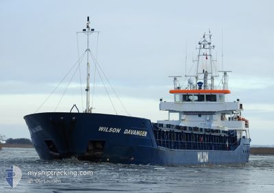
WILSON DAVANGER
General Cargo
Current Trip
| Trip Time | 13 days |
|---|---|
| Trip Distance | 2286.57 nm |
| AVG Speed | 7.9 Noeuds |
| MAX Speed | 7.9 Noeuds |
| Tirant d eau | 3.5 m |
| AVG Wind | 13.8 knots |
| MAX Wind | 34.5 knots |
| MIN Temp | 0.4°C / 32.72°F |
| MAX Temp | 10.8°C / 51.44°F |
| Position reçue | 1 m depuis |
Current Position
| Longitude | 3.70580° |
|---|---|
| Latitude | 51.44929° |
| Etat | Moored |
| Vitesse | |
| Parcours | 327° |
| Zone | North Sea |
| Station | T-AIS |
| Position reçue | 1 m depuis |
Info
Information
The current position of WILSON DAVANGER is in North Sea with coordinates 51.44929° / 3.70580° as reported on 2024-04-25 08:50 by AIS to our vessel tracker app. The vessel's current speed is 0 Noeuds and is currently inside the port of VLISSINGEN.
The vessel WILSON DAVANGER (IMO: 9390111, MMSI: 314618000) is a General Cargo that was built in 2008 ( 16 Age ). It's sailing under the flag of [BB] Barbados.
In this page you can find informations about the vessels current position, last detected port calls, and current voyage information. If the vessels is not in coverage by AIS you will find the latest position.
The current position of WILSON DAVANGER is detected by our AIS receivers and we are not responsible for the reliability of the data. The last position was recorded while the vessel was in Coverage by the Ais receivers of our vessel tracking app.
The current draught of WILSON DAVANGER as reported by AIS is 3.5 meters
Weather
| Temperature | 8°C / 46.4°F |
|---|---|
| Wind Speed | 10 knots |
| Direction | 259° W |
| Pressure | 1006.7 hPa |
| Humidity | 57.8 % |
| Cloud Coverage | 100 % |
Featured Company
Last Port Calls
| Port | Arrival | Departure | Time In Port |
|---|---|---|---|
| 2024-04-25 08:06 | |||
| 2024-04-10 05:05 | 2024-04-11 20:02 | 1 d | |
| 2024-04-09 06:25 | 2024-04-09 11:21 | 4 h | |
| 2024-04-05 05:24 | 2024-04-07 00:05 | 1 d | |
| 2024-03-31 07:44 | 2024-03-31 07:47 | 3 m | |
| 2024-03-26 02:23 | 2024-03-28 15:48 | 2 d | |
| 2024-03-19 00:12 | 2024-03-23 13:46 | 4 d | |
| 2024-03-15 08:26 | 2024-03-17 15:45 | 2 d | |
| 2024-03-12 05:19 | 2024-03-14 05:42 | 2 d | |
| 2024-03-07 19:52 | 2024-03-08 20:36 | 1 d |
Last Trips
| Origin | Departure | Destination | Arrival | Distance | |
|---|---|---|---|---|---|
| 2024-04-11 22:02 | 2024-04-25 10:06 | 2286.57 nm | |||
| 2024-04-09 13:21 | 2024-04-10 07:05 | 125.81 nm | |||
| 2024-04-07 03:05 | 2024-04-09 08:25 | 462.50 nm | |||
| 2024-03-31 09:47 | 2024-04-05 08:24 | 800.79 nm | |||
| 2024-03-28 16:48 | 2024-03-31 09:44 | 605.57 nm | |||
| 2024-03-23 14:46 | 2024-03-26 03:23 | 485.12 nm | |||
| 2024-03-17 16:45 | 2024-03-19 01:12 | 269.99 nm | |||
| 2024-03-14 06:42 | 2024-03-15 09:26 | 280.05 nm | |||
| 2024-03-08 21:36 | 2024-03-12 06:19 | 646.27 nm | |||
| 2024-03-07 20:37 | 2024-03-07 20:52 | 0.97 nm |
Events
| Heure | Evenement | Détails | Position/ Destination | Info |
|---|---|---|---|---|
| 2024-04-25 08:44 | Etat Changé | Moored Under way using engine |
51.44929 / 3.70580
[NL] VLISSINGEN
|
Vitesse: Parcours: 327° |
| 2024-04-25 08:35 | Arret |
51.44930 / 3.70601
[NL] VLISSINGEN
|
Vitesse: 0.3 kn Parcours: 347° |
|
| 2024-04-25 08:06 | Port d'arrivée |
|
51.44842 / 3.67157
[NL] VLISSINGEN
|
Vitesse: 10.8 kn Parcours: 35.3° |
| 2024-04-25 06:47 | Changement de zone | Dutch part of the North Sea Belgian part of the North Sea |
51.39976 / 3.34754
North Sea
NLVLI
|
Vitesse: 8.4 kn Parcours: 78.3° |
| 2024-04-25 03:19 | Changement d'ETA | 2024/04/25 04:30 2024/04/25 04:00 |
51.35172 / 2.45501
NLVLI
|
Vitesse: 8.3 kn Parcours: 63.8° |
| 2024-04-25 02:51 | Detecté en mer | Belgian part of the North Sea |
51.31885 / 2.36690
North Sea
NLVLI
|
Vitesse: 8.2 kn Parcours: 54.1° |
| 2024-04-25 02:48 | Etat Changé | Under way using engine Default |
51.31337 / 2.35482
NLVLI
|
Vitesse: 8.3 kn Parcours: 54° |
| 2024-04-25 02:39 | Dans la zone couverte |
51.31506 / 2.35850
North Sea
NLVLI
|
Vitesse: 8.3 kn Parcours: 51.9° |
|
| 2024-04-25 00:40 | Etat Changé | Default Under way using engine |
51.13912 / 1.89456
NLVLI
|
Vitesse: 9.2 kn Parcours: 63.2° |
| 2024-04-25 00:35 | Hors de la zone couverte |
51.13350 / 1.87638
North Sea
NLVLI
|
Vitesse: 9.2 kn Parcours: 63.2° |