
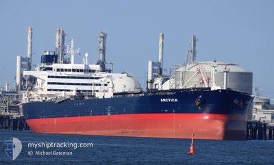
ARCTICA
Crude Oil Tanker
Current Trip
| Time Travelled | 1 day |
|---|---|
| Remaining Time | --- |
| Distance Travelled | 392.49 nm |
| Remaining Distance | 13.53 nm |
| AVG Speed | 10.5 Noeuds |
| MAX Speed | 14.8 Noeuds |
| AVG Wind | 14.8 knots |
| MAX Wind | 32 knots |
| MIN Temp | 4.8°C / 40.64°F |
| MAX Temp | 6.7°C / 44.06°F |
| Tirant d eau | 13.1 m |
| Position reçue | 1 m depuis |
Current Position
| Longitude | 11.21078° |
|---|---|
| Latitude | 58.18121° |
| Etat | At anchor |
| Vitesse | |
| Parcours | 175° |
| Zone | Skaggerak |
| Station | T-AIS |
| Position reçue | 1 m depuis |
Info
Information
The current position of ARCTICA is in Skaggerak with coordinates 58.18121° / 11.21078° as reported on 2024-04-25 01:58 by AIS to our vessel tracker app. The vessel's current speed is 0 Noeuds and is heading at the port of BROFJORDEN. The estimated time of arrival as calculated by MyShipTracking vessel tracking app is 2024-04-24 20:00 LT
The vessel ARCTICA (IMO: 9305556, MMSI: 257861000) is a Crude Oil Tanker that was built in 2005 ( 19 Age ). It's sailing under the flag of [NO] Norway.
In this page you can find informations about the vessels current position, last detected port calls, and current voyage information. If the vessels is not in coverage by AIS you will find the latest position.
The current position of ARCTICA is detected by our AIS receivers and we are not responsible for the reliability of the data. The last position was recorded while the vessel was in Coverage by the Ais receivers of our vessel tracking app.
The current draught of ARCTICA as reported by AIS is 13.1 meters
Weather
| Temperature | 5°C / 41°F |
|---|---|
| Wind Speed | 2 knots |
| Direction | 149° SSE |
| Pressure | 1006.2 hPa |
| Humidity | 68.9 % |
| Cloud Coverage | 100 % |
Featured Company
Last Port Calls
| Port | Arrival | Departure | Time In Port |
|---|---|---|---|
| 2024-04-22 04:05 | 2024-04-23 10:11 | 1 d | |
| 2024-04-09 16:42 | 2024-04-10 22:52 | 1 d | |
| 2024-04-02 06:18 | 2024-04-03 00:11 | 17 h | |
| 2024-03-27 22:53 | 2024-03-29 03:39 | 1 d | |
| 2024-03-12 23:13 | 2024-03-14 04:01 | 1 d | |
| 2024-03-07 15:31 | 2024-03-08 18:22 | 1 d | |
| 2024-03-02 02:43 | 2024-03-03 07:51 | 1 d | |
| 2024-02-24 09:03 | 2024-02-25 16:29 | 1 d | |
| 2024-02-13 18:49 | 2024-02-15 00:16 | 1 d | |
| 2024-02-10 09:15 | 2024-02-11 09:54 | 1 d |
Last Trips
| Origin | Departure | Destination | Arrival | Distance | |
|---|---|---|---|---|---|
| 2024-04-11 00:52 | 2024-04-22 06:05 | 549.87 nm | |||
| 2024-04-03 02:11 | 2024-04-09 18:42 | 506.49 nm | |||
| 2024-03-29 05:39 | 2024-04-02 08:18 | 1260.31 nm | |||
| 2024-03-14 05:01 | 2024-03-28 00:53 | 1252.02 nm | |||
| 2024-03-08 20:22 | 2024-03-13 00:13 | 1251.74 nm | |||
| 2024-03-03 08:51 | 2024-03-07 17:31 | 1255.08 nm | |||
| 2024-02-25 18:29 | 2024-03-02 03:43 | 1242.20 nm | |||
| 2024-02-15 01:16 | 2024-02-24 11:03 | 2036.53 nm | |||
| 2024-02-11 10:54 | 2024-02-13 19:49 | 495.84 nm | |||
| 2024-01-28 11:56 | 2024-02-10 10:15 | 1736.47 nm |
Events
| Heure | Evenement | Détails | Position/ Destination | Info |
|---|---|---|---|---|
| 2024-04-25 01:46 | Etat Changé | At anchor Default |
58.18136 / 11.21036
SE BRO
|
Vitesse: Parcours: 169° |
| 2024-04-25 01:43 | Etat Changé | Default At anchor |
58.18136 / 11.21017
SE BRO
|
Vitesse: Parcours: 176° |
| 2024-04-25 00:31 | Etat Changé | At anchor Default |
58.18140 / 11.20987
SE BRO
|
Vitesse: Parcours: 184° |
| 2024-04-25 00:28 | Etat Changé | Default At anchor |
58.18138 / 11.20995
SE BRO
|
Vitesse: Parcours: 186° |
| 2024-04-25 00:10 | Etat Changé | At anchor Default |
58.18142 / 11.21043
SE BRO
|
Vitesse: 0.1 kn Parcours: 191° |
| 2024-04-25 00:07 | Etat Changé | Default At anchor |
58.18140 / 11.21064
SE BRO
|
Vitesse: 0.1 kn Parcours: 192° |
| 2024-04-24 23:37 | Etat Changé | At anchor Default |
58.18132 / 11.21083
SE BRO
|
Vitesse: Parcours: 173° |
| 2024-04-24 23:31 | Etat Changé | Default At anchor |
58.18143 / 11.21054
SE BRO
|
Vitesse: Parcours: 174° |
| 2024-04-24 23:10 | Etat Changé | At anchor Default |
58.18133 / 11.21124
SE BRO
|
Vitesse: 0.1 kn Parcours: 199° |
| 2024-04-24 23:04 | Etat Changé | Default At anchor |
58.18119 / 11.21162
SE BRO
|
Vitesse: Parcours: 192° |