
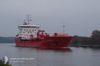
STEN FRIGG
Oil/Chemical Tanker
Current Trip
| Time Travelled | 3 days |
|---|---|
| Remaining Time | --- |
| Distance Travelled | 735.28 nm |
| Remaining Distance | 14.65 nm |
| AVG Speed | 9.5 Noeuds |
| MAX Speed | 16.4 Noeuds |
| AVG Wind | 9.4 knots |
| MAX Wind | 27 knots |
| MIN Temp | 3.2°C / 37.76°F |
| MAX Temp | 9.3°C / 48.74°F |
| Tirant d eau | 8.4 m |
| Position reçue | 1 m depuis |
Current Position
| Longitude | 3.77378° |
|---|---|
| Latitude | 51.94723° |
| Etat | At anchor |
| Vitesse | 0.2 Noeuds |
| Parcours | 297° |
| Zone | North Sea |
| Station | T-AIS |
| Position reçue | 1 m depuis |
Info
Information
The current position of STEN FRIGG is in North Sea with coordinates 51.94723° / 3.77378° as reported on 2024-04-19 04:51 by AIS to our vessel tracker app. The vessel's current speed is 0.2 Noeuds and is heading at the port of ROTTERDAM. The estimated time of arrival as calculated by MyShipTracking vessel tracking app is 2024-04-19 04:53 LT
The vessel STEN FRIGG (IMO: 9407976, MMSI: 257436000) is a Oil/Chemical Tanker that was built in 2009 ( 15 Age ). It's sailing under the flag of [NO] Norway.
In this page you can find informations about the vessels current position, last detected port calls, and current voyage information. If the vessels is not in coverage by AIS you will find the latest position.
The current position of STEN FRIGG is detected by our AIS receivers and we are not responsible for the reliability of the data. The last position was recorded while the vessel was in Coverage by the Ais receivers of our vessel tracking app.
The current draught of STEN FRIGG as reported by AIS is 8.4 meters
Weather
| Temperature | 9.3°C / 48.74°F |
|---|---|
| Wind Speed | 27 knots |
| Direction | 284° WNW |
| Pressure | 1010.3 hPa |
| Humidity | 91.4 % |
| Cloud Coverage | 100 % |
Featured Company
Last Port Calls
| Port | Arrival | Departure | Time In Port |
|---|---|---|---|
| 2024-04-14 22:46 | 2024-04-16 02:48 | 1 d | |
| 2024-04-11 12:33 | 2024-04-12 14:44 | 1 d | |
| 2024-04-07 15:40 | 2024-04-09 08:51 | 1 d | |
| 2024-04-01 11:29 | 2024-04-04 16:48 | 3 d | |
| 2024-03-27 20:05 | 2024-03-29 07:00 | 1 d | |
| 2024-03-23 20:39 | 2024-03-25 05:14 | 1 d | |
| 2024-03-21 04:46 | 2024-03-23 04:41 | 1 d | |
| 2024-03-17 22:08 | 2024-03-19 11:06 | 1 d | |
| 2024-03-13 12:02 | 2024-03-15 14:57 | 2 d | |
| 2024-03-08 07:38 | 2024-03-09 21:26 | 1 d |
Last Trips
| Origin | Departure | Destination | Arrival | Distance | |
|---|---|---|---|---|---|
| 2024-04-12 16:44 | 2024-04-15 00:46 | 566.40 nm | |||
| 2024-04-09 10:51 | 2024-04-11 14:33 | 580.00 nm | |||
| 2024-04-04 18:48 | 2024-04-07 17:40 | 92.46 nm | |||
| 2024-03-29 08:00 | 2024-04-01 13:29 | 504.54 nm | |||
| 2024-03-25 05:14 | 2024-03-27 21:05 | 714.27 nm | |||
| 2024-03-23 05:41 | 2024-03-23 20:39 | 180.87 nm | |||
| 2024-03-19 12:06 | 2024-03-21 05:46 | 151.11 nm | |||
| 2024-03-15 14:57 | 2024-03-17 23:08 | 628.45 nm | |||
| 2024-03-09 21:26 | 2024-03-13 12:02 | 186.40 nm | |||
| 2024-03-04 05:12 | 2024-03-08 07:38 | 902.98 nm |
Events
| Heure | Evenement | Détails | Position/ Destination | Info |
|---|---|---|---|---|
| 2024-04-19 03:48 | Etat Changé | At anchor Under way using engine |
51.94735 / 3.77029
NLRTM NOK
|
Vitesse: 1.1 kn Parcours: 6° |
| 2024-04-19 03:44 | Arret | 10.91 nm, North West of OUDDORP |
51.94799 / 3.76960
NLRTM NOK
|
Vitesse: 0.3 kn Parcours: 315° |
| 2024-04-19 01:31 | Detecté en mer | Dutch part of the North Sea |
52.22513 / 3.31316
North Sea
NLRTM NOK
|
Vitesse: 9.9 kn Parcours: 142.6° |
| 2024-04-19 01:31 | Dans la zone couverte |
52.22513 / 3.31316
North Sea
NLRTM NOK
|
Vitesse: 9.9 kn Parcours: 142.6° |
|
| 2024-04-18 07:36 | Etat Changé | Default Under way using engine |
54.17500 / 6.15833
NLRTM NOK
|
Vitesse: 11.1 kn Parcours: 262° |
| 2024-04-18 07:32 | Hors de la zone couverte |
54.17795 / 6.18032
North Sea
NLRTM NOK
|
Vitesse: 11.1 kn Parcours: 262° |
|
| 2024-04-18 03:10 | Etat Changé | Under way using engine Default |
54.20366 / 7.48468
NLRTM NOK
|
Vitesse: 10 kn Parcours: 268° |
| 2024-04-18 03:03 | Etat Changé | Default Under way using engine |
54.20334 / 7.51667
NLRTM NOK
|
Vitesse: 9.9 kn Parcours: 269.2° |
| 2024-04-18 02:58 | Changement d'ETA | 2024/04/19 05:00 2024/04/19 07:00 |
54.20366 / 7.54761
NLRTM NOK
|
Vitesse: 10 kn Parcours: 283.1° |
| 2024-04-18 02:18 | Etat Changé | Under way using engine Default |
54.14543 / 7.71281
NLRTM NOK
|
Vitesse: 10 kn Parcours: 300° |