
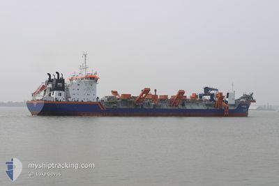
ROTTERDAM
Trailing Suction Hopper Dredger
Current Trip
NMDC
| Time Travelled | --- |
|---|---|
| Remaining Time | --- |
| Distance Travelled | 3521.39 nm |
| Remaining Distance | --- |
| AVG Speed | 8.9 Noeuds |
| MAX Speed | 8.9 Noeuds |
| AVG Wind | 8.8 knots |
| MAX Wind | 28.8 knots |
| MIN Temp | 18.5°C / 65.3°F |
| MAX Temp | 28.5°C / 83.3°F |
| Tirant d eau | 11.4 m |
| Position reçue | 1 m depuis |
Current Position
| Longitude | 54.55588° |
|---|---|
| Latitude | 24.74465° |
| Etat | Restricted manoeuverability |
| Vitesse | |
| Parcours | 120° |
| Zone | Persian Gulf |
| Station | T-AIS |
| Position reçue | 1 m depuis |
Info
Information
The current position of ROTTERDAM is in Persian Gulf with coordinates 24.74465° / 54.55588° as reported on 2024-04-25 21:16 by AIS to our vessel tracker app. The vessel's current speed is 0 Noeuds
The vessel ROTTERDAM (IMO: 9229582, MMSI: 245450000) is a Trailing Suction Hopper Dredger that was built in 2001 ( 23 Age ). It's sailing under the flag of [NL] Netherlands.
In this page you can find informations about the vessels current position, last detected port calls, and current voyage information. If the vessels is not in coverage by AIS you will find the latest position.
The current position of ROTTERDAM is detected by our AIS receivers and we are not responsible for the reliability of the data. The last position was recorded while the vessel was in Coverage by the Ais receivers of our vessel tracking app.
The current draught of ROTTERDAM as reported by AIS is 11.4 meters
Weather
| Temperature | 26°C / 78.8°F |
|---|---|
| Wind Speed | 6 knots |
| Direction | 2° N |
| Pressure | 1006.2 hPa |
| Humidity | 64.5 % |
| Cloud Coverage | --- |
Featured Company
Most Visited Ports (Last year)
| Port | Arrivals | |
|---|---|---|
| 96 | ||
| 47 | ||
| 1 | ||
| 1 | ||
| 1 | ||
| 1 |
Last Trips
| Origin | Departure | Destination | Arrival | Distance |
|---|
Events
| Heure | Evenement | Détails | Position/ Destination | Info |
|---|---|---|---|---|
| 2024-04-25 15:58 | Etat Changé | Restricted manoeuverability Default |
24.74466 / 54.55585
NMDC
|
Vitesse: Parcours: 121° |
| 2024-04-25 15:52 | Etat Changé | Default Restricted manoeuverability |
24.74463 / 54.55582
NMDC
|
Vitesse: Parcours: 121° |
| 2024-04-25 14:28 | Arret | 7.19 nm, South West of KHALIFA |
24.74474 / 54.55570
NMDC
|
Vitesse: 0.3 kn Parcours: 120° |
| 2024-04-25 08:32 | Démarrage | 7.27 nm, South West of KHALIFA |
24.74530 / 54.55353
NMDC
|
Vitesse: 4.2 kn Parcours: 295° |
| 2024-04-25 03:36 | Arret | 7.17 nm, South West of KHALIFA |
24.74491 / 54.55588
NMDC
|
Vitesse: 0.3 kn Parcours: 125° |
| 2024-04-24 23:11 | Démarrage | 7.25 nm, South West of KHALIFA |
24.74568 / 54.55379
NMDC
|
Vitesse: 6.5 kn Parcours: 296.9° |
| 2024-04-24 17:59 | Arret | 7.18 nm, South West of KHALIFA |
24.74508 / 54.55568
NMDC
|
Vitesse: 0.3 kn Parcours: 114° |
| 2024-04-24 16:52 | Démarrage | 11.66 nm, West of KHALIFA |
24.85196 / 54.45958
NMDC
|
Vitesse: 3.1 kn Parcours: 159° |
| 2024-04-24 12:45 | Arret | 11.73 nm, West of KHALIFA |
24.85893 / 54.46033
NMDC
|
Vitesse: 0.3 kn Parcours: 279° |
| 2024-04-24 11:54 | Démarrage | 7.21 nm, South West of KHALIFA |
24.74600 / 54.55438
NMDC
|
Vitesse: 4.5 kn Parcours: 286° |