
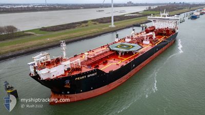
PEARY SPIRIT
Shuttle Tanker
Current Trip
| Time Travelled | 7 days |
|---|---|
| Remaining Time | 6 h, 54 mins |
| Distance Travelled | 1812.87 nm |
| Remaining Distance | 81.32 nm |
| AVG Speed | 12.1 Noeuds |
| MAX Speed | 14.1 Noeuds |
| AVG Wind | 19.2 knots |
| MAX Wind | 36 knots |
| MIN Temp | 0.5°C / 32.9°F |
| MAX Temp | 9.8°C / 49.64°F |
| Tirant d eau | 12.9 m |
| Position reçue | 1 m depuis |
Current Position
| Longitude | --- |
|---|---|
| Latitude | --- |
| Etat | Under way using engine |
| Vitesse | 11.5 Noeuds |
| Parcours | 72.1° |
| Zone | Gulf of Finland |
| Station | T-AIS |
| Position reçue | 1 m depuis |
Info
Information
The current position of PEARY SPIRIT is in Gulf of Finland with coordinates 59.61633° / 23.77383° as reported on 2024-11-29 14:17 by AIS to our vessel tracker app. The vessel's current speed is 11.5 Noeuds and is heading at the port of PORVOO. The estimated time of arrival as calculated by MyShipTracking vessel tracking app is 2024-11-29 21:13 LT
The vessel PEARY SPIRIT (IMO: 9466130, MMSI: 311027600) is a Shuttle Tanker that was built in 2011 ( 13 Age ). It's sailing under the flag of [BS] Bahamas.
In this page you can find informations about the vessels current position, last detected port calls, and current voyage information. If the vessels is not in coverage by AIS you will find the latest position.
The current position of PEARY SPIRIT is detected by our AIS receivers and we are not responsible for the reliability of the data. The last position was recorded while the vessel was in Coverage by the Ais receivers of our vessel tracking app.
The current draught of PEARY SPIRIT as reported by AIS is 12.9 meters
Weather
| Temperature | 5.2°C / 41.36°F |
|---|---|
| Wind Speed | 21 knots |
| Direction | 248° WSW |
| Pressure | 1024.3 hPa |
| Humidity | 74.2 % |
| Cloud Coverage | 100 % |
Featured Company
Last Port Calls
| Port | Arrival | Departure | Time In Port |
|---|---|---|---|
| 2024-11-20 12:22 | 2024-11-21 21:44 | 1 d | |
| 2024-11-06 01:23 | 2024-11-07 11:58 | 1 d | |
| 2024-10-20 03:40 | 2024-10-21 08:23 | 1 d | |
| 2024-09-26 11:16 | 2024-09-29 08:21 | 2 d | |
| 2024-09-08 06:09 | 2024-09-17 13:33 | 9 d | |
| 2024-09-04 09:32 | 2024-09-05 15:52 | 1 d |
Most Visited Ports (Last year)
| Port | Arrivals | |
|---|---|---|
| 6 | ||
| 4 | ||
| 3 | ||
| 3 | ||
| 2 | ||
| 2 |
Last Trips
| Origin | Departure | Destination | Arrival | Distance | |
|---|---|---|---|---|---|
| 2024-11-07 11:58 | 2024-11-20 13:22 | 1997.79 nm | |||
| 2024-10-21 10:23 | 2024-11-06 01:23 | 2471.89 nm | |||
| 2024-09-29 10:21 | 2024-10-20 05:40 | 2566.64 nm | |||
| 2024-09-17 15:33 | 2024-09-26 13:16 | 859.24 nm | |||
| 2024-09-05 17:52 | 2024-09-08 08:09 | 679.13 nm | |||
| 2024-08-23 20:17 | 2024-09-04 11:32 | 1905.91 nm |
Events
| Heure | Evenement | Détails | Position/ Destination | Info |
|---|---|---|---|---|
| 2024-11-29 12:49 | Changement de zone | Finnish part of the Gulf of Finland Estonian part of the Gulf of Finland |
59.52883 / 23.25183
Gulf of Finland
FISKV
|
Vitesse: 11.3 kn Parcours: 72.8° |
| 2024-11-29 12:38 | Changement de zone | Estonian part of the Gulf of Finland Estonian part of the Baltic Sea |
59.51767 / 23.18333
Gulf of Finland
FISKV
|
Vitesse: 11.3 kn Parcours: 72.3° |
| 2024-11-29 12:12 | Changement de zone | Estonian part of the Baltic Sea Finnish part of the Baltic Sea |
59.49267 / 23.03567
Baltic Sea
FISKV
|
Vitesse: 11 kn Parcours: 69.4° |
| 2024-11-29 11:41 | Changement d'ETA | 2024/11/29 20:00 2025/03/21 12:34 |
59.45833 / 22.84117
FISKV
|
Vitesse: 12.3 kn Parcours: 73.3° |
| 2024-11-29 11:35 | Etat Changé | Under way using engine Default |
59.45267 / 22.80450
FISKV
|
Vitesse: 12.4 kn Parcours: 72° |
| 2024-11-29 11:22 | Etat Changé | Default Under way using engine |
59.43933 / 22.72283
FISKV
|
Vitesse: 12.1 kn Parcours: 72° |
| 2024-11-29 10:59 | Detecté en mer | Finnish part of the Baltic Sea |
59.41083 / 22.58550
Baltic Sea
|
Vitesse: 11.3 kn Parcours: 53.4° |
| 2024-11-29 10:55 | Detecté en mer | Estonian part of the Baltic Sea |
59.40300 / 22.56467
Baltic Sea
|
Vitesse: 11.4 kn Parcours: 54.7° |
| 2024-11-29 10:53 | Etat Changé | Under way using engine Default |
59.40033 / 22.55700
FISKV
|
Vitesse: 11.5 kn Parcours: 55° |
| 2024-11-29 10:53 | Dans la zone couverte |
59.40300 / 22.56467
Baltic Sea
|
Vitesse: 11.4 kn Parcours: 54.7° |