
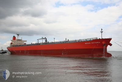
NEXUS VICTORIA
Tanker
Current Trip
| Time Travelled | 23 h, 31 mins |
|---|---|
| Remaining Time | --- |
| Distance Travelled | 26.18 nm |
| Remaining Distance | --- |
| AVG Speed | 7.3 Noeuds |
| MAX Speed | 12.2 Noeuds |
| AVG Wind | 6.3 knots |
| MAX Wind | 10.9 knots |
| MIN Temp | 27°C / 80.6°F |
| MAX Temp | 29.4°C / 84.92°F |
| Tirant d eau | 8.3 m |
| Position reçue | 1 m depuis |
Current Position
| Longitude | 103.56802° |
|---|---|
| Latitude | 1.20063° |
| Etat | Under way using engine |
| Vitesse | 9.5 Noeuds |
| Parcours | 282° |
| Zone | Singapore Strait |
| Station | T-AIS |
| Position reçue | 1 m depuis |
Info
Information
The current position of NEXUS VICTORIA is in Singapore Strait with coordinates 1.20063° / 103.56802° as reported on 2024-04-20 15:06 by AIS to our vessel tracker app. The vessel's current speed is 9.5 Noeuds and is heading at the port of SIKKA. The estimated time of arrival as calculated by MyShipTracking vessel tracking app is 2024-04-30 06:30 LT
The vessel NEXUS VICTORIA (IMO: 9610389, MMSI: 235108514) is a Tanker It's sailing under the flag of [GB] United Kingdom.
In this page you can find informations about the vessels current position, last detected port calls, and current voyage information. If the vessels is not in coverage by AIS you will find the latest position.
The current position of NEXUS VICTORIA is detected by our AIS receivers and we are not responsible for the reliability of the data. The last position was recorded while the vessel was in Coverage by the Ais receivers of our vessel tracking app.
The current draught of NEXUS VICTORIA as reported by AIS is 8.3 meters
Weather
| Temperature | 27.9°C / 82.22°F |
|---|---|
| Wind Speed | 8 knots |
| Direction | 314° NW |
| Pressure | 1009.7 hPa |
| Humidity | 82 % |
| Cloud Coverage | 100 % |
Featured Company
Last Port Calls
| Port | Arrival | Departure | Time In Port |
|---|---|---|---|
| 2024-04-17 22:26 | 2024-04-19 15:36 | 1 d | |
| 2024-04-05 17:26 | 2024-04-07 03:24 | 1 d | |
| 2024-03-29 00:36 | 2024-03-31 07:22 | 2 d |
Most Visited Ports (Last year)
| Port | Arrivals | |
|---|---|---|
| 1 | ||
| 1 | ||
| 1 | ||
| 1 |
Last Trips
| Origin | Departure | Destination | Arrival | Distance | |
|---|---|---|---|---|---|
| 2024-04-07 08:54 | 2024-04-18 06:26 | 2825.13 nm | |||
| 2024-03-31 11:22 | 2024-04-05 22:56 | 1020.45 nm |
Events
| Heure | Evenement | Détails | Position/ Destination | Info |
|---|---|---|---|---|
| 2024-04-20 14:59 | Changement de zone | Malaysian part of the Singapore Strait Indonesian part of the Singapore Strait |
1.19687 / 103.58573
Singapore Strait
SGSIN=>INSIK
|
Vitesse: 9.5 kn Parcours: 282° |
| 2024-04-20 14:17 | Changement de zone | Indonesian part of the Singapore Strait Singaporean part of the Singapore Strait |
1.16313 / 103.69242
Singapore Strait
SGSIN=>INSIK
|
Vitesse: 10.1 kn Parcours: 300° |
| 2024-04-20 13:09 | Démarrage | 3.43 nm, South West of SINGAPORE |
1.22195 / 103.80990
SGSIN=>INSIK
|
Vitesse: 3.1 kn Parcours: 140° |
| 2024-04-20 13:07 | Changement de destination | SGSIN=>INSIK AWPB |
1.22323 / 103.80908
SGSIN=>INSIK
|
Vitesse: 1 kn Parcours: 144° |
| 2024-04-20 13:07 | Changement d'ETA | 2024/04/30 06:30 2024/04/19 04:00 |
1.22323 / 103.80908
SGSIN=>INSIK
|
Vitesse: 1 kn Parcours: 144° |
| 2024-04-20 13:07 | Etat Changé | Under way using engine At anchor |
1.22323 / 103.80908
AWPB
|
Vitesse: 0.4 kn Parcours: 146° |
| 2024-04-20 07:33 | Etat Changé | At anchor Default |
1.22170 / 103.81320
AWPB
|
Vitesse: Parcours: 282° |
| 2024-04-20 07:31 | Etat Changé | Default At anchor |
1.22172 / 103.81316
AWPB
|
Vitesse: Parcours: 282° |
| 2024-04-19 16:45 | Arret | 3.37 nm, East of BUKOM ISLAND |
1.22223 / 103.80768
AWPB
|
Vitesse: 0.3 kn Parcours: 109° |
| 2024-04-19 16:42 | Etat Changé | At anchor Under way using engine |
1.22225 / 103.80803
AWPB
|
Vitesse: 0.4 kn Parcours: 108° |