
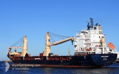
MIENA DESGAGNES
Cargo
Current Trip
CNJIA
| Time Travelled | 22 days |
|---|---|
| Remaining Time | --- |
| Distance Travelled | 7199.16 nm |
| Remaining Distance | --- |
| AVG Speed | 13.9 Noeuds |
| MAX Speed | 16.9 Noeuds |
| AVG Wind | 10.8 knots |
| MAX Wind | 25.8 knots |
| MIN Temp | 7.6°C / 45.68°F |
| MAX Temp | 29.6°C / 85.28°F |
| Tirant d eau | 7 m |
| Position reçue | 4 d depuis |
Current Position
| Longitude | 57.45849° |
|---|---|
| Latitude | -20.14265° |
| Etat | Under way using engine |
| Vitesse | 0.3 Noeuds |
| Parcours | 85° |
| Zone | Yellow Sea |
| Station | T-AIS |
| Position reçue | 4 d depuis |
Info
Information
The current position of MIENA DESGAGNES is in Yellow Sea with coordinates -20.14265° / 57.45849° as reported on 2024-04-19 20:10 by AIS to our vessel tracker app. The vessel's current speed is 0.3 Noeuds
The vessel MIENA DESGAGNES (IMO: 9700380, MMSI: 314467000) is a Cargo It's sailing under the flag of [BB] Barbados.
In this page you can find informations about the vessels current position, last detected port calls, and current voyage information. If the vessels is not in coverage by AIS you will find the latest position.
The current position of MIENA DESGAGNES is detected by our AIS receivers and we are not responsible for the reliability of the data. The last position was recorded while the vessel was in Coverage by the Ais receivers of our vessel tracking app.
The current draught of MIENA DESGAGNES as reported by AIS is 7 meters
Weather
| Temperature | 22.7°C / 72.86°F |
|---|---|
| Wind Speed | 18 knots |
| Direction | 87° E |
| Pressure | 1018 hPa |
| Humidity | 75.2 % |
| Cloud Coverage | 100 % |
Featured Company
Last Port Calls
| Port | Arrival | Departure | Time In Port |
|---|---|---|---|
| 2024-03-31 01:17 | 2024-04-01 16:05 | 1 d | |
| 2024-03-28 02:09 | 2024-03-29 05:16 | 1 d | |
| 2024-03-21 00:04 | 2024-03-22 21:26 | 1 d | |
| 2024-03-15 09:57 | 2024-03-17 21:47 | 2 d | |
| 2024-03-12 08:15 | |||
| 2024-02-01 00:05 | 2024-02-03 12:13 | 2 d |
Most Visited Ports (Last year)
| Port | Arrivals | |
|---|---|---|
| 2 | ||
| 2 | ||
| 2 | ||
| 2 | ||
| 1 | ||
| 1 |
Last Trips
| Origin | Departure | Destination | Arrival | Distance | |
|---|---|---|---|---|---|
| 2024-03-29 13:16 | 2024-03-31 09:17 | 513.98 nm | |||
| 2024-03-23 06:26 | 2024-03-28 10:09 | 609.83 nm | |||
| 2024-03-18 06:47 | 2024-03-21 09:04 | 437.79 nm | |||
| 2024-03-12 17:15 | 2024-03-15 18:57 | 817.15 nm | |||
| 2024-01-29 21:32 | 2024-02-01 10:05 | 730.41 nm |
Events
| Heure | Evenement | Détails | Position/ Destination | Info |
|---|---|---|---|---|
| 2024-04-20 03:59 | Démarrage | 1.11 nm, West of PORT LOUIS |
-20.14204 / 57.46275
CNJIA
|
Vitesse: 5.5 kn Parcours: 14° |
| 2024-04-19 20:28 | Etat Changé | Default Under way using engine |
-20.14061 / 57.45981
CNJIA
|
Vitesse: 0.3 kn Parcours: 85° |
| 2024-04-19 20:10 | Hors de la zone couverte |
-20.14265 / 57.45849
Yellow Sea
|
Vitesse: 0.3 kn Parcours: 24° |
|
| 2024-04-19 20:06 | Etat Changé | Under way using engine Default |
-20.14273 / 57.45870
CNJIA
|
Vitesse: 0.1 kn Parcours: 90° |
| 2024-04-19 19:39 | Etat Changé | Default Under way using engine |
-20.14266 / 57.45878
CNJIA
|
Vitesse: 0.1 kn Parcours: 82° |
| 2024-04-19 19:10 | Etat Changé | Under way using engine Default |
-20.14263 / 57.45868
CNJIA
|
Vitesse: Parcours: 88° |
| 2024-04-19 19:03 | Etat Changé | Default Under way using engine |
-20.14256 / 57.45863
CNJIA
|
Vitesse: Parcours: 87° |
| 2024-04-19 19:03 | Etat Changé | Under way using engine Default |
-20.14257 / 57.45865
CNJIA
|
Vitesse: Parcours: 90° |
| 2024-04-19 18:51 | Etat Changé | Default Under way using engine |
-20.14242 / 57.45867
CNJIA
|
Vitesse: 0.1 kn Parcours: 85° |
| 2024-04-19 18:43 | Etat Changé | Under way using engine Default |
-20.14274 / 57.45860
CNJIA
|
Vitesse: 0.2 kn Parcours: 72° |