
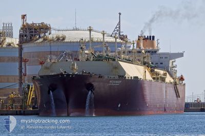
MESAIMEER
Lng Tanker
Current Trip
| Time Travelled | 30 days |
|---|---|
| Remaining Time | --- |
| Distance Travelled | 8342.24 nm |
| Remaining Distance | --- |
| AVG Speed | 15.3 Noeuds |
| MAX Speed | 19 Noeuds |
| AVG Wind | 8.9 knots |
| MAX Wind | 28.5 knots |
| MIN Temp | 13.2°C / 55.76°F |
| MAX Temp | 30.3°C / 86.54°F |
| Tirant d eau | 9.7 m |
| Position reçue | Maintenant |
Current Position
| Longitude | 103.65320° |
|---|---|
| Latitude | 1.22542° |
| Etat | Restricted manoeuverability |
| Vitesse | |
| Parcours | 143° |
| Zone | Singapore Strait |
| Station | T-AIS |
| Position reçue | Maintenant |
Info
Information
The current position of MESAIMEER is in Singapore Strait with coordinates 1.22542° / 103.65320° as reported on 2024-04-25 03:43 by AIS to our vessel tracker app. The vessel's current speed is 0 Noeuds
The vessel MESAIMEER (IMO: 9337729, MMSI: 538003360) is a Lng Tanker that was built in 2009 ( 15 Age ). It's sailing under the flag of [MH] Marshall Is.
In this page you can find informations about the vessels current position, last detected port calls, and current voyage information. If the vessels is not in coverage by AIS you will find the latest position.
The current position of MESAIMEER is detected by our AIS receivers and we are not responsible for the reliability of the data. The last position was recorded while the vessel was in Coverage by the Ais receivers of our vessel tracking app.
The current draught of MESAIMEER as reported by AIS is 9.7 meters
Weather
| Temperature | 30.1°C / 86.18°F |
|---|---|
| Wind Speed | 10 knots |
| Direction | 92° E |
| Pressure | 1009.2 hPa |
| Humidity | 72.9 % |
| Cloud Coverage | 100 % |
Featured Company
Last Port Calls
| Port | Arrival | Departure | Time In Port |
|---|---|---|---|
| 2024-03-23 22:48 | 2024-03-25 18:14 | 1 d |
Most Visited Ports (Last year)
| Port | Arrivals | |
|---|---|---|
| 9 | ||
| 4 | ||
| 1 | ||
| 1 |
Last Trips
| Origin | Departure | Destination | Arrival | Distance | |
|---|---|---|---|---|---|
| 2024-01-16 04:12 | 2024-03-24 01:48 | 17517.55 nm |
Events
| Heure | Evenement | Détails | Position/ Destination | Info |
|---|---|---|---|---|
| 2024-04-25 02:55 | Changement de destination | VLCC ANCHORAGE SG PGBG |
1.22528 / 103.65299
VLCC ANCHORAGE
|
Vitesse: Parcours: 142° |
| 2024-04-25 02:55 | Changement d'ETA | 2024/04/25 02:00 2024/04/25 00:00 |
1.22528 / 103.65299
VLCC ANCHORAGE
|
Vitesse: Parcours: 142° |
| 2024-04-25 02:41 | Etat Changé | Restricted manoeuverability Under way using engine |
1.22463 / 103.65270
SG PGBG
|
Vitesse: 0.4 kn Parcours: 115° |
| 2024-04-25 01:54 | Arret | 3.02 nm, South West of JURONG ISLAND |
1.22187 / 103.65614
SG PGBG
|
Vitesse: 0.1 kn Parcours: 358° |
| 2024-04-25 00:24 | Démarrage | 4.34 nm, South East of BUKOM ISLAND |
1.18003 / 103.79883
SG PGBG
|
Vitesse: 3.2 kn Parcours: 236° |
| 2024-04-25 00:01 | Arret | 4.42 nm, South East of BUKOM ISLAND |
1.18018 / 103.80104
SG PGBG
|
Vitesse: 0.3 kn Parcours: 252° |
| 2024-04-24 22:26 | Detecté en mer | Singaporean part of the Singapore Strait |
1.25515 / 103.99806
Singapore Strait
SG PGBG
|
Vitesse: 9.3 kn Parcours: 259.3° |
| 2024-04-24 21:56 | Changement de zone | Indonesian part of the Singapore Strait Malaysian part of the Singapore Strait |
1.26969 / 104.07962
Singapore Strait
SG PGBG
|
Vitesse: 10.5 kn Parcours: 261.8° |
| 2024-04-24 21:34 | Changement de destination | SG PGBG SG SIN |
1.27417 / 104.15169
SG PGBG
|
Vitesse: 12.8 kn Parcours: 272° |
| 2024-04-24 21:34 | Changement d'ETA | 2024/04/25 00:00 2024/04/24 08:00 |
1.27417 / 104.15169
SG PGBG
|
Vitesse: 12.8 kn Parcours: 272° |