
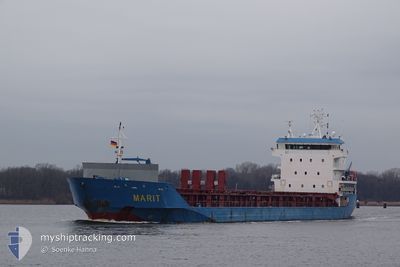
MARIT
General Cargo
Current Trip
| Time Travelled | 1 day |
|---|---|
| Remaining Time | 2 days |
| Distance Travelled | 440.34 nm |
| Remaining Distance | 750.49 nm |
| AVG Speed | 12.1 Noeuds |
| MAX Speed | 13.2 Noeuds |
| AVG Wind | 13.3 knots |
| MAX Wind | 34.9 knots |
| MIN Temp | 9.4°C / 48.92°F |
| MAX Temp | 15.1°C / 59.18°F |
| Tirant d eau | 4.7 m |
| Position reçue | 2 h, 15 m depuis |
Current Position
| Longitude | 2.96320° |
|---|---|
| Latitude | 39.07706° |
| Etat | Under way using engine |
| Vitesse | 12.4 Noeuds |
| Parcours | 236.4° |
| Zone | Mediterranean Sea - Western Basin |
| Station | T-AIS |
| Position reçue | 2 h, 15 m depuis |
Info
Information
The current position of MARIT is in Mediterranean Sea - Western Basin with coordinates 39.07706° / 2.96320° as reported on 2024-04-25 06:02 by AIS to our vessel tracker app. The vessel's current speed is 12.4 Noeuds and is heading at the port of SETUBAL. The estimated time of arrival as calculated by MyShipTracking vessel tracking app is 2024-04-27 18:10 LT
The vessel MARIT (IMO: 9364148, MMSI: 246127000) is a General Cargo that was built in 2008 ( 16 Age ). It's sailing under the flag of [NL] Netherlands.
In this page you can find informations about the vessels current position, last detected port calls, and current voyage information. If the vessels is not in coverage by AIS you will find the latest position.
The current position of MARIT is detected by our AIS receivers and we are not responsible for the reliability of the data. The last position was recorded while the vessel was in Coverage by the Ais receivers of our vessel tracking app.
The current draught of MARIT as reported by AIS is 4.7 meters
Weather
| Temperature | 15.1°C / 59.18°F |
|---|---|
| Wind Speed | 6 knots |
| Direction | 216° SW |
| Pressure | 1011.6 hPa |
| Humidity | 61.7 % |
| Cloud Coverage | 85 % |
Featured Company
Last Port Calls
| Port | Arrival | Departure | Time In Port |
|---|---|---|---|
| 2024-04-21 08:21 | 2024-04-23 18:16 | 2 d | |
| 2024-04-17 07:47 | 2024-04-17 18:51 | 11 h | |
| 2024-04-01 15:53 | 2024-04-03 16:21 | 2 d | |
| 2024-03-30 14:29 | 2024-04-01 05:17 | 1 d | |
| 2024-03-11 21:54 | 2024-03-13 14:46 | 1 d | |
| 2024-03-06 19:04 | 2024-03-08 16:35 | 1 d | |
| 2024-03-04 10:07 | 2024-03-04 16:35 | 6 h | |
| 2024-02-27 12:30 | 2024-02-27 15:01 | 2 h | |
| 2024-02-26 05:46 | 2024-02-26 19:51 | 14 h | |
| 2024-02-22 14:59 | 2024-02-23 23:11 | 1 d |
Last Trips
| Origin | Departure | Destination | Arrival | Distance | |
|---|---|---|---|---|---|
| 2024-04-17 20:51 | 2024-04-21 10:21 | 792.10 nm | |||
| 2024-04-03 18:21 | 2024-04-17 09:47 | 3248.25 nm | |||
| 2024-04-01 08:17 | 2024-04-01 17:53 | 129.27 nm | |||
| 2024-03-13 14:46 | 2024-03-30 16:29 | 2100.89 nm | |||
| 2024-03-08 17:35 | 2024-03-11 21:54 | 709.99 nm | |||
| 2024-03-04 16:35 | 2024-03-06 20:04 | 516.17 nm | |||
| 2024-02-27 16:01 | 2024-03-04 10:07 | 1276.25 nm | |||
| 2024-02-26 20:51 | 2024-02-27 13:30 | 192.51 nm | |||
| 2024-02-24 00:11 | 2024-02-26 06:46 | 632.53 nm | |||
| 2024-02-15 16:50 | 2024-02-22 15:59 | 429.94 nm |
Events
| Heure | Evenement | Détails | Position/ Destination | Info |
|---|---|---|---|---|
| 2024-04-25 06:08 | Etat Changé | Default Under way using engine |
39.06416 / 2.93811
PTSET
|
Vitesse: 12.4 kn Parcours: 236.4° |
| 2024-04-25 06:02 | Hors de la zone couverte |
39.07706 / 2.96320
Mediterranean Sea - Western Basin
PTSET
|
Vitesse: 12.4 kn Parcours: 236.4° |
|
| 2024-04-25 05:47 | Changement de zone | Spanish part of the Mediterranean Sea - Western Basin Italian part of the Tyrrhenian Sea |
39.10507 / 3.01933
Mediterranean Sea - Western Basin
PTSET
|
Vitesse: 12.6 kn Parcours: 237.2° |
| 2024-04-25 05:45 | Etat Changé | Under way using engine Default |
39.10783 / 3.02504
PTSET
|
Vitesse: 12.7 kn Parcours: 237° |
| 2024-04-25 05:41 | Dans la zone couverte |
39.10507 / 3.01933
Mediterranean Sea - Western Basin
PTSET
|
Vitesse: 12.6 kn Parcours: 237.2° |
|
| 2024-04-23 20:37 | Hors de la zone couverte |
43.25077 / 9.75485
Tyrrhenian Sea
PTSET
|
Vitesse: 12 kn Parcours: 240.9° |
|
| 2024-04-23 18:16 | PORT DE DEPART |
|
43.53874 / 10.28384
PTSET
|
Vitesse: 8 kn Parcours: 249° |
| 2024-04-23 18:07 | Démarrage |
43.55511 / 10.29555
[IT] LIVORNO
|
Vitesse: 3.2 kn Parcours: 207° |
|
| 2024-04-23 17:55 | Etat Changé | Under way using engine Moored |
43.55727 / 10.29810
[IT] LIVORNO
|
Vitesse: Parcours: 44° |
| 2024-04-23 17:00 | Changement d'ETA | 2024/04/27 21:00 2024/04/20 18:00 |
43.55725 / 10.29808
[IT] LIVORNO
|
Vitesse: Parcours: 44° |