
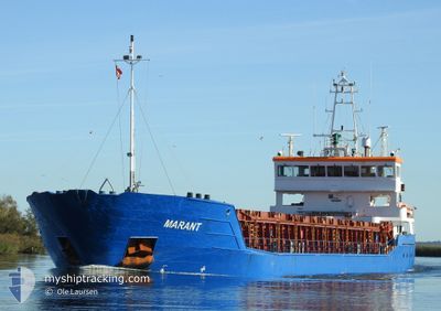
MARANT
General Cargo
Current Trip
| Time Travelled | 5 days |
|---|---|
| Remaining Time | --- |
| Distance Travelled | 612.24 nm |
| Remaining Distance | --- |
| AVG Speed | 8 Noeuds |
| MAX Speed | 9.3 Noeuds |
| AVG Wind | 17.4 knots |
| MAX Wind | 24.3 knots |
| MIN Temp | 8.3°C / 46.94°F |
| MAX Temp | 13.4°C / 56.12°F |
| Tirant d eau | 5.7 m |
| Position reçue | 2 d depuis |
Current Position
| Longitude | --- |
|---|---|
| Latitude | --- |
| Etat | Under way using engine |
| Vitesse | 8.8 Noeuds |
| Parcours | 213.4° |
| Zone | English Channel |
| Station | T-AIS |
| Position reçue | 2 d depuis |
Info
Information
The current position of MARANT is in English Channel with coordinates 49.71889° / -4.56907° as reported on 2025-02-24 23:00 by AIS to our vessel tracker app. The vessel's current speed is 8.8 Noeuds and is heading at the port of CASTELLON. The estimated time of arrival as calculated by MyShipTracking vessel tracking app is 2025-03-03 19:00 LT
The vessel MARANT (IMO: 9280689, MMSI: 205050000) is a General Cargo that was built in 2006 ( 19 Age ). It's sailing under the flag of [BE] Belgium.
In this page you can find informations about the vessels current position, last detected port calls, and current voyage information. If the vessels is not in coverage by AIS you will find the latest position.
The current position of MARANT is detected by our AIS receivers and we are not responsible for the reliability of the data. The last position was recorded while the vessel was in Coverage by the Ais receivers of our vessel tracking app.
The current draught of MARANT as reported by AIS is 5.7 meters
Weather
| Temperature | 13°C / 55.4°F |
|---|---|
| Wind Speed | 17 knots |
| Direction | 99° E |
| Pressure | 1015.9 hPa |
| Humidity | 83 % |
| Cloud Coverage | 100 % |
Featured Company
Last Port Calls
| Port | Arrival | Departure | Time In Port |
|---|---|---|---|
| 2025-02-22 10:32 | 2025-02-22 10:43 | 10 m | |
| 2025-02-19 13:46 | 2025-02-19 14:16 | 30 m | |
| 2025-02-19 13:13 | 2025-02-19 13:28 | 15 m | |
| 2025-02-16 17:11 | 2025-02-19 12:37 | 2 d | |
| 2025-02-16 16:01 | 2025-02-16 16:21 | 20 m | |
| 2025-02-16 15:06 | 2025-02-16 15:41 | 34 m | |
| 2025-02-10 08:14 | 2025-02-11 19:17 | 1 d | |
| 2025-02-02 18:47 | 2025-02-08 19:35 | 6 d | |
| 2025-01-27 09:15 | 2025-01-30 23:42 | 3 d | |
| 2025-01-24 12:34 | 2025-01-26 13:16 | 2 d |
Most Visited Ports (Last year)
| Port | Arrivals | |
|---|---|---|
| 8 | ||
| 4 | ||
| 3 | ||
| 3 | ||
| 2 | ||
| 2 |
Last Trips
| Origin | Departure | Destination | Arrival | Distance | |
|---|---|---|---|---|---|
| 2025-02-19 14:16 | 2025-02-22 10:32 | 387.81 nm | |||
| 2025-02-19 13:28 | 2025-02-19 13:46 | 1.40 nm | |||
| 2025-02-19 12:37 | 2025-02-19 13:13 | 4.66 nm | |||
| 2025-02-16 16:21 | 2025-02-16 17:11 | 4.44 nm | |||
| 2025-02-16 15:41 | 2025-02-16 16:01 | 1.88 nm | |||
| 2025-02-11 19:17 | 2025-02-16 15:06 | 1030.27 nm | |||
| 2025-02-08 20:35 | 2025-02-10 08:14 | 339.51 nm | |||
| 2025-01-31 00:42 | 2025-02-02 19:47 | 560.14 nm | |||
| 2025-01-26 14:16 | 2025-01-27 10:15 | 118.49 nm | |||
| 2025-01-17 20:17 | 2025-01-24 13:34 | 1126.35 nm |
Events
| Heure | Evenement | Détails | Position/ Destination | Info |
|---|---|---|---|---|
| 2025-02-24 23:07 | Etat Changé | Default Under way using engine |
49.70451 / -4.58401
GB PLY>ES CAS
|
Vitesse: 8.8 kn Parcours: 213.4° |
| 2025-02-24 23:00 | Etat Changé | Under way using engine Default |
49.71889 / -4.56907
GB PLY>ES CAS
|
Vitesse: 8.6 kn Parcours: 214° |
| 2025-02-24 23:00 | Hors de la zone couverte |
49.71889 / -4.56907
English Channel
GB PLY>ES CAS
|
Vitesse: 8.8 kn Parcours: 213.4° |
|
| 2025-02-24 22:43 | Etat Changé | Default Under way using engine |
49.75343 / -4.53416
GB PLY>ES CAS
|
Vitesse: 8.4 kn Parcours: 213.6° |
| 2025-02-24 17:57 | Démarrage | 1.36 nm, East of PLYMOUTH |
50.36114 / -4.11892
GB PLY>ES CAS
|
Vitesse: 3.7 kn Parcours: 253° |
| 2025-02-24 17:51 | Etat Changé | Under way using engine Moored |
50.36170 / -4.11603
GB PLY>ES CAS
|
Vitesse: Parcours: 260° |
| 2025-02-24 17:30 | Tirant d'eau modifié | 5.7 5.5 |
50.36169 / -4.11602
GB PLY>ES CAS
|
Vitesse: Parcours: 260° |
| 2025-02-24 13:57 | Tirant d'eau modifié | 5.5 3.5 |
50.36171 / -4.11604
GB PLY>ES CAS
|
Vitesse: Parcours: 260° |
| 2025-02-24 13:57 | Changement d'ETA | 2025/03/03 19:00 2025/02/22 09:00 |
50.36171 / -4.11604
GB PLY>ES CAS
|
Vitesse: Parcours: 260° |
| 2025-02-24 13:56 | Changement de destination | GB PLY>ES CAS GB RUN>GB PLY |
50.36171 / -4.11604
GB PLY>ES CAS
|
Vitesse: Parcours: 260° |