
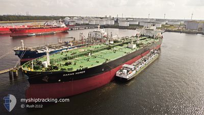
MARAN HOMER
Tanker A
Current Trip
ITTRS
| Time Travelled | 12 days |
|---|---|
| Remaining Time | --- |
| Distance Travelled | 287.84 nm |
| Remaining Distance | --- |
| AVG Speed | 6.3 Noeuds |
| MAX Speed | 10.2 Noeuds |
| AVG Wind | 10.3 knots |
| MAX Wind | 26.4 knots |
| MIN Temp | 2.8°C / 37.04°F |
| MAX Temp | 11.2°C / 52.16°F |
| Tirant d eau | 12.3 m |
| Position reçue | 1 m depuis |
Current Position
| Longitude | --- |
|---|---|
| Latitude | --- |
| Etat | At anchor |
| Vitesse | 0.1 Noeuds |
| Parcours | 87° |
| Zone | Adriatic Sea |
| Station | T-AIS |
| Position reçue | 1 m depuis |
Info
Information
The current position of MARAN HOMER is in Adriatic Sea with coordinates 45.62799° / 13.65121° as reported on 2025-02-27 22:18 by AIS to our vessel tracker app. The vessel's current speed is 0.1 Noeuds
The vessel MARAN HOMER (IMO: 9761372, MMSI: 241518000) is a Tanker A It's sailing under the flag of [GR] Greece.
In this page you can find informations about the vessels current position, last detected port calls, and current voyage information. If the vessels is not in coverage by AIS you will find the latest position.
The current position of MARAN HOMER is detected by our AIS receivers and we are not responsible for the reliability of the data. The last position was recorded while the vessel was in Coverage by the Ais receivers of our vessel tracking app.
The current draught of MARAN HOMER as reported by AIS is 12.3 meters
Weather
| Temperature | 5.5°C / 41.9°F |
|---|---|
| Wind Speed | 7 knots |
| Direction | 71° ENE |
| Pressure | 1019.5 hPa |
| Humidity | 81.4 % |
| Cloud Coverage | 8 % |
Featured Company
Last Port Calls
| Port | Arrival | Departure | Time In Port |
|---|---|---|---|
| 2025-02-14 09:29 | 2025-02-15 09:00 | 23 h | |
| 2024-12-25 07:30 | 2024-12-26 17:54 | 1 d |
Most Visited Ports (Last year)
| Port | Arrivals | |
|---|---|---|
| 2 | ||
| 1 | ||
| 1 | ||
| 1 | ||
| 1 | ||
| 1 |
Last Trips
| Origin | Departure | Destination | Arrival | Distance | |
|---|---|---|---|---|---|
| 2024-12-26 17:54 | 2025-02-14 09:29 | 5236.39 nm | |||
| 2024-11-22 18:51 | 2024-12-25 07:30 | 8554.69 nm |
Events
| Heure | Evenement | Détails | Position/ Destination | Info |
|---|---|---|---|---|
| 2025-02-27 20:31 | Tirant d'eau modifié | 12.3 12 |
45.62869 / 13.65127
ITTRS
|
Vitesse: Parcours: 104° |
| 2025-02-27 20:31 | Changement d'ETA | 2025/02/23 23:00 |
45.62869 / 13.65127
ITTRS
|
Vitesse: Parcours: 104° |
| 2025-02-27 20:25 | Tirant d'eau modifié | 12 12.3 |
45.62874 / 13.65134
ITTRS
|
Vitesse: Parcours: 106° |
| 2025-02-27 18:19 | Tirant d'eau modifié | 12.3 12 |
45.62854 / 13.65125
ITTRS
|
Vitesse: Parcours: 98° |
| 2025-02-27 18:19 | Changement d'ETA | 2025/02/23 23:00 |
45.62854 / 13.65125
ITTRS
|
Vitesse: Parcours: 98° |
| 2025-02-27 18:13 | Tirant d'eau modifié | 12 12.3 |
45.62845 / 13.65131
ITTRS
|
Vitesse: Parcours: 97° |
| 2025-02-27 17:13 | Tirant d'eau modifié | 12.3 12 |
45.62832 / 13.65123
ITTRS
|
Vitesse: 0.1 kn Parcours: 95° |
| 2025-02-27 17:13 | Changement d'ETA | 2025/02/23 23:00 |
45.62832 / 13.65123
ITTRS
|
Vitesse: 0.1 kn Parcours: 95° |
| 2025-02-27 17:07 | Tirant d'eau modifié | 12 12.3 |
45.62823 / 13.65113
ITTRS
|
Vitesse: 0.1 kn Parcours: 91° |
| 2025-02-27 14:42 | Detecté en mer | Italian part of the Adriatic Sea |
45.62686 / 13.65180
Adriatic Sea
|
Vitesse: Parcours: 330° |