
MALANJE
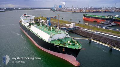
Lng Tanker
Current Trip
MOHESHKHALI
| Time Travelled | 13 days |
|---|---|
| Remaining Time | --- |
| Distance Travelled | 5850.22 nm |
| Remaining Distance | --- |
| AVG Speed | 18.4 Noeuds |
| MAX Speed | 21.3 Noeuds |
| AVG Wind | 15.9 knots |
| MAX Wind | 33.1 knots |
| MIN Temp | 14°C / 57.2°F |
| MAX Temp | 29.4°C / 84.92°F |
| Tirant d eau | 11.5 m |
| Position reçue | 3 d depuis |
Current Position
| Longitude | 55.33191° |
|---|---|
| Latitude | -20.13175° |
| Etat | Under way using engine |
| Vitesse | 19 Noeuds |
| Parcours | 53.5° |
| Zone | Indian Ocean |
| Station | T-AIS |
| Position reçue | 3 d depuis |
Info
Information
The current position of MALANJE is in Indian Ocean with coordinates -20.13175° / 55.33191° as reported on 2024-04-16 06:53 by AIS to our vessel tracker app. The vessel's current speed is 19 Noeuds
The vessel MALANJE (IMO: 9490959, MMSI: 311038600) is a Lng Tanker that was built in 2011 ( 13 Age ). It's sailing under the flag of [BS] Bahamas.
In this page you can find informations about the vessels current position, last detected port calls, and current voyage information. If the vessels is not in coverage by AIS you will find the latest position.
The current position of MALANJE is detected by our AIS receivers and we are not responsible for the reliability of the data. The last position was recorded while the vessel was in Coverage by the Ais receivers of our vessel tracking app.
The current draught of MALANJE as reported by AIS is 11.5 meters
Weather
| Temperature | 29.2°C / 84.56°F |
|---|---|
| Wind Speed | 3 knots |
| Direction | 298° WNW |
| Pressure | 1009.1 hPa |
| Humidity | 73.2 % |
| Cloud Coverage | 64 % |
Featured Company
Last Port Calls
| Port | Arrival | Departure | Time In Port |
|---|---|---|---|
| 2024-04-05 07:59 | 2024-04-07 05:43 | 1 d | |
| 2024-02-17 01:16 | 2024-02-18 01:47 | 1 d |
Most Visited Ports (Last year)
| Port | Arrivals | |
|---|---|---|
| 8 | ||
| 1 | ||
| 1 | ||
| 1 | ||
| 1 |
Last Trips
| Origin | Departure | Destination | Arrival | Distance | |
|---|---|---|---|---|---|
| 2024-02-18 08:47 | 2024-04-05 08:59 | 6552.63 nm | |||
| 2024-01-25 06:52 | 2024-02-17 08:16 | 8457.92 nm |
Events
| Heure | Evenement | Détails | Position/ Destination | Info |
|---|---|---|---|---|
| 2024-04-16 06:58 | Etat Changé | Default Under way using engine |
-20.11828 / 55.35155
MOHESHKHALI
|
Vitesse: 19 kn Parcours: 53.5° |
| 2024-04-16 06:53 | Hors de la zone couverte |
-20.13175 / 55.33191
Indian Ocean
MOHESHKHALI
|
Vitesse: 19 kn Parcours: 53.5° |
|
| 2024-04-16 06:35 | Etat Changé | Under way using engine Default |
-20.18963 / 55.25209
MOHESHKHALI
|
Vitesse: 19 kn Parcours: 51° |
| 2024-04-16 06:29 | Etat Changé | Default Under way using engine |
-20.21073 / 55.22321
MOHESHKHALI
|
Vitesse: 19.1 kn Parcours: 54.7° |
| 2024-04-16 06:11 | Etat Changé | Under way using engine Default |
-20.26791 / 55.14048
MOHESHKHALI
|
Vitesse: 19.2 kn Parcours: 55° |
| 2024-04-16 06:10 | Etat Changé | Default Under way using engine |
-20.27155 / 55.13484
MOHESHKHALI
|
Vitesse: 19.4 kn Parcours: 56.4° |
| 2024-04-16 05:59 | Etat Changé | Under way using engine Default |
-20.30435 / 55.08454
MOHESHKHALI
|
Vitesse: 19.3 kn Parcours: 55° |
| 2024-04-16 05:56 | Etat Changé | Default Under way using engine |
-20.31323 / 55.07125
MOHESHKHALI
|
Vitesse: 19.2 kn Parcours: 55.5° |
| 2024-04-16 04:34 | Changement de zone | R�union part of the Indian Ocean South African part of the South Atlantic Ocean |
-20.57117 / 54.68800
Indian Ocean
MOHESHKHALI
|
Vitesse: 19.8 kn Parcours: 55.1° |
| 2024-04-16 04:32 | Etat Changé | Under way using engine Default |
-20.57560 / 54.68130
MOHESHKHALI
|
Vitesse: 19 kn Parcours: 54° |