
LUCIE SCHULTE
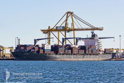
Container Ship
Current Trip
| Time Travelled | 12 days |
|---|---|
| Remaining Time | 8 h, 50 mins |
| Distance Travelled | 4735.84 nm |
| Remaining Distance | 139.26 nm |
| AVG Speed | 16.7 Noeuds |
| MAX Speed | 19.2 Noeuds |
| AVG Wind | 10.5 knots |
| MAX Wind | 27 knots |
| MIN Temp | 8.3°C / 46.94°F |
| MAX Temp | 30.7°C / 87.26°F |
| Tirant d eau | 11.4 m |
| Position reçue | Maintenant |
Current Position
| Longitude | -4.43420° |
|---|---|
| Latitude | 49.94058° |
| Etat | Under way using engine |
| Vitesse | 14.7 Noeuds |
| Parcours | 73° |
| Zone | English Channel |
| Station | T-AIS |
| Position reçue | Maintenant |
Info
Information
The current position of LUCIE SCHULTE is in English Channel with coordinates 49.94058° / -4.43420° as reported on 2024-04-18 13:41 by AIS to our vessel tracker app. The vessel's current speed is 14.7 Noeuds and is heading at the port of SOUTHAMPTON. The estimated time of arrival as calculated by MyShipTracking vessel tracking app is 2024-04-18 22:31 LT
The vessel LUCIE SCHULTE (IMO: 9301926, MMSI: 565213000) is a Container Ship that was built in 2006 ( 18 Age ). It's sailing under the flag of [SG] Singapore.
In this page you can find informations about the vessels current position, last detected port calls, and current voyage information. If the vessels is not in coverage by AIS you will find the latest position.
The current position of LUCIE SCHULTE is detected by our AIS receivers and we are not responsible for the reliability of the data. The last position was recorded while the vessel was in Coverage by the Ais receivers of our vessel tracking app.
The current draught of LUCIE SCHULTE as reported by AIS is 11.4 meters
Weather
| Temperature | 8.3°C / 46.94°F |
|---|---|
| Wind Speed | 1 knots |
| Direction | 193° SSW |
| Pressure | 1026.8 hPa |
| Humidity | 68.5 % |
| Cloud Coverage | 13 % |
Featured Company
Last Port Calls
| Port | Arrival | Departure | Time In Port |
|---|---|---|---|
| 2024-04-04 08:21 | 2024-04-05 18:50 | 1 d | |
| 2024-03-30 13:15 | 2024-03-31 12:15 | 23 h | |
| 2024-03-25 16:22 | 2024-03-26 03:59 | 11 h | |
| 2024-03-06 04:28 | 2024-03-07 06:50 | 1 d | |
| 2024-03-03 15:28 | 2024-03-04 20:16 | 1 d | |
| 2024-03-01 02:46 | 2024-03-02 04:40 | 1 d | |
| 2024-02-28 08:07 | 2024-02-28 22:55 | 14 h | |
| 2024-02-28 07:21 | 2024-02-28 07:28 | 6 m | |
| 2024-02-15 12:02 | 2024-02-16 12:16 | 1 d | |
| 2024-02-12 19:16 | 2024-02-13 12:29 | 17 h |
Most Visited Ports (Last year)
| Port | Arrivals | |
|---|---|---|
| 12 | ||
| 8 | ||
| 8 | ||
| 7 | ||
| 7 | ||
| 7 |
Last Trips
| Origin | Departure | Destination | Arrival | Distance | |
|---|---|---|---|---|---|
| 2024-03-31 06:15 | 2024-04-04 03:21 | 874.76 nm | |||
| 2024-03-25 21:59 | 2024-03-30 07:15 | 1053.26 nm | |||
| 2024-03-07 07:50 | 2024-03-25 10:22 | 6138.36 nm | |||
| 2024-03-04 21:16 | 2024-03-06 05:28 | 361.19 nm | |||
| 2024-03-02 04:40 | 2024-03-03 16:28 | 266.44 nm | |||
| 2024-02-28 22:55 | 2024-03-01 02:46 | 391.38 nm | |||
| 2024-02-28 07:28 | 2024-02-28 08:07 | 3.43 nm | |||
| 2024-02-16 07:16 | 2024-02-28 07:21 | 4725.79 nm | |||
| 2024-02-13 06:29 | 2024-02-15 07:02 | 832.36 nm | |||
| 2024-02-08 17:47 | 2024-02-12 13:16 | 1043.80 nm |
Events
| Heure | Evenement | Détails | Position/ Destination | Info |
|---|---|---|---|---|
| 2024-04-18 11:17 | Tirant d'eau modifié | 11.4 9.8 |
49.76852 / -5.35378
GBSOU
|
Vitesse: 15.4 kn Parcours: 85° |
| 2024-04-18 11:17 | Changement de destination | GBSOU PAMIT TAR |
49.76852 / -5.35378
GBSOU
|
Vitesse: 15.4 kn Parcours: 85° |
| 2024-04-18 11:17 | Changement d'ETA | 2024/04/19 00:30 2024/04/03 22:00 |
49.76852 / -5.35378
GBSOU
|
Vitesse: 15.4 kn Parcours: 85° |
| 2024-04-18 11:10 | Detecté en mer | United Kingdom part of the English Channel |
49.76918 / -5.39643
English Channel
|
Vitesse: 15.7 kn Parcours: 80° |
| 2024-04-18 11:10 | Etat Changé | Under way using engine Default |
49.76890 / -5.39920
PAMIT TAR
|
Vitesse: 15.6 kn Parcours: 76° |
| 2024-04-18 10:47 | Etat Changé | Default Under way using engine |
49.74467 / -5.54758
PAMIT TAR
|
Vitesse: 15.6 kn Parcours: 85° |
| 2024-04-18 10:34 | Etat Changé | Under way using engine Default |
49.73643 / -5.62680
PAMIT TAR
|
Vitesse: 15.5 kn Parcours: 74° |
| 2024-04-18 10:25 | Dans la zone couverte |
49.73643 / -5.62680
Celtic Sea
|
Vitesse: 15.6 kn Parcours: 85° |
|
| 2024-04-18 09:41 | Etat Changé | Default Under way using engine |
49.67713 / -5.97073
PAMIT TAR
|
Vitesse: 15.3 kn Parcours: 74° |
| 2024-04-18 09:28 | Hors de la zone couverte |
49.66337 / -6.04952
Celtic Sea
|
Vitesse: 15.3 kn Parcours: 74° |