
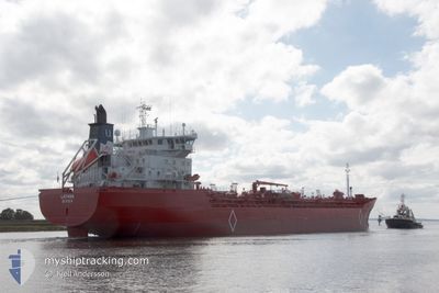
LATANA
Oil/Chemical Tanker
Current Trip
| Time Travelled | 5 days |
|---|---|
| Remaining Time | 3 days |
| Distance Travelled | 1404.62 nm |
| Remaining Distance | 1114.67 nm |
| AVG Speed | 12.4 Noeuds |
| MAX Speed | 14.3 Noeuds |
| AVG Wind | 7.4 knots |
| MAX Wind | 17.4 knots |
| MIN Temp | -1.3°C / 29.66°F |
| MAX Temp | 8.4°C / 47.12°F |
| Tirant d eau | 6.2 m |
| Position reçue | 2 h, 46 m depuis |
Current Position
| Longitude | 22.63571° |
|---|---|
| Latitude | 59.54483° |
| Etat | Under way using engine |
| Vitesse | 11.3 Noeuds |
| Parcours | 241.9° |
| Zone | Baltic Sea |
| Station | T-AIS |
| Position reçue | 2 h, 46 m depuis |
Info
Information
The current position of LATANA is in Baltic Sea with coordinates 59.54483° / 22.63571° as reported on 2024-04-20 10:33 by AIS to our vessel tracker app. The vessel's current speed is 11.3 Noeuds and is heading at the port of ELNESVAGEN. The estimated time of arrival as calculated by MyShipTracking vessel tracking app is 2024-04-24 12:27 LT
The vessel LATANA (IMO: 9186352, MMSI: 257374000) is a Oil/Chemical Tanker that was built in 2000 ( 24 Age ). It's sailing under the flag of [NO] Norway.
In this page you can find informations about the vessels current position, last detected port calls, and current voyage information. If the vessels is not in coverage by AIS you will find the latest position.
The current position of LATANA is detected by our AIS receivers and we are not responsible for the reliability of the data. The last position was recorded while the vessel was in Coverage by the Ais receivers of our vessel tracking app.
The current draught of LATANA as reported by AIS is 6.2 meters
Weather
| Temperature | -0.5°C / 31.1°F |
|---|---|
| Wind Speed | 17 knots |
| Direction | 322° NW |
| Pressure | 1011.1 hPa |
| Humidity | 85.1 % |
| Cloud Coverage | 100 % |
Featured Company
Last Port Calls
| Port | Arrival | Departure | Time In Port |
|---|---|---|---|
| 2024-04-14 06:26 | 2024-04-15 02:19 | 19 h | |
| 2024-04-04 05:39 | 2024-04-04 23:23 | 17 h | |
| 2024-04-03 11:27 | 2024-04-03 18:20 | 6 h | |
| 2024-03-31 12:03 | 2024-04-01 15:39 | 1 d | |
| 2024-03-19 08:02 | 2024-03-22 16:17 | 3 d | |
| 2024-03-09 05:09 | 2024-03-09 20:55 | 15 h | |
| 2024-02-27 10:01 | 2024-02-28 20:09 | 1 d | |
| 2024-02-17 17:40 | 2024-02-18 08:49 | 15 h | |
| 2024-02-06 01:08 | 2024-02-07 04:57 | 1 d |
Most Visited Ports (Last year)
| Port | Arrivals | |
|---|---|---|
| 47 | ||
| 7 | ||
| 7 | ||
| 6 | ||
| 1 | ||
| 1 |
Last Trips
| Origin | Departure | Destination | Arrival | Distance | |
|---|---|---|---|---|---|
| 2024-04-05 01:23 | 2024-04-14 08:26 | 2534.60 nm | |||
| 2024-04-03 20:20 | 2024-04-04 07:39 | 0.83 nm | |||
| 2024-04-01 17:39 | 2024-04-03 13:27 | 3.88 nm | |||
| 2024-03-22 17:17 | 2024-03-31 14:03 | 203.86 nm | |||
| 2024-03-09 21:55 | 2024-03-19 09:02 | 2373.37 nm | |||
| 2024-02-28 21:09 | 2024-03-09 06:09 | 2526.42 nm | |||
| 2024-02-18 09:49 | 2024-02-27 11:01 | 2534.07 nm | |||
| 2024-02-07 05:57 | 2024-02-17 18:40 | 2547.63 nm | |||
| 2024-01-26 17:00 | 2024-02-06 02:08 | 2527.40 nm |
Events
| Heure | Evenement | Détails | Position/ Destination | Info |
|---|---|---|---|---|
| 2024-04-20 10:45 | Etat Changé | Default Under way using engine |
59.52882 / 22.57631
FIFOR > NOELN
|
Vitesse: 11.3 kn Parcours: 241.9° |
| 2024-04-20 10:33 | Hors de la zone couverte |
59.54483 / 22.63571
Baltic Sea
FIFOR > NOELN
|
Vitesse: 11.3 kn Parcours: 241.9° |
|
| 2024-04-20 09:20 | Changement de zone | Finnish part of the Baltic Sea Finnish part of the Gulf of Finland |
59.65610 / 23.03197
Baltic Sea
FIFOR > NOELN
|
Vitesse: 11.2 kn Parcours: 209.7° |
| 2024-04-20 08:26 | Changement de zone | Finnish part of the Gulf of Finland Finnish part of the Baltic Sea |
59.78256 / 22.94252
Gulf of Finland
FIFOR > NOELN
|
Vitesse: 11.2 kn Parcours: 96.5° |
| 2024-04-20 08:17 | Changement de zone | Finnish part of the Baltic Sea Finnish part of the Gulf of Bothnia |
59.78991 / 22.88137
Baltic Sea
FIFOR > NOELN
|
Vitesse: 13.4 kn Parcours: 133.2° |
| 2024-04-20 06:36 | Démarrage | 11.75 nm, North East of DALSBRUK |
60.10204 / 22.85730
FIFOR > NOELN
|
Vitesse: 5.4 kn Parcours: 254.4° |
| 2024-04-20 06:36 | Tirant d'eau modifié | 6.2 8.9 |
60.10211 / 22.85800
FIFOR > NOELN
|
Vitesse: 4.7 kn Parcours: 244° |
| 2024-04-20 06:36 | Changement de destination | FIFOR > NOELN NOELN > FIFOR |
60.10211 / 22.85800
FIFOR > NOELN
|
Vitesse: 4.7 kn Parcours: 244° |
| 2024-04-20 06:36 | Changement d'ETA | 2024/04/24 12:00 2024/04/19 08:30 |
60.10211 / 22.85800
FIFOR > NOELN
|
Vitesse: 4.7 kn Parcours: 244° |
| 2024-04-20 06:24 | Dans la zone couverte |
60.10146 / 22.86071
Gulf of Bothnia
|
Vitesse: 0.1 kn Parcours: 176.3° |