
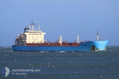
KIRSTEN MAERSK
Oil/Chemical Tanker
Current Trip
| Time Travelled | 1 day |
|---|---|
| Remaining Time | 14 h, 9 mins |
| Distance Travelled | 413.46 nm |
| Remaining Distance | 299.15 nm |
| AVG Speed | 13.4 Noeuds |
| MAX Speed | 14.3 Noeuds |
| AVG Wind | 10.5 knots |
| MAX Wind | 26.3 knots |
| MIN Temp | 13.3°C / 55.94°F |
| MAX Temp | 19.6°C / 67.28°F |
| Tirant d eau | 10.5 m |
| Position reçue | 8 h, 42 m depuis |
Current Position
| Longitude | 27.90294° |
|---|---|
| Latitude | 34.43856° |
| Etat | Under way using engine |
| Vitesse | 12.9 Noeuds |
| Parcours | 128° |
| Zone | Mediterranean Sea - Eastern Basin |
| Station | T-AIS |
| Position reçue | 8 h, 42 m depuis |
Info
Information
The current position of KIRSTEN MAERSK is in Mediterranean Sea - Eastern Basin with coordinates 34.43856° / 27.90294° as reported on 2024-04-19 23:15 by AIS to our vessel tracker app. The vessel's current speed is 12.9 Noeuds and is heading at the port of PORT SAID. The estimated time of arrival as calculated by MyShipTracking vessel tracking app is 2024-04-20 22:06 LT
The vessel KIRSTEN MAERSK (IMO: 9431264, MMSI: 220530000) is a Oil/Chemical Tanker that was built in 2010 ( 14 Age ). It's sailing under the flag of [DK] Denmark.
In this page you can find informations about the vessels current position, last detected port calls, and current voyage information. If the vessels is not in coverage by AIS you will find the latest position.
The current position of KIRSTEN MAERSK is detected by our AIS receivers and we are not responsible for the reliability of the data. The last position was recorded while the vessel was in Coverage by the Ais receivers of our vessel tracking app.
The current draught of KIRSTEN MAERSK as reported by AIS is 10.5 meters
Weather
| Temperature | 18.2°C / 64.76°F |
|---|---|
| Wind Speed | 16 knots |
| Direction | 281° W |
| Pressure | 1011.7 hPa |
| Humidity | 83.6 % |
| Cloud Coverage | 100 % |
Featured Company
Last Port Calls
| Port | Arrival | Departure | Time In Port |
|---|---|---|---|
| 2024-04-16 19:20 | 2024-04-18 22:48 | 2 d | |
| 2024-04-02 04:36 | 2024-04-04 08:43 | 2 d | |
| 2024-03-25 03:37 | 2024-03-26 14:00 | 1 d | |
| 2024-03-18 15:27 | 2024-03-21 08:11 | 2 d | |
| 2024-03-12 12:41 | 2024-03-13 21:13 | 1 d | |
| 2024-02-08 22:04 | 2024-02-16 05:50 | 7 d | |
| 2024-02-01 15:24 | 2024-02-03 09:33 | 1 d |
Most Visited Ports (Last year)
| Port | Arrivals | |
|---|---|---|
| 4 | ||
| 4 | ||
| 4 | ||
| 3 | ||
| 3 | ||
| 3 |
Last Trips
| Origin | Departure | Destination | Arrival | Distance | |
|---|---|---|---|---|---|
| 2024-04-04 10:43 | 2024-04-16 22:20 | 811.15 nm | |||
| 2024-03-26 16:00 | 2024-04-02 06:36 | 733.55 nm | |||
| 2024-03-21 09:11 | 2024-03-25 05:37 | 874.77 nm | |||
| 2024-03-13 22:13 | 2024-03-18 16:27 | 1002.59 nm | |||
| 2024-02-03 10:33 | 2024-02-08 23:04 | 135.57 nm | |||
| 2024-01-21 06:54 | 2024-02-01 16:24 | 3507.06 nm |
Events
| Heure | Evenement | Détails | Position/ Destination | Info |
|---|---|---|---|---|
| 2024-04-19 23:20 | Etat Changé | Default Under way using engine |
34.42794 / 27.91946
PORT SAID
|
Vitesse: 12.9 kn Parcours: 128° |
| 2024-04-19 23:15 | Hors de la zone couverte |
34.43856 / 27.90294
Mediterranean Sea - Eastern Basin
PORT SAID
|
Vitesse: 12.9 kn Parcours: 128° |
|
| 2024-04-19 23:13 | Etat Changé | Under way using engine Default |
34.44309 / 27.89621
PORT SAID
|
Vitesse: 13.1 kn Parcours: 128° |
| 2024-04-19 22:40 | Etat Changé | Default Under way using engine |
34.51796 / 27.78159
PORT SAID
|
Vitesse: 13.3 kn Parcours: 128° |
| 2024-04-19 22:32 | Etat Changé | Under way using engine Default |
34.53632 / 27.75371
PORT SAID
|
Vitesse: 13.2 kn Parcours: 127° |
| 2024-04-19 22:18 | Dans la zone couverte |
34.53632 / 27.75371
Mediterranean Sea - Eastern Basin
PORT SAID
|
Vitesse: 13.3 kn Parcours: 128° |
|
| 2024-04-19 21:10 | Etat Changé | Default Under way using engine |
34.72098 / 27.46335
PORT SAID
|
Vitesse: 13.2 kn Parcours: 125° |
| 2024-04-19 21:06 | Etat Changé | Under way using engine Default |
34.73056 / 27.44789
PORT SAID
|
Vitesse: 13.1 kn Parcours: 128° |
| 2024-04-19 21:06 | Hors de la zone couverte |
34.73056 / 27.44789
Mediterranean Sea - Eastern Basin
PORT SAID
|
Vitesse: 13.2 kn Parcours: 125° |
|
| 2024-04-19 20:45 | Etat Changé | Default Under way using engine |
34.77498 / 27.37616
PORT SAID
|
Vitesse: 13.2 kn Parcours: 126° |