
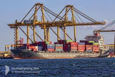
JOSITA B
Cargo A
Current Trip
| Time Travelled | 6 days |
|---|---|
| Remaining Time | --- |
| Distance Travelled | 392.79 nm |
| Remaining Distance | 17.35 nm |
| AVG Speed | 5.4 Noeuds |
| MAX Speed | 15.5 Noeuds |
| AVG Wind | 7.3 knots |
| MAX Wind | 14.5 knots |
| MIN Temp | 14.5°C / 58.1°F |
| MAX Temp | 18.9°C / 66.02°F |
| Tirant d eau | 6.6 m |
| Position reçue | 5 d depuis |
Current Position
| Longitude | 4.00596° |
|---|---|
| Latitude | 39.11132° |
| Etat | Under way using engine |
| Vitesse | 10.1 Noeuds |
| Parcours | 157.7° |
| Zone | Mediterranean Sea - Western Basin |
| Station | T-AIS |
| Position reçue | 5 d depuis |
Info
Information
The current position of JOSITA B is in Mediterranean Sea - Western Basin with coordinates 39.11132° / 4.00596° as reported on 2024-04-15 07:47 by AIS to our vessel tracker app. The vessel's current speed is 10.1 Noeuds and is heading at the port of BEJAIA. The estimated time of arrival as calculated by MyShipTracking vessel tracking app is 2024-04-16 11:00 LT
The vessel JOSITA B (IMO: 9673630, MMSI: 229966000) is a Cargo A It's sailing under the flag of [MT] Malta.
In this page you can find informations about the vessels current position, last detected port calls, and current voyage information. If the vessels is not in coverage by AIS you will find the latest position.
The current position of JOSITA B is detected by our AIS receivers and we are not responsible for the reliability of the data. The last position was recorded while the vessel was in Coverage by the Ais receivers of our vessel tracking app.
The current draught of JOSITA B as reported by AIS is 6.6 meters
Weather
| Temperature | 15.3°C / 59.54°F |
|---|---|
| Wind Speed | 11 knots |
| Direction | 75° ENE |
| Pressure | 1016.4 hPa |
| Humidity | 64.5 % |
| Cloud Coverage | 100 % |
Featured Company
Last Port Calls
| Port | Arrival | Departure | Time In Port |
|---|---|---|---|
| 2024-04-13 21:22 | 2024-04-14 04:47 | 7 h | |
| 2024-04-11 15:11 | 2024-04-12 04:19 | 13 h | |
| 2024-04-06 01:01 | 2024-04-06 12:34 | 11 h | |
| 2024-03-27 09:57 | 2024-03-28 00:34 | 14 h | |
| 2024-03-26 13:09 | 2024-03-27 05:23 | 16 h | |
| 2024-03-24 19:41 | 2024-03-25 15:52 | 20 h | |
| 2024-03-23 10:06 | 2024-03-23 18:40 | 8 h | |
| 2024-03-19 23:26 | 2024-03-20 12:34 | 13 h | |
| 2024-03-18 07:57 | 2024-03-18 18:46 | 10 h | |
| 2024-03-14 04:25 | 2024-03-15 00:00 | 19 h |
Most Visited Ports (Last year)
| Port | Arrivals | |
|---|---|---|
| 24 | ||
| 22 | ||
| 16 | ||
| 13 | ||
| 12 | ||
| 12 |
Last Trips
| Origin | Departure | Destination | Arrival | Distance | |
|---|---|---|---|---|---|
| 2024-04-12 06:19 | 2024-04-13 23:22 | 532.35 nm | |||
| 2024-04-06 14:34 | 2024-04-11 17:11 | 451.61 nm | |||
| 2024-03-28 01:34 | 2024-04-06 03:01 | 1009.99 nm | |||
| 2024-03-27 06:23 | 2024-03-27 10:57 | 53.60 nm | |||
| 2024-03-25 16:52 | 2024-03-26 14:09 | 197.00 nm | |||
| 2024-03-23 19:40 | 2024-03-24 20:41 | 220.26 nm | |||
| 2024-03-20 12:34 | 2024-03-23 11:06 | 857.94 nm | |||
| 2024-03-18 19:46 | 2024-03-19 23:26 | 89.76 nm | |||
| 2024-03-15 01:00 | 2024-03-18 08:57 | 992.31 nm | |||
| 2024-03-13 22:22 | 2024-03-14 05:25 | 53.36 nm |
Events
| Heure | Evenement | Détails | Position/ Destination | Info |
|---|---|---|---|---|
| 2024-04-20 08:27 | Démarrage | 11.73 nm, North East of TARANIMT |
37.00516 / 5.05002
DZ BJA
|
Vitesse: 3.4 kn Parcours: 103° |
| 2024-04-19 19:02 | Arret | 16.47 nm, North East of BEJAIA |
36.96333 / 5.31333
DZ BJA
|
Vitesse: Parcours: -1° |
| 2024-04-17 06:15 | Arret | 16.31 nm, North East of BEJAIA |
37.00026 / 5.23342
DZ BJA
|
Vitesse: 0.3 kn Parcours: 123° |
| 2024-04-17 04:26 | Démarrage | 19.23 nm, North East of TARANIMT |
37.06333 / 5.22167
DZ BJA
|
Vitesse: 4 kn Parcours: -1° |
| 2024-04-16 18:05 | Arret | 14.24 nm, North East of BEJAIA |
36.95167 / 5.25500
DZ BJA
|
Vitesse: Parcours: -1° |
| 2024-04-16 17:48 | Démarrage | 13.9 nm, North East of BEJAIA |
36.94803 / 5.24871
DZ BJA
|
Vitesse: 3.6 kn Parcours: 53° |
| 2024-04-16 12:38 | Arret | 16.4 nm, North East of BEJAIA |
36.95833 / 5.31833
DZ BJA
|
Vitesse: Parcours: -1° |
| 2024-04-16 12:15 | Démarrage | 17.08 nm, North East of BEJAIA |
36.96407 / 5.33181
DZ BJA
|
Vitesse: 3.4 kn Parcours: 283° |
| 2024-04-16 10:35 | Arret | 17.06 nm, North East of BEJAIA |
36.96833 / 5.32500
DZ BJA
|
Vitesse: Parcours: -1° |
| 2024-04-15 07:47 | Hors de la zone couverte |
39.11132 / 4.00596
Mediterranean Sea - Western Basin
DZ BJA
|
Vitesse: 10.1 kn Parcours: 157.7° |