
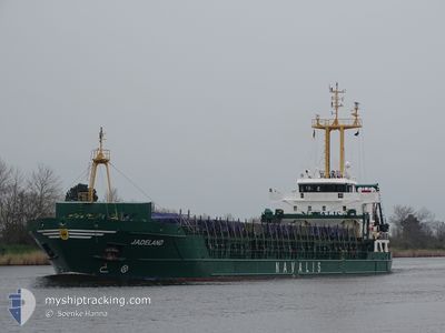
JADELAND
General Cargo
Current Trip
| Time Travelled | 1 day |
|---|---|
| Remaining Time | --- |
| Distance Travelled | 365.95 nm |
| Remaining Distance | --- |
| AVG Speed | 10 Noeuds |
| MAX Speed | 11.1 Noeuds |
| AVG Wind | 5.7 knots |
| MAX Wind | 12.9 knots |
| MIN Temp | 15.8°C / 60.44°F |
| MAX Temp | 18.1°C / 64.58°F |
| Tirant d eau | 3.6 m |
| Position reçue | 1 d depuis |
Current Position
| Longitude | -9.00366° |
|---|---|
| Latitude | 35.27002° |
| Etat | Under way using engine |
| Vitesse | 10.7 Noeuds |
| Parcours | 187.3° |
| Zone | North Atlantic Ocean |
| Station | T-AIS |
| Position reçue | 1 d depuis |
Info
Information
The current position of JADELAND is in North Atlantic Ocean with coordinates 35.27002° / -9.00366° as reported on 2024-04-19 08:47 by AIS to our vessel tracker app. The vessel's current speed is 10.7 Noeuds
The vessel JADELAND (IMO: 9518983, MMSI: 255806468) is a General Cargo that was built in 2011 ( 13 Age ). It's sailing under the flag of [PT] Portugal.
In this page you can find informations about the vessels current position, last detected port calls, and current voyage information. If the vessels is not in coverage by AIS you will find the latest position.
The current position of JADELAND is detected by our AIS receivers and we are not responsible for the reliability of the data. The last position was recorded while the vessel was in Coverage by the Ais receivers of our vessel tracking app.
The current draught of JADELAND as reported by AIS is 3.6 meters
Weather
| Temperature | 16.8°C / 62.24°F |
|---|---|
| Wind Speed | 5 knots |
| Direction | 296° WNW |
| Pressure | 1015.6 hPa |
| Humidity | 71 % |
| Cloud Coverage | 100 % |
Featured Company
Last Port Calls
| Port | Arrival | Departure | Time In Port |
|---|---|---|---|
| 2024-04-13 23:34 | 2024-04-18 14:28 | 4 d | |
| 2024-04-12 23:23 | 2024-04-13 00:03 | 40 m | |
| 2024-04-10 20:33 | 2024-04-10 21:17 | 44 m | |
| 2024-04-09 05:09 | 2024-04-09 12:00 | 6 h | |
| 2024-04-08 08:15 | 2024-04-08 18:50 | 10 h | |
| 2024-04-02 10:25 | 2024-04-04 14:32 | 2 d | |
| 2024-04-01 09:16 | 2024-04-02 00:59 | 15 h | |
| 2024-03-27 09:39 | 2024-03-29 05:02 | 1 d | |
| 2024-03-25 00:31 | 2024-03-25 14:40 | 14 h | |
| 2024-03-21 16:34 | 2024-03-22 21:22 | 1 d |
Most Visited Ports (Last year)
| Port | Arrivals | |
|---|---|---|
| 7 | ||
| 7 | ||
| 6 | ||
| 6 | ||
| 5 | ||
| 4 |
Last Trips
| Origin | Departure | Destination | Arrival | Distance | |
|---|---|---|---|---|---|
| 2024-04-13 02:03 | 2024-04-14 00:34 | 199.48 nm | |||
| 2024-04-10 23:17 | 2024-04-13 01:23 | 1.71 nm | |||
| 2024-04-09 12:00 | 2024-04-10 22:33 | 220.80 nm | |||
| 2024-04-08 18:50 | 2024-04-09 05:09 | 38.84 nm | |||
| 2024-04-04 16:32 | 2024-04-08 08:15 | 261.12 nm | |||
| 2024-04-02 00:59 | 2024-04-02 12:25 | 78.20 nm | |||
| 2024-03-29 06:02 | 2024-04-01 09:16 | 523.13 nm | |||
| 2024-03-25 14:40 | 2024-03-27 10:39 | 425.75 nm | |||
| 2024-03-22 22:22 | 2024-03-25 00:31 | 447.05 nm | |||
| 2024-03-19 19:17 | 2024-03-21 17:34 | 88.72 nm |
Events
| Heure | Evenement | Détails | Position/ Destination | Info |
|---|---|---|---|---|
| 2024-04-20 02:16 | Arret | 2.05 nm, West of SAFI |
32.31004 / -9.29112
MASFI
|
Vitesse: 0.1 kn Parcours: 296° |
| 2024-04-19 09:25 | Etat Changé | Default Under way using engine |
35.15647 / -9.02104
MASFI
|
Vitesse: 10.7 kn Parcours: 187.3° |
| 2024-04-19 08:47 | Hors de la zone couverte |
35.27002 / -9.00366
North Atlantic Ocean
|
Vitesse: 10.7 kn Parcours: 187.3° |
|
| 2024-04-19 08:45 | Etat Changé | Under way using engine Default |
35.27687 / -9.00261
MASFI
|
Vitesse: 10.2 kn Parcours: 186° |
| 2024-04-19 08:45 | Dans la zone couverte |
35.27392 / -9.00307
North Atlantic Ocean
|
Vitesse: 10.6 kn Parcours: 187.5° |
|
| 2024-04-19 06:14 | Hors de la zone couverte |
35.70955 / -8.95167
North Atlantic Ocean
|
Vitesse: 10.3 kn Parcours: 187.4° |
|
| 2024-04-18 22:45 | Etat Changé | Under way using engine Default |
36.73577 / -9.48812
MASFI
|
Vitesse: 9.7 kn Parcours: 139° |
| 2024-04-18 22:41 | Etat Changé | Default Under way using engine |
36.72957 / -9.48126
MASFI
|
Vitesse: 9.9 kn Parcours: 138.3° |
| 2024-04-18 14:28 | PORT DE DEPART |
|
37.93057 / -8.87617
MASFI
|
Vitesse: 10.3 kn Parcours: 191° |
| 2024-04-18 14:17 | Démarrage |
37.94005 / -8.85755
[PT] SINES
|
Vitesse: 3.1 kn Parcours: 314° |