
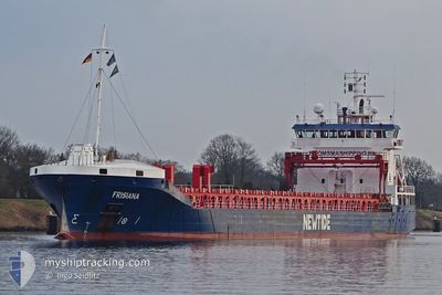
FRISIANA
General Cargo
Current Trip
| Time Travelled | 2 days |
|---|---|
| Remaining Time | --- |
| Distance Travelled | 536.35 nm |
| Remaining Distance | --- |
| AVG Speed | 10.7 Noeuds |
| MAX Speed | 12.3 Noeuds |
| AVG Wind | 11.7 knots |
| MAX Wind | 27.5 knots |
| MIN Temp | 0.2°C / 32.36°F |
| MAX Temp | 6.5°C / 43.7°F |
| Tirant d eau | 7.1 m |
| Position reçue | 12 h, 58 m depuis |
Current Position
| Longitude | 3.74779° |
|---|---|
| Latitude | 58.20790° |
| Etat | Under way using engine |
| Vitesse | 8.3 Noeuds |
| Parcours | 287.6° |
| Zone | North Sea |
| Station | T-AIS |
| Position reçue | 12 h, 58 m depuis |
Info
Information
The current position of FRISIANA is in North Sea with coordinates 58.20790° / 3.74779° as reported on 2024-04-23 07:59 by AIS to our vessel tracker app. The vessel's current speed is 8.3 Noeuds and is heading at the port of BELFAST. The estimated time of arrival as calculated by MyShipTracking vessel tracking app is 2024-04-25 12:00 LT
The vessel FRISIANA (IMO: 9385893, MMSI: 246602000) is a General Cargo that was built in 2010 ( 14 Age ). It's sailing under the flag of [NL] Netherlands.
In this page you can find informations about the vessels current position, last detected port calls, and current voyage information. If the vessels is not in coverage by AIS you will find the latest position.
The current position of FRISIANA is detected by our AIS receivers and we are not responsible for the reliability of the data. The last position was recorded while the vessel was in Coverage by the Ais receivers of our vessel tracking app.
The current draught of FRISIANA as reported by AIS is 7.1 meters
Weather
| Temperature | 5.6°C / 42.08°F |
|---|---|
| Wind Speed | 25 knots |
| Direction | 355° N |
| Pressure | 1019.3 hPa |
| Humidity | 74.2 % |
| Cloud Coverage | 81 % |
Featured Company
Last Port Calls
| Port | Arrival | Departure | Time In Port |
|---|---|---|---|
| 2024-04-16 19:00 | 2024-04-21 06:13 | 4 d | |
| 2024-04-13 00:46 | 2024-04-15 21:42 | 2 d | |
| 2024-04-01 13:44 | 2024-04-03 06:16 | 1 d | |
| 2024-03-25 07:46 | 2024-03-27 13:51 | 2 d | |
| 2024-03-15 08:16 | 2024-03-16 19:13 | 1 d | |
| 2024-03-10 07:19 | 2024-03-11 17:45 | 1 d | |
| 2024-03-06 23:00 | 2024-03-08 14:14 | 1 d | |
| 2024-03-03 03:27 | 2024-03-03 23:14 | 19 h | |
| 2024-02-26 05:40 | 2024-02-29 17:05 | 3 d | |
| 2024-02-23 02:24 | 2024-02-24 14:44 | 1 d |
Last Trips
| Origin | Departure | Destination | Arrival | Distance | |
|---|---|---|---|---|---|
| 2024-04-15 23:42 | 2024-04-16 21:00 | 95.53 nm | |||
| 2024-04-03 08:16 | 2024-04-13 02:46 | 993.90 nm | |||
| 2024-03-27 13:51 | 2024-04-01 15:44 | 675.53 nm | |||
| 2024-03-16 20:13 | 2024-03-25 07:46 | 918.78 nm | |||
| 2024-03-11 19:45 | 2024-03-15 09:16 | 460.48 nm | |||
| 2024-03-08 15:14 | 2024-03-10 09:19 | 474.25 nm | |||
| 2024-03-04 00:14 | 2024-03-07 00:00 | 684.21 nm | |||
| 2024-02-29 17:05 | 2024-03-03 04:27 | 417.70 nm | |||
| 2024-02-24 15:44 | 2024-02-26 05:40 | 381.40 nm | |||
| 2024-02-23 03:09 | 2024-02-23 03:24 | 0.63 nm |
Events
| Heure | Evenement | Détails | Position/ Destination | Info |
|---|---|---|---|---|
| 2024-04-23 07:59 | Hors de la zone couverte |
58.20790 / 3.74779
North Sea
BELFAST
|
Vitesse: 8.3 kn Parcours: 287.6° |
|
| 2024-04-22 20:56 | Changement de zone | Norwegian part of the North Sea Norwegian part of the Skaggerak |
57.77877 / 7.39022
North Sea
BELFAST
|
Vitesse: 11.6 kn Parcours: 272° |
| 2024-04-22 15:56 | Detecté en mer | Norwegian part of the Skaggerak |
57.84866 / 9.14587
Skaggerak
BELFAST
|
Vitesse: 11.1 kn Parcours: 263° |
| 2024-04-22 10:47 | Detecté en mer | Danish part of the Skaggerak |
57.89873 / 10.91190
Skaggerak
BELFAST
|
Vitesse: 11.7 kn Parcours: 294.4° |
| 2024-04-22 10:08 | Changement de zone | Swedish part of the Skaggerak Swedish part of the Kattegat |
57.84522 / 11.12936
Skaggerak
BELFAST
|
Vitesse: 11.7 kn Parcours: 309.9° |
| 2024-04-22 09:18 | Tirant d'eau modifié | 7.1 7.2 |
57.72507 / 11.34670
BELFAST
|
Vitesse: 12.3 kn Parcours: 315.1° |
| 2024-04-22 08:00 | Démarrage | 3.15 nm, West of VRANGO |
57.57384 / 11.68006
BELFAST
|
Vitesse: 4.9 kn Parcours: 268° |
| 2024-04-22 07:54 | Etat Changé | Under way using engine At anchor |
57.57335 / 11.68203
BELFAST
|
Vitesse: 0.6 kn Parcours: 118° |
| 2024-04-22 07:01 | Changement d'ETA | 2024/04/25 12:00 2024/04/25 09:00 |
57.57329 / 11.68195
BELFAST
|
Vitesse: 0.1 kn Parcours: 74° |
| 2024-04-22 02:02 | Etat Changé | At anchor Under way using engine |
57.57585 / 11.68446
BELFAST
|
Vitesse: 0.6 kn Parcours: 161° |