
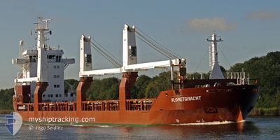
FLORETGRACHT
General Cargo
Current Trip
| Time Travelled | 1 day |
|---|---|
| Remaining Time | --- |
| Distance Travelled | 288.82 nm |
| Remaining Distance | --- |
| AVG Speed | 10.4 Noeuds |
| MAX Speed | 16 Noeuds |
| AVG Wind | 5.8 knots |
| MAX Wind | 13.7 knots |
| MIN Temp | 7.5°C / 45.5°F |
| MAX Temp | 15.4°C / 59.72°F |
| Tirant d eau | 7.9 m |
| Position reçue | 7 h, 16 m depuis |
Current Position
| Longitude | -73.24639° |
|---|---|
| Latitude | 39.14394° |
| Etat | Under way using engine |
| Vitesse | 12.9 Noeuds |
| Parcours | 68.5° |
| Zone | North Atlantic Ocean |
| Station | T-AIS |
| Position reçue | 7 h, 16 m depuis |
Info
Information
The current position of FLORETGRACHT is in North Atlantic Ocean with coordinates 39.14394° / -73.24639° as reported on 2024-04-20 04:57 by AIS to our vessel tracker app. The vessel's current speed is 12.9 Noeuds and is heading at the port of KRISTIANSAND. The estimated time of arrival as calculated by MyShipTracking vessel tracking app is 2024-04-30 06:00 LT
The vessel FLORETGRACHT (IMO: 9507611, MMSI: 246614000) is a General Cargo that was built in 2012 ( 12 Age ). It's sailing under the flag of [NL] Netherlands.
In this page you can find informations about the vessels current position, last detected port calls, and current voyage information. If the vessels is not in coverage by AIS you will find the latest position.
The current position of FLORETGRACHT is detected by our AIS receivers and we are not responsible for the reliability of the data. The last position was recorded while the vessel was in Coverage by the Ais receivers of our vessel tracking app.
The current draught of FLORETGRACHT as reported by AIS is 7.9 meters
Weather
| Temperature | 8.9°C / 48.02°F |
|---|---|
| Wind Speed | 1 knots |
| Direction | 294° WNW |
| Pressure | 1015 hPa |
| Humidity | 98.9 % |
| Cloud Coverage | 100 % |
Featured Company
Last Port Calls
| Port | Arrival | Departure | Time In Port |
|---|---|---|---|
| 2024-04-17 22:54 | 2024-04-19 11:40 | 1 d | |
| 2024-04-17 19:33 | 2024-04-17 19:49 | 15 m | |
| 2024-04-11 21:23 | 2024-04-13 13:26 | 1 d | |
| 2024-03-30 23:15 | 2024-03-31 14:33 | 15 h | |
| 2024-03-23 10:10 | 2024-03-23 21:39 | 11 h | |
| 2024-03-09 22:55 | 2024-03-13 15:28 | 3 d | |
| 2024-02-23 01:28 | 2024-02-23 02:33 | 1 h | |
| 2024-02-13 18:20 | 2024-02-22 07:42 | 8 d |
Most Visited Ports (Last year)
| Port | Arrivals | |
|---|---|---|
| 3 | ||
| 3 | ||
| 1 | ||
| 1 | ||
| 1 | ||
| 1 |
Last Trips
| Origin | Departure | Destination | Arrival | Distance | |
|---|---|---|---|---|---|
| 2024-04-17 15:49 | 2024-04-17 18:54 | 22.91 nm | |||
| 2024-04-13 09:26 | 2024-04-17 15:33 | 381.59 nm | |||
| 2024-03-31 15:33 | 2024-04-11 17:23 | 3408.32 nm | |||
| 2024-03-23 21:39 | 2024-03-30 23:15 | 2191.72 nm | |||
| 2024-03-13 12:28 | 2024-03-23 10:10 | 2925.56 nm | |||
| 2024-02-23 03:33 | 2024-03-09 19:55 | 4555.78 nm | |||
| 2024-02-22 08:42 | 2024-02-23 02:28 | 225.68 nm | |||
| 2023-12-25 09:44 | 2024-02-13 19:20 | 5620.35 nm |
Events
| Heure | Evenement | Détails | Position/ Destination | Info |
|---|---|---|---|---|
| 2024-04-20 04:59 | Etat Changé | Default Under way using engine |
39.14667 / -73.23500
NOKRS
|
Vitesse: 12.9 kn Parcours: 68.5° |
| 2024-04-20 04:57 | Hors de la zone couverte |
39.14394 / -73.24639
North Atlantic Ocean
NOKRS
|
Vitesse: 12.9 kn Parcours: 68.5° |
|
| 2024-04-20 04:41 | Etat Changé | Under way using engine Default |
39.12325 / -73.31511
NOKRS
|
Vitesse: 12 kn Parcours: 69° |
| 2024-04-20 04:32 | Etat Changé | Default Under way using engine |
39.11167 / -73.35333
NOKRS
|
Vitesse: 13.1 kn Parcours: 71° |
| 2024-04-20 03:08 | Etat Changé | Under way using engine Default |
39.00421 / -73.72274
NOKRS
|
Vitesse: 13 kn Parcours: 69° |
| 2024-04-20 03:08 | Dans la zone couverte |
39.00421 / -73.72274
North Atlantic Ocean
NOKRS
|
Vitesse: 13.2 kn Parcours: 69.3° |
|
| 2024-04-19 23:58 | Etat Changé | Default Under way using engine |
38.76421 / -74.55928
NOKRS
|
Vitesse: 11.8 kn Parcours: 87° |
| 2024-04-19 23:52 | Hors de la zone couverte |
38.76049 / -74.58389
North Atlantic Ocean
NOKRS
|
Vitesse: 11.8 kn Parcours: 87° |
|
| 2024-04-19 23:51 | Etat Changé | Under way using engine Default |
38.76031 / -74.58959
NOKRS
|
Vitesse: 11.8 kn Parcours: 88° |
| 2024-04-19 23:34 | Etat Changé | Default Under way using engine |
38.75906 / -74.64738
NOKRS
|
Vitesse: 9 kn Parcours: 92.6° |