
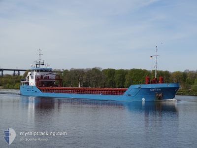
FAST SIM
General Cargo
Current Trip
| Time Travelled | 2 h, 56 mins |
|---|---|
| Remaining Time | 6 h, 36 mins |
| Distance Travelled | 21.79 nm |
| Remaining Distance | 56.01 nm |
| AVG Speed | 9.4 Noeuds |
| MAX Speed | 11.2 Noeuds |
| AVG Wind | 5.6 knots |
| MAX Wind | 7.6 knots |
| MIN Temp | 6.6°C / 43.88°F |
| MAX Temp | 8.2°C / 46.76°F |
| Tirant d eau | 3.2 m |
| Position reçue | 3 m depuis |
Current Position
| Longitude | -5.64652° |
|---|---|
| Latitude | 54.09796° |
| Etat | Under way using engine |
| Vitesse | 7.8 Noeuds |
| Parcours | 67.2° |
| Zone | Irish Sea and St. George's Channel |
| Station | T-AIS |
| Position reçue | 3 m depuis |
Info
Information
The current position of FAST SIM is in Irish Sea and St. George's Channel with coordinates 54.09796° / -5.64652° as reported on 2024-04-25 20:58 by AIS to our vessel tracker app. The vessel's current speed is 7.8 Noeuds and is heading at the port of BELFAST. The estimated time of arrival as calculated by MyShipTracking vessel tracking app is 2024-04-26 03:38 LT
The vessel FAST SIM (IMO: 9356517, MMSI: 205011000) is a General Cargo that was built in 2008 ( 16 Age ). It's sailing under the flag of [BE] Belgium.
In this page you can find informations about the vessels current position, last detected port calls, and current voyage information. If the vessels is not in coverage by AIS you will find the latest position.
The current position of FAST SIM is detected by our AIS receivers and we are not responsible for the reliability of the data. The last position was recorded while the vessel was in Coverage by the Ais receivers of our vessel tracking app.
The current draught of FAST SIM as reported by AIS is 3.2 meters
Weather
| Temperature | 8.2°C / 46.76°F |
|---|---|
| Wind Speed | 7 knots |
| Direction | 45° NE |
| Pressure | 1003.7 hPa |
| Humidity | 60 % |
| Cloud Coverage | 100 % |
Featured Company
Last Port Calls
| Port | Arrival | Departure | Time In Port |
|---|---|---|---|
| 2024-04-23 21:30 | 2024-04-25 18:06 | 1 d | |
| 2024-04-18 09:39 | 2024-04-20 17:30 | 2 d | |
| 2024-04-16 03:45 | |||
| 2024-04-12 12:47 | 2024-04-12 13:58 | 1 h | |
| 2024-04-06 06:51 | 2024-04-06 08:51 | 2 h | |
| 2024-04-01 14:08 | 2024-04-02 17:54 | 1 d | |
| 2024-03-26 18:46 | 2024-03-28 21:09 | 2 d | |
| 2024-03-22 18:59 | 2024-03-24 15:21 | 1 d | |
| 2024-03-20 07:47 | 2024-03-21 21:28 | 1 d | |
| 2024-03-12 23:30 | 2024-03-16 13:50 | 3 d |
Last Trips
| Origin | Departure | Destination | Arrival | Distance | |
|---|---|---|---|---|---|
| 2024-04-20 19:30 | 2024-04-23 22:30 | 700.34 nm | |||
| 2024-04-12 15:58 | 2024-04-18 11:39 | 794.36 nm | |||
| 2024-04-12 15:58 | 2024-04-16 05:45 | 790.31 nm | |||
| 2024-04-06 10:51 | 2024-04-12 14:47 | 77.52 nm | |||
| 2024-04-02 19:54 | 2024-04-06 08:51 | 779.38 nm | |||
| 2024-03-28 22:09 | 2024-04-01 16:08 | 505.48 nm | |||
| 2024-03-24 16:21 | 2024-03-26 19:46 | 356.50 nm | |||
| 2024-03-21 21:28 | 2024-03-22 19:59 | 220.03 nm | |||
| 2024-03-16 14:50 | 2024-03-20 07:47 | 703.02 nm | |||
| 2024-03-05 16:48 | 2024-03-13 00:30 | 1372.55 nm |
Events
| Heure | Evenement | Détails | Position/ Destination | Info |
|---|---|---|---|---|
| 2024-04-25 20:55 | Etat Changé | Under way using engine Default |
54.09546 / -5.65683
BELFAST
|
Vitesse: 7.8 kn Parcours: 68° |
| 2024-04-25 20:50 | Etat Changé | Default Under way using engine |
54.09179 / -5.67166
BELFAST
|
Vitesse: 7.8 kn Parcours: 67.4° |
| 2024-04-25 19:55 | Etat Changé | Under way using engine Default |
54.04509 / -5.85622
BELFAST
|
Vitesse: 7.6 kn Parcours: 66° |
| 2024-04-25 19:54 | Etat Changé | Default Under way using engine |
54.04366 / -5.86174
BELFAST
|
Vitesse: 7.7 kn Parcours: 66.1° |
| 2024-04-25 19:20 | Changement d'ETA | 2024/04/26 04:00 2024/04/26 05:00 |
54.01563 / -5.97518
BELFAST
|
Vitesse: 7.6 kn Parcours: 71.4° |
| 2024-04-25 18:44 | Changement de zone | United Kingdom part of the Irish Sea and St. George's Channel Irish part of the Irish Sea and St. George's Channel |
54.02790 / -6.10433
Irish Sea and St. George's Channel
BELFAST
|
Vitesse: 11 kn Parcours: 106.3° |
| 2024-04-25 18:38 | Changement de zone | Irish part of the Irish Sea and St. George's Channel United Kingdom part of the Irish Sea and St. George's Channel |
54.03575 / -6.12878
Irish Sea and St. George's Channel
BELFAST
|
Vitesse: 10.1 kn Parcours: 130.1° |
| 2024-04-25 18:37 | Tirant d'eau modifié | 3.2 5.5 |
54.03668 / -6.13060
BELFAST
|
Vitesse: 10 kn Parcours: 133.5° |
| 2024-04-25 18:37 | Changement de destination | BELFAST WARRENPOINT |
54.03668 / -6.13060
BELFAST
|
Vitesse: 10 kn Parcours: 133.5° |
| 2024-04-25 18:37 | Changement d'ETA | 2024/04/26 05:00 2024/04/23 20:20 |
54.03668 / -6.13060
BELFAST
|
Vitesse: 10 kn Parcours: 133.5° |