
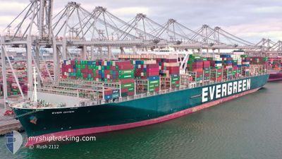
EVER GIVEN
Cargo A
Current Trip
NLRTM>>LKCMB
| Time Travelled | 9 days |
|---|---|
| Remaining Time | --- |
| Distance Travelled | 3680.71 nm |
| Remaining Distance | --- |
| AVG Speed | 18.6 Noeuds |
| MAX Speed | 21.6 Noeuds |
| AVG Wind | 17.2 knots |
| MAX Wind | 36.4 knots |
| MIN Temp | 8.2°C / 46.76°F |
| MAX Temp | 29.1°C / 84.38°F |
| Tirant d eau | 14.6 m |
| Position reçue | 3 d depuis |
Current Position
| Longitude | -17.05929° |
|---|---|
| Latitude | 10.25335° |
| Etat | Under way using engine |
| Vitesse | 20.5 Noeuds |
| Parcours | 144.3° |
| Zone | North Atlantic Ocean |
| Station | T-AIS |
| Position reçue | 3 d depuis |
Info
Information
The current position of EVER GIVEN is in North Atlantic Ocean with coordinates 10.25335° / -17.05929° as reported on 2024-04-21 12:23 by AIS to our vessel tracker app. The vessel's current speed is 20.5 Noeuds
The vessel EVER GIVEN (IMO: 9811000, MMSI: 353136000) is a Cargo A It's sailing under the flag of [PA] Panama.
In this page you can find informations about the vessels current position, last detected port calls, and current voyage information. If the vessels is not in coverage by AIS you will find the latest position.
The current position of EVER GIVEN is detected by our AIS receivers and we are not responsible for the reliability of the data. The last position was recorded while the vessel was in Coverage by the Ais receivers of our vessel tracking app.
The current draught of EVER GIVEN as reported by AIS is 14.6 meters
Weather
| Temperature | 28°C / 82.4°F |
|---|---|
| Wind Speed | 2 knots |
| Direction | 172° S |
| Pressure | 1009 hPa |
| Humidity | 75.7 % |
| Cloud Coverage | 72 % |
Featured Company
Last Port Calls
| Port | Arrival | Departure | Time In Port |
|---|---|---|---|
| 2024-04-12 22:20 | 2024-04-15 09:16 | 2 d | |
| 2024-04-06 00:34 | 2024-04-09 06:24 | 3 d | |
| 2024-03-28 15:45 | 2024-03-31 08:24 | 2 d | |
| 2024-02-26 07:10 | 2024-02-27 16:23 | 1 d | |
| 2024-02-20 06:35 | 2024-02-21 01:15 | 18 h | |
| 2024-02-18 07:15 | 2024-02-18 23:13 | 15 h | |
| 2024-02-14 21:11 | 2024-02-16 01:13 | 1 d | |
| 2024-02-08 12:10 | 2024-02-10 12:26 | 2 d | |
| 2024-02-03 23:44 | 2024-02-04 20:08 | 20 h |
Most Visited Ports (Last year)
| Port | Arrivals | |
|---|---|---|
| 8 | ||
| 4 | ||
| 4 | ||
| 4 | ||
| 3 | ||
| 3 |
Last Trips
| Origin | Departure | Destination | Arrival | Distance | |
|---|---|---|---|---|---|
| 2024-04-09 08:24 | 2024-04-13 00:20 | 355.01 nm | |||
| 2024-03-31 10:24 | 2024-04-06 02:34 | 533.17 nm | |||
| 2024-02-28 00:23 | 2024-03-28 16:45 | 11892.58 nm | |||
| 2024-02-21 09:15 | 2024-02-26 15:10 | 1485.16 nm | |||
| 2024-02-19 07:13 | 2024-02-20 14:35 | 455.61 nm | |||
| 2024-02-16 09:13 | 2024-02-18 15:15 | 473.36 nm | |||
| 2024-02-10 20:26 | 2024-02-15 05:11 | 689.07 nm | |||
| 2024-02-05 04:08 | 2024-02-08 20:10 | 949.74 nm | |||
| 2024-01-31 16:37 | 2024-02-04 07:44 | 1651.01 nm |
Events
| Heure | Evenement | Détails | Position/ Destination | Info |
|---|---|---|---|---|
| 2024-04-21 12:30 | Etat Changé | Default Under way using engine |
10.21724 / -17.03256
NLRTM>>LKCMB
|
Vitesse: 20.5 kn Parcours: 144.3° |
| 2024-04-21 12:23 | Etat Changé | Under way using engine Default |
10.25335 / -17.05929
NLRTM>>LKCMB
|
Vitesse: 20.4 kn Parcours: 143° |
| 2024-04-21 12:23 | Hors de la zone couverte |
10.25335 / -17.05929
North Atlantic Ocean
|
Vitesse: 20.5 kn Parcours: 144.3° |
|
| 2024-04-21 12:04 | Etat Changé | Default Under way using engine |
10.33726 / -17.12017
NLRTM>>LKCMB
|
Vitesse: 20.1 kn Parcours: 145.1° |
| 2024-04-21 12:01 | Etat Changé | Under way using engine Default |
10.35290 / -17.13124
NLRTM>>LKCMB
|
Vitesse: 20.1 kn Parcours: 146° |
| 2024-04-21 11:38 | Etat Changé | Default Under way using engine |
10.45917 / -17.20461
NLRTM>>LKCMB
|
Vitesse: 20.2 kn Parcours: 145.3° |
| 2024-04-21 11:28 | Etat Changé | Under way using engine Default |
10.50782 / -17.23869
NLRTM>>LKCMB
|
Vitesse: 20.1 kn Parcours: 146° |
| 2024-04-21 11:09 | Dans la zone couverte |
10.50782 / -17.23869
North Atlantic Ocean
|
Vitesse: 20.1 kn Parcours: 145.4° |
|
| 2024-04-21 09:02 | Etat Changé | Default Under way using engine |
11.17233 / -17.70118
NLRTM>>LKCMB
|
Vitesse: 20.4 kn Parcours: 146.5° |
| 2024-04-21 08:57 | Hors de la zone couverte |
11.19646 / -17.71754
North Atlantic Ocean
|
Vitesse: 20.4 kn Parcours: 146.5° |