
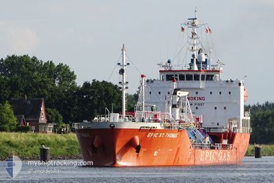
EPIC ST.THOMAS
Tanker
Current Trip
| Time Travelled | 1 day |
|---|---|
| Remaining Time | 5 h, 36 mins |
| Distance Travelled | 575.90 nm |
| Remaining Distance | 83.00 nm |
| AVG Speed | 12.7 Noeuds |
| MAX Speed | 14.5 Noeuds |
| AVG Wind | 15.9 knots |
| MAX Wind | 26 knots |
| MIN Temp | 4.9°C / 40.82°F |
| MAX Temp | 7.4°C / 45.32°F |
| Tirant d eau | 5.7 m |
| Position reçue | 1 m depuis |
Current Position
| Longitude | 2.59666° |
|---|---|
| Latitude | 51.83706° |
| Etat | Under way using engine |
| Vitesse | 13.4 Noeuds |
| Parcours | 165.2° |
| Zone | North Sea |
| Station | T-AIS |
| Position reçue | 1 m depuis |
Info
Information
The current position of EPIC ST.THOMAS is in North Sea with coordinates 51.83706° / 2.59666° as reported on 2024-04-24 08:35 by AIS to our vessel tracker app. The vessel's current speed is 13.4 Noeuds and is heading at the port of ANTWERP. The estimated time of arrival as calculated by MyShipTracking vessel tracking app is 2024-04-24 14:12 LT
The vessel EPIC ST.THOMAS (IMO: 9697492, MMSI: 563716000) is a Tanker It's sailing under the flag of [SG] Singapore.
In this page you can find informations about the vessels current position, last detected port calls, and current voyage information. If the vessels is not in coverage by AIS you will find the latest position.
The current position of EPIC ST.THOMAS is detected by our AIS receivers and we are not responsible for the reliability of the data. The last position was recorded while the vessel was in Coverage by the Ais receivers of our vessel tracking app.
The current draught of EPIC ST.THOMAS as reported by AIS is 5.7 meters
Weather
| Temperature | 7.4°C / 45.32°F |
|---|---|
| Wind Speed | 22 knots |
| Direction | 343° NNW |
| Pressure | 1014 hPa |
| Humidity | 64.2 % |
| Cloud Coverage | 100 % |
Featured Company
Last Port Calls
| Port | Arrival | Departure | Time In Port |
|---|---|---|---|
| 2024-04-20 21:38 | 2024-04-22 10:33 | 1 d | |
| 2024-04-15 05:11 | 2024-04-16 14:04 | 1 d | |
| 2024-04-09 15:12 | 2024-04-10 05:43 | 14 h | |
| 2024-04-05 05:38 | 2024-04-06 19:18 | 1 d | |
| 2024-03-30 22:13 | 2024-04-01 05:59 | 1 d | |
| 2024-03-26 00:51 | 2024-03-27 12:58 | 1 d | |
| 2024-03-15 13:19 | 2024-03-16 20:32 | 1 d | |
| 2024-03-12 14:31 | 2024-03-13 01:10 | 10 h | |
| 2024-02-01 17:04 | 2024-03-02 06:41 | 29 d |
Last Trips
| Origin | Departure | Destination | Arrival | Distance | |
|---|---|---|---|---|---|
| 2024-04-16 15:04 | 2024-04-20 23:38 | 684.88 nm | |||
| 2024-04-10 07:43 | 2024-04-15 06:11 | 574.36 nm | |||
| 2024-04-06 21:18 | 2024-04-09 17:12 | 544.84 nm | |||
| 2024-04-01 07:59 | 2024-04-05 07:38 | 653.83 nm | |||
| 2024-03-27 13:58 | 2024-03-30 23:13 | 648.88 nm | |||
| 2024-03-16 21:32 | 2024-03-26 01:51 | 1897.22 nm | |||
| 2024-03-13 01:10 | 2024-03-15 14:19 | 735.45 nm | |||
| 2024-03-02 06:41 | 2024-03-12 14:31 | 358.74 nm | |||
| 2024-01-26 13:40 | 2024-02-01 17:04 | 88.32 nm |
Events
| Heure | Evenement | Détails | Position/ Destination | Info |
|---|---|---|---|---|
| 2024-04-24 08:17 | Changement d'ETA | 2024/04/24 11:30 2024/04/24 02:30 |
51.90727 / 2.59862
BE ANR
|
Vitesse: 14.4 kn Parcours: 187.9° |
| 2024-04-24 08:07 | Changement de zone | Dutch part of the North Sea United Kingdom part of the North Sea |
51.94491 / 2.60184
North Sea
|
Vitesse: 14.1 kn Parcours: 176.7° |
| 2024-04-24 07:47 | Etat Changé | Under way using engine Default |
52.02356 / 2.61125
BE ANR
|
Vitesse: 14.1 kn Parcours: 181° |
| 2024-04-24 07:39 | Dans la zone couverte |
52.01449 / 2.60954
North Sea
|
Vitesse: 14.2 kn Parcours: 186.1° |
|
| 2024-04-24 06:39 | Etat Changé | Default Under way using engine |
52.28667 / 2.62667
BE ANR
|
Vitesse: 13.2 kn Parcours: 179.8° |
| 2024-04-24 06:35 | Changement de zone | United Kingdom part of the North Sea Danish part of the North Sea |
52.30273 / 2.62860
North Sea
BE ANR
|
Vitesse: 13.2 kn Parcours: 179.8° |
| 2024-04-24 06:35 | Etat Changé | Under way using engine Default |
52.30273 / 2.62860
BE ANR
|
Vitesse: 13.3 kn Parcours: 181° |
| 2024-04-24 06:35 | Hors de la zone couverte |
52.30273 / 2.62860
North Sea
|
Vitesse: 13.2 kn Parcours: 179.8° |
|
| 2024-04-24 06:32 | Dans la zone couverte |
52.30273 / 2.62860
North Sea
BE ANR
|
Vitesse: 13.2 kn Parcours: 179.8° |
|
| 2024-04-23 11:53 | Hors de la zone couverte |
56.04452 / 3.85771
North Sea
BE ANR
|
Vitesse: 13.2 kn Parcours: 191° |