
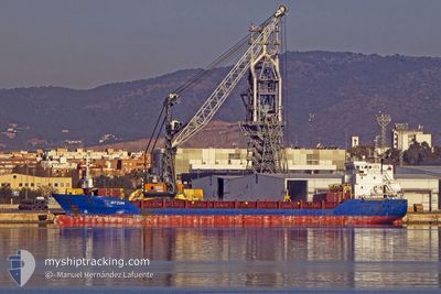
DITZUM
General Cargo
Current Trip
| Time Travelled | 4 days |
|---|---|
| Remaining Time | 6 days |
| Distance Travelled | 853.54 nm |
| Remaining Distance | 1118.63 nm |
| AVG Speed | 9.2 Noeuds |
| MAX Speed | 10.9 Noeuds |
| AVG Wind | 15.7 knots |
| MAX Wind | 28.8 knots |
| MIN Temp | 13.4°C / 56.12°F |
| MAX Temp | 20°C / 68°F |
| Tirant d eau | 6.1 m |
| Position reçue | 11 h, 34 m depuis |
Current Position
| Longitude | 12.42103° |
|---|---|
| Latitude | 37.46531° |
| Etat | Under way using engine |
| Vitesse | 4.9 Noeuds |
| Parcours | 305° |
| Zone | Mediterranean Sea - Eastern Basin |
| Station | T-AIS |
| Position reçue | 11 h, 34 m depuis |
Info
Information
The current position of DITZUM is in Mediterranean Sea - Eastern Basin with coordinates 37.46531° / 12.42103° as reported on 2024-04-19 15:43 by AIS to our vessel tracker app. The vessel's current speed is 4.9 Noeuds and is heading at the port of CASABLANCA. The estimated time of arrival as calculated by MyShipTracking vessel tracking app is 2024-04-26 17:31 LT
The vessel DITZUM (IMO: 9323651, MMSI: 236297000) is a General Cargo that was built in 2005 ( 19 Age ). It's sailing under the flag of [GI] Gibraltar.
In this page you can find informations about the vessels current position, last detected port calls, and current voyage information. If the vessels is not in coverage by AIS you will find the latest position.
The current position of DITZUM is detected by our AIS receivers and we are not responsible for the reliability of the data. The last position was recorded while the vessel was in Coverage by the Ais receivers of our vessel tracking app.
The current draught of DITZUM as reported by AIS is 6.1 meters
Weather
| Temperature | 15.1°C / 59.18°F |
|---|---|
| Wind Speed | 16 knots |
| Direction | 274° W |
| Pressure | 1016.7 hPa |
| Humidity | 71.1 % |
| Cloud Coverage | --- |
Featured Company
Last Port Calls
| Port | Arrival | Departure | Time In Port |
|---|---|---|---|
| 2024-04-09 06:28 | 2024-04-15 15:23 | 6 d | |
| 2024-03-31 06:22 | 2024-04-02 17:06 | 2 d | |
| 2024-03-25 06:14 | 2024-03-25 20:30 | 14 h | |
| 2024-02-27 15:57 | 2024-02-29 04:52 | 1 d | |
| 2024-02-14 19:11 | 2024-02-21 21:59 | 7 d | |
| 2024-02-11 13:27 | 2024-02-13 23:22 | 2 d | |
| 2024-02-08 04:56 | 2024-02-08 04:59 | 3 m | |
| 2024-02-01 22:20 |
Most Visited Ports (Last year)
| Port | Arrivals | |
|---|---|---|
| 4 | ||
| 3 | ||
| 3 | ||
| 2 | ||
| 2 | ||
| 2 |
Last Trips
| Origin | Departure | Destination | Arrival | Distance | |
|---|---|---|---|---|---|
| 2024-04-02 19:06 | 2024-04-09 08:28 | 10.23 nm | |||
| 2024-03-25 22:30 | 2024-03-31 08:22 | 1216.86 nm | |||
| 2024-02-29 04:52 | 2024-03-25 08:14 | 3672.35 nm | |||
| 2024-02-21 22:59 | 2024-02-27 15:57 | 1250.36 nm | |||
| 2024-02-14 01:22 | 2024-02-14 20:11 | 155.52 nm | |||
| 2024-02-08 05:59 | 2024-02-11 15:27 | 676.84 nm | |||
| 2024-02-01 23:20 | 2024-02-08 05:56 | 1084.97 nm |
Events
| Heure | Evenement | Détails | Position/ Destination | Info |
|---|---|---|---|---|
| 2024-04-19 15:44 | Etat Changé | Default Under way using engine |
37.46601 / 12.41788
MACAS
|
Vitesse: 4.9 kn Parcours: 305° |
| 2024-04-19 15:43 | Hors de la zone couverte |
37.46531 / 12.42103
Mediterranean Sea - Eastern Basin
MACAS
|
Vitesse: 4.9 kn Parcours: 286.8° |
|
| 2024-04-19 15:14 | Dans la zone couverte |
37.45381 / 12.46587
Mediterranean Sea - Eastern Basin
MACAS
|
Vitesse: 5.3 kn Parcours: 295° |
|
| 2024-04-19 01:25 | Hors de la zone couverte |
36.96005 / 13.81511
Mediterranean Sea - Eastern Basin
MACAS
|
Vitesse: 7 kn Parcours: 299.6° |
|
| 2024-04-18 17:12 | Dans la zone couverte |
36.59112 / 14.94118
Mediterranean Sea - Eastern Basin
MACAS
|
Vitesse: 7.6 kn Parcours: 284.4° |
|
| 2024-04-18 15:54 | Hors de la zone couverte |
36.60692 / 15.15940
Mediterranean Sea - Eastern Basin
MACAS
|
Vitesse: 7.9 kn Parcours: 243.9° |
|
| 2024-04-18 15:44 | Detecté en mer | Italian part of the Mediterranean Sea - Eastern Basin |
36.61687 / 15.18466
Mediterranean Sea - Eastern Basin
MACAS
|
Vitesse: 8.6 kn Parcours: 244° |
| 2024-04-18 12:09 | Dans la zone couverte |
36.98544 / 15.60728
Ionian Sea
MACAS
|
Vitesse: 9.2 kn Parcours: 218.6° |
|
| 2024-04-18 09:23 | Hors de la zone couverte |
37.33745 / 15.95966
Ionian Sea
MACAS
|
Vitesse: 9.5 kn Parcours: 220° |
|
| 2024-04-18 09:18 | Dans la zone couverte |
37.34655 / 15.96922
Ionian Sea
MACAS
|
Vitesse: 9.5 kn Parcours: 220.8° |