
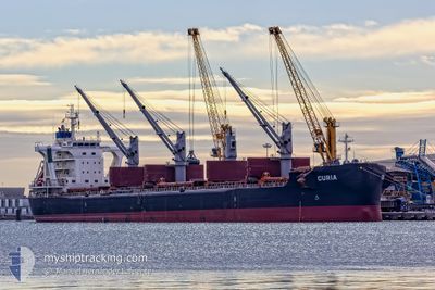
CURIA
Cargo
Current Trip
| Time Travelled | 7 days |
|---|---|
| Remaining Time | --- |
| Distance Travelled | 1881.67 nm |
| Remaining Distance | --- |
| AVG Speed | 10.6 Noeuds |
| MAX Speed | 14.7 Noeuds |
| AVG Wind | 8.2 knots |
| MAX Wind | 25 knots |
| MIN Temp | 12.8°C / 55.04°F |
| MAX Temp | 21°C / 69.8°F |
| Tirant d eau | 10.3 m |
| Position reçue | 1 m depuis |
Current Position
| Longitude | -11.35632° |
|---|---|
| Latitude | 36.00001° |
| Etat | Under way using engine |
| Vitesse | 12.5 Noeuds |
| Parcours | 289.7° |
| Zone | North Atlantic Ocean |
| Station | T-AIS |
| Position reçue | 1 m depuis |
Info
Information
The current position of CURIA is in North Atlantic Ocean with coordinates 36.00001° / -11.35632° as reported on 2024-04-24 13:26 by AIS to our vessel tracker app. The vessel's current speed is 12.5 Noeuds and is heading at the port of NORFOLK. The estimated time of arrival as calculated by MyShipTracking vessel tracking app is 2024-05-04 10:00 LT
The vessel CURIA (IMO: 9710048, MMSI: 269056000) is a Cargo It's sailing under the flag of [CH] Switzerland.
In this page you can find informations about the vessels current position, last detected port calls, and current voyage information. If the vessels is not in coverage by AIS you will find the latest position.
The current position of CURIA is detected by our AIS receivers and we are not responsible for the reliability of the data. The last position was recorded while the vessel was in Coverage by the Ais receivers of our vessel tracking app.
The current draught of CURIA as reported by AIS is 10.3 meters
Weather
| Temperature | 17°C / 62.6°F |
|---|---|
| Wind Speed | 14 knots |
| Direction | 15° NNE |
| Pressure | 1019.5 hPa |
| Humidity | 79.9 % |
| Cloud Coverage | 100 % |
Featured Company
Last Port Calls
| Port | Arrival | Departure | Time In Port |
|---|---|---|---|
| 2024-04-09 06:18 | 2024-04-16 14:15 | 7 d | |
| 2024-03-24 06:49 | 2024-04-06 02:03 | 12 d | |
| 2024-03-21 00:26 | 2024-03-21 02:14 | 1 h | |
| 2024-02-23 08:21 | 2024-02-24 12:57 | 1 d |
Most Visited Ports (Last year)
| Port | Arrivals | |
|---|---|---|
| 2 | ||
| 2 | ||
| 2 | ||
| 1 | ||
| 1 | ||
| 1 |
Last Trips
| Origin | Departure | Destination | Arrival | Distance | |
|---|---|---|---|---|---|
| 2024-04-06 04:03 | 2024-04-09 09:18 | 582.69 nm | |||
| 2024-03-21 04:14 | 2024-03-24 08:49 | 22.35 nm | |||
| 2024-02-24 06:57 | 2024-03-21 02:26 | 6731.98 nm | |||
| 2024-01-05 17:14 | 2024-02-23 02:21 | 10402.82 nm |
Events
| Heure | Evenement | Détails | Position/ Destination | Info |
|---|---|---|---|---|
| 2024-04-24 02:13 | Etat Changé | Under way using engine Default |
35.95927 / -8.39851
US ORF
|
Vitesse: 13.1 kn Parcours: 270° |
| 2024-04-24 02:06 | Etat Changé | Default Under way using engine |
35.95952 / -8.36961
US ORF
|
Vitesse: 13.1 kn Parcours: 269.4° |
| 2024-04-24 02:06 | Etat Changé | Under way using engine Default |
35.95954 / -8.36826
US ORF
|
Vitesse: 13.1 kn Parcours: 270° |
| 2024-04-24 01:54 | Etat Changé | Default Under way using engine |
35.95954 / -8.31582
US ORF
|
Vitesse: 13.1 kn Parcours: 270.2° |
| 2024-04-24 01:47 | Etat Changé | Under way using engine Default |
35.95952 / -8.28125
US ORF
|
Vitesse: 13.2 kn Parcours: 271° |
| 2024-04-24 00:58 | Etat Changé | Default Under way using engine |
35.95777 / -8.05863
US ORF
|
Vitesse: 13.3 kn Parcours: 269.5° |
| 2024-04-24 00:38 | Etat Changé | Under way using engine Default |
35.95915 / -7.96576
US ORF
|
Vitesse: 12.9 kn Parcours: 269° |
| 2024-04-24 00:18 | Dans la zone couverte |
35.95915 / -7.96576
North Atlantic Ocean
US ORF
|
Vitesse: 13.1 kn Parcours: 267.8° |
|
| 2024-04-23 23:00 | Etat Changé | Default Under way using engine |
35.96006 / -7.53495
US ORF
|
Vitesse: 12.7 kn Parcours: 270.2° |
| 2024-04-23 22:58 | Hors de la zone couverte |
35.96012 / -7.52328
North Atlantic Ocean
US ORF
|
Vitesse: 12.7 kn Parcours: 270.2° |