
COE ANNA
Cargo
Current Trip
| Trip Time | 2 days |
|---|---|
| Trip Distance | 667.61 nm |
| AVG Speed | 9.3 Noeuds |
| MAX Speed | 12.3 Noeuds |
| Tirant d eau | 7.3 m |
| AVG Wind | 19.3 knots |
| MAX Wind | 27.9 knots |
| MIN Temp | -2.4°C / 27.68°F |
| MAX Temp | 2.7°C / 36.86°F |
| Position reçue | 1 d depuis |
Current Position
| Longitude | 21.34771° |
|---|---|
| Latitude | 63.63947° |
| Etat | Under way using engine |
| Vitesse | 6 Noeuds |
| Parcours | 76° |
| Zone | Gulf of Bothnia |
| Station | T-AIS |
| Position reçue | 1 d depuis |
Info
Information
The current position of COE ANNA is in Gulf of Bothnia with coordinates 63.63947° / 21.34771° as reported on 2024-04-23 23:05 by AIS to our vessel tracker app. The vessel's current speed is 6 Noeuds and is currently inside the port of AJOS.
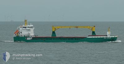
The vessel COE ANNA (IMO: 9366160, MMSI: 218615000) is a Cargo It's sailing under the flag of [DE] Germany.
In this page you can find informations about the vessels current position, last detected port calls, and current voyage information. If the vessels is not in coverage by AIS you will find the latest position.
The current position of COE ANNA is detected by our AIS receivers and we are not responsible for the reliability of the data. The last position was recorded while the vessel was in Coverage by the Ais receivers of our vessel tracking app.
The current draught of COE ANNA as reported by AIS is 7.3 meters
Weather
| Temperature | -1°C / 30.2°F |
|---|---|
| Wind Speed | 7 knots |
| Direction | 39° NE |
| Pressure | 1013.6 hPa |
| Humidity | 95.3 % |
| Cloud Coverage | 100 % |
Featured Company
Last Port Calls
| Port | Arrival | Departure | Time In Port |
|---|---|---|---|
| 2024-04-24 14:00 | |||
| 2024-04-20 13:12 | 2024-04-21 20:48 | 1 d | |
| 2024-04-17 07:56 | |||
| 2024-04-12 02:09 | 2024-04-16 00:19 | 3 d | |
| 2024-03-06 05:27 | 2024-03-07 12:45 | 1 d | |
| 2024-03-04 07:01 | |||
| 2024-02-04 13:22 | 2024-02-10 18:23 | 6 d |
Most Visited Ports (Last year)
| Port | Arrivals | |
|---|---|---|
| 3 | ||
| 3 | ||
| 3 | ||
| 2 | ||
| 2 | ||
| 2 |
Last Trips
| Origin | Departure | Destination | Arrival | Distance | |
|---|---|---|---|---|---|
| 2024-04-21 23:48 | 2024-04-24 17:00 | 667.61 nm | |||
| 2024-04-16 03:19 | 2024-04-17 10:56 | 316.97 nm | |||
| 2024-03-07 14:45 | 2024-04-12 05:09 | 968.12 nm | |||
| 2024-02-10 21:23 | 2024-03-04 09:01 | 4143.57 nm | |||
| 2024-01-27 06:35 | 2024-02-04 16:22 | 1779.00 nm |
Events
| Heure | Evenement | Détails | Position/ Destination | Info |
|---|---|---|---|---|
| 2024-04-24 14:16 | Arret |
65.66612 / 24.51478
[FI] AJOS
|
Vitesse: 0.1 kn Parcours: 57° |
|
| 2024-04-24 14:00 | Port d'arrivée |
|
65.65652 / 24.50923
[FI] AJOS
|
Vitesse: 5.6 kn Parcours: 14° |
| 2024-04-24 13:20 | Démarrage | 6.07 nm, South of AJOS |
65.56273 / 24.45111
AJOS
|
Vitesse: 9.2 kn Parcours: 16° |
| 2024-04-24 13:04 | Arret | 6.62 nm, South of AJOS |
65.55416 / 24.44369
AJOS
|
Vitesse: 0.2 kn Parcours: 23° |
| 2024-04-24 12:12 | Démarrage | 13.89 nm, South West of AJOS |
65.45579 / 24.25371
AJOS
|
Vitesse: 4.2 kn Parcours: 39° |
| 2024-04-24 11:48 | Arret | 14.02 nm, South West of AJOS |
65.45406 / 24.25045
AJOS
|
Vitesse: Parcours: 40° |
| 2024-04-23 23:13 | Etat Changé | Default Under way using engine |
63.64178 / 21.37166
AJOS
|
Vitesse: 6 kn Parcours: 76° |
| 2024-04-23 23:05 | Hors de la zone couverte |
63.63947 / 21.34771
Gulf of Bothnia
AJOS
|
Vitesse: 6 kn Parcours: 76° |
|
| 2024-04-23 23:00 | Etat Changé | Under way using engine Default |
63.63777 / 21.33179
AJOS
|
Vitesse: 9.6 kn Parcours: 68° |
| 2024-04-23 22:52 | Etat Changé | Default Under way using engine |
63.62982 / 21.29127
AJOS
|
Vitesse: 11.4 kn Parcours: 67.1° |