
COCHRANE
Cargo A
Current Trip
| Time Travelled | 12 days |
|---|---|
| Remaining Time | --- |
| Distance Travelled | 3436.10 nm |
| Remaining Distance | --- |
| AVG Speed | 11.8 Noeuds |
| MAX Speed | 18 Noeuds |
| AVG Wind | 11.4 knots |
| MAX Wind | 24.9 knots |
| MIN Temp | 18.7°C / 65.66°F |
| MAX Temp | 34°C / 93.2°F |
| Tirant d eau | 9.6 m |
| Position reçue | 4 m depuis |
Current Position
| Longitude | -105.97275° |
|---|---|
| Latitude | 18.46525° |
| Etat | Under way using engine |
| Vitesse | 11.8 Noeuds |
| Parcours | 304.7° |
| Zone | North Pacific Ocean |
| Station | T-AIS |
| Position reçue | 4 m depuis |
Info
Information
The current position of COCHRANE is in North Pacific Ocean with coordinates 18.46525° / -105.97275° as reported on 2024-04-23 10:12 by AIS to our vessel tracker app. The vessel's current speed is 11.8 Noeuds and is heading at the port of SHANGHAI. The estimated time of arrival as calculated by MyShipTracking vessel tracking app is 2024-05-16 14:00 LT
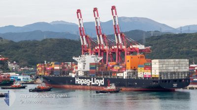
The vessel COCHRANE (IMO: 9687540, MMSI: 636092793) is a Cargo A It's sailing under the flag of [LR] Liberia.
In this page you can find informations about the vessels current position, last detected port calls, and current voyage information. If the vessels is not in coverage by AIS you will find the latest position.
The current position of COCHRANE is detected by our AIS receivers and we are not responsible for the reliability of the data. The last position was recorded while the vessel was in Coverage by the Ais receivers of our vessel tracking app.
The current draught of COCHRANE as reported by AIS is 9.6 meters
Weather
| Temperature | 24.3°C / 75.74°F |
|---|---|
| Wind Speed | 12 knots |
| Direction | 344° NNW |
| Pressure | 1011.5 hPa |
| Humidity | 77.7 % |
| Cloud Coverage | --- |
Featured Company
Last Port Calls
| Port | Arrival | Departure | Time In Port |
|---|---|---|---|
| 2024-04-08 09:05 | 2024-04-10 11:29 | 2 d | |
| 2024-04-05 01:54 | 2024-04-06 07:13 | 1 d | |
| 2024-04-02 20:13 | 2024-04-03 18:47 | 22 h | |
| 2024-03-28 09:41 | 2024-03-30 12:28 | 2 d | |
| 2024-03-02 10:01 | |||
| 2024-02-22 18:45 | 2024-02-24 08:27 | 1 d | |
| 2024-02-19 04:17 | |||
| 2024-02-15 00:38 | 2024-02-15 23:52 | 23 h | |
| 2024-02-13 02:19 | 2024-02-13 12:03 | 9 h |
Most Visited Ports (Last year)
| Port | Arrivals | |
|---|---|---|
| 4 | ||
| 3 | ||
| 3 | ||
| 3 | ||
| 3 | ||
| 3 |
Last Trips
| Origin | Departure | Destination | Arrival | Distance | |
|---|---|---|---|---|---|
| 2024-04-06 03:13 | 2024-04-08 05:05 | 126.79 nm | |||
| 2024-04-03 14:47 | 2024-04-04 21:54 | 438.46 nm | |||
| 2024-03-30 08:28 | 2024-04-02 16:13 | 317.83 nm | |||
| 2024-02-24 16:27 | 2024-03-02 15:31 | 1700.71 nm | |||
| 2024-02-16 07:52 | 2024-02-19 11:17 | 913.43 nm | |||
| 2024-02-13 20:03 | 2024-02-15 08:38 | 494.74 nm | |||
| 2023-11-27 22:06 | 2024-02-13 10:19 | 11996.20 nm |
Events
| Heure | Evenement | Détails | Position/ Destination | Info |
|---|---|---|---|---|
| 2024-04-23 10:12 | Etat Changé | Under way using engine Default |
18.46525 / -105.97275
CNSHA
|
Vitesse: 11.8 kn Parcours: 307° |
| 2024-04-23 10:10 | Etat Changé | Default Under way using engine |
18.46135 / -105.96711
CNSHA
|
Vitesse: 12.2 kn Parcours: 306.2° |
| 2024-04-23 10:03 | Etat Changé | Under way using engine Default |
18.44796 / -105.94758
CNSHA
|
Vitesse: 12 kn Parcours: 307° |
| 2024-04-23 09:13 | Etat Changé | Default Under way using engine |
18.35356 / -105.79739
CNSHA
|
Vitesse: 12 kn Parcours: 302.8° |
| 2024-04-23 09:06 | Etat Changé | Under way using engine Default |
18.34225 / -105.77716
CNSHA
|
Vitesse: 12 kn Parcours: 304° |
| 2024-04-23 09:06 | Dans la zone couverte |
18.34358 / -105.77914
North Pacific Ocean
CNSHA
|
Vitesse: 12 kn Parcours: 302.8° |
|
| 2024-04-22 00:50 | Etat Changé | Default Under way using engine |
14.36167 / -99.66666
CNSHA
|
Vitesse: 14.5 kn Parcours: 302.1° |
| 2024-04-22 00:42 | Hors de la zone couverte |
14.34660 / -99.64051
North Pacific Ocean
CNSHA
|
Vitesse: 14.5 kn Parcours: 302.1° |
|
| 2024-04-22 00:28 | Etat Changé | Under way using engine Default |
14.31516 / -99.59175
CNSHA
|
Vitesse: 14 kn Parcours: 304° |
| 2024-04-22 00:26 | Etat Changé | Default Under way using engine |
14.30833 / -99.58167
CNSHA
|
Vitesse: 14.5 kn Parcours: 303.7° |